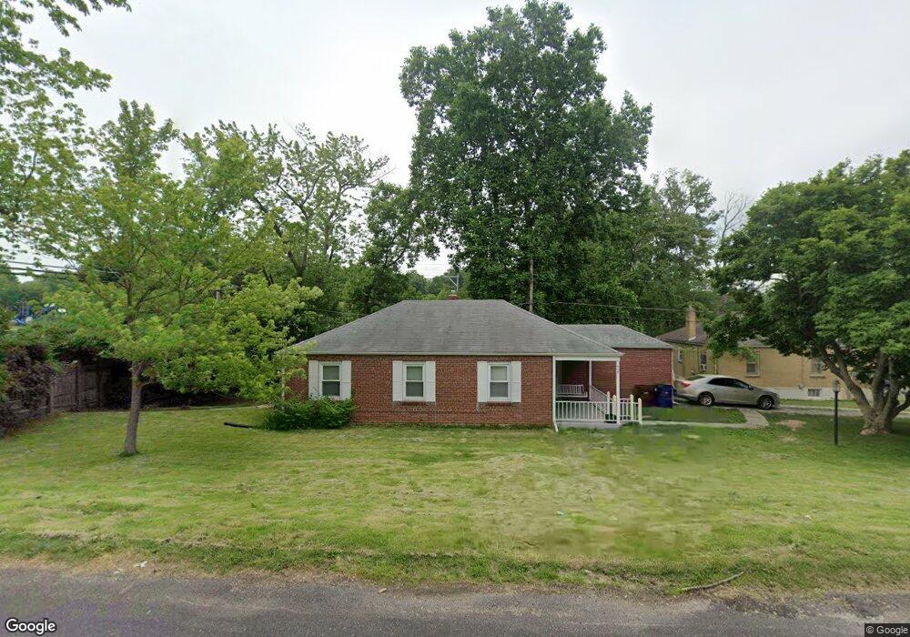
448 Warfield Ave Saint Louis, MO 63135
Estimated Value: $80,000 - $103,000
2
Beds
1
Bath
918
Sq Ft
$99/Sq Ft
Est. Value
About This Home
This home is located at 448 Warfield Ave, Saint Louis, MO 63135 and is currently estimated at $90,434, approximately $98 per square foot. 448 Warfield Ave is a home located in St. Louis County with nearby schools including Ferguson Middle School, Johnson Wabash Elementary School, and McCluer High School.
Ownership History
Date
Name
Owned For
Owner Type
Purchase Details
Closed on
Nov 19, 2024
Sold by
448 Warfield Avenue Trust
Bought by
Hazel Hilbert Llc
Current Estimated Value
Purchase Details
Closed on
Jan 6, 2015
Sold by
448 Warfield Trust
Bought by
448 Warfield Avenue Trust
Purchase Details
Closed on
Dec 10, 2014
Sold by
Sell A House Llc
Bought by
448 Warfield Trust
Create a Home Valuation Report for This Property
The Home Valuation Report is an in-depth analysis detailing your home's value as well as a comparison with similar homes in the area
Home Values in the Area
Average Home Value in this Area
Purchase History
| Date | Buyer | Sale Price | Title Company |
|---|---|---|---|
| Hazel Hilbert Llc | -- | Title Experts | |
| 448 Warfield Avenue Trust | -- | Title Experts Llc | |
| 448 Warfield Trust | -- | -- | |
| Sell A House Llc | -- | -- |
Source: Public Records
Tax History
| Year | Tax Paid | Tax Assessment Tax Assessment Total Assessment is a certain percentage of the fair market value that is determined by local assessors to be the total taxable value of land and additions on the property. | Land | Improvement |
|---|---|---|---|---|
| 2025 | $942 | $16,110 | $2,090 | $14,020 |
| 2024 | $942 | $12,820 | $1,670 | $11,150 |
| 2023 | $936 | $12,820 | $1,670 | $11,150 |
| 2022 | $775 | $9,190 | $1,250 | $7,940 |
| 2021 | $751 | $9,190 | $1,250 | $7,940 |
| 2020 | $638 | $6,970 | $1,710 | $5,260 |
| 2019 | $626 | $6,970 | $1,710 | $5,260 |
| 2018 | $795 | $7,980 | $1,410 | $6,570 |
| 2017 | $780 | $7,980 | $1,410 | $6,570 |
| 2016 | $792 | $7,980 | $1,790 | $6,190 |
Source: Public Records
Map
Nearby Homes
- 439 Warford Ave
- 411 Warford Ave
- 415 N Dade Ave
- 324 N Dade Ave
- 310 N Marguerite Ave
- 318 N Dade Ave
- 825 Walters Dr
- 35 Robert Ave
- 324 Henquin Dr
- 308 Henquin Dr
- 138 N Marguerite Ave
- 222 Henquin Dr
- 309 Newell Dr
- 127 Thoroughman Ave
- 213 Henquin Dr
- 847 N Florissant Rd
- 716 Nancy Place
- 8027 Aline Ave
- 8 Drummond Dr
- 45 Beacon Ave
- 454 Warford Ave
- 447 Warfield Ave
- 436 Warfield Ave
- 450 Warford Ave
- 600 January Ave
- 443 Warfield Ave
- 451 Warford Ave
- 439 Warfield Ave
- 432 Warfield Ave
- 612 January Ave
- 437 Warfield Ave
- 447 Warford Ave
- 428 Warfield Ave
- 431 Warfield Ave
- 426 January Ave
- 424 Warfield Ave
- 438 Jehling Dr
- 427 Warfield Ave
- 448 Warford Ave
- 434 Jehling Dr
Your Personal Tour Guide
Ask me questions while you tour the home.