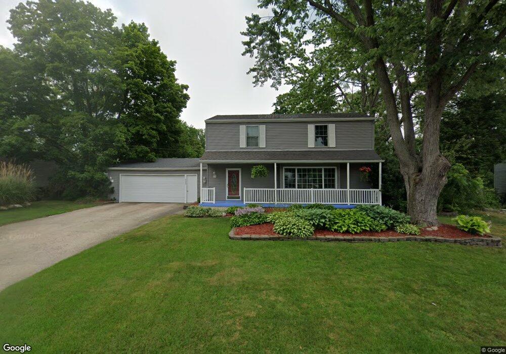
4480 Foxcroft Ave NW Comstock Park, MI 49321
Estimated Value: $333,000 - $370,000
3
Beds
2
Baths
2,872
Sq Ft
$124/Sq Ft
Est. Value
About This Home
This home is located at 4480 Foxcroft Ave NW, Comstock Park, MI 49321 and is currently estimated at $357,508, approximately $124 per square foot. 4480 Foxcroft Ave NW is a home located in Kent County with nearby schools including Alpine Elementary School, Kenowa Hills Middle School, and Kenowa Hills High School.
Ownership History
Date
Name
Owned For
Owner Type
Purchase Details
Closed on
Mar 27, 2008
Sold by
Post Daryl L and Post Pamela A
Bought by
Lowery Michael
Current Estimated Value
Home Financials for this Owner
Home Financials are based on the most recent Mortgage that was taken out on this home.
Original Mortgage
$153,200
Outstanding Balance
$98,803
Interest Rate
6.32%
Mortgage Type
VA
Estimated Equity
$258,705
Purchase Details
Closed on
Feb 8, 2007
Sold by
Post Pamela A and Jewell Pamela A
Bought by
Post Daryl L and Post Pamela A
Home Financials for this Owner
Home Financials are based on the most recent Mortgage that was taken out on this home.
Original Mortgage
$101,000
Interest Rate
5.75%
Mortgage Type
New Conventional
Purchase Details
Closed on
Jun 8, 1995
Bought by
Lowery Harris>Jewell and Lowery Michael
Create a Home Valuation Report for This Property
The Home Valuation Report is an in-depth analysis detailing your home's value as well as a comparison with similar homes in the area
Home Values in the Area
Average Home Value in this Area
Purchase History
| Date | Buyer | Sale Price | Title Company |
|---|---|---|---|
| Lowery Michael | $150,000 | None Available | |
| Post Daryl L | -- | Fidelity National Title | |
| Lowery Harris>Jewell | $97,000 | -- |
Source: Public Records
Mortgage History
| Date | Status | Borrower | Loan Amount |
|---|---|---|---|
| Open | Lowery Michael | $153,200 | |
| Previous Owner | Post Daryl L | $101,000 |
Source: Public Records
Tax History Compared to Growth
Tax History
| Year | Tax Paid | Tax Assessment Tax Assessment Total Assessment is a certain percentage of the fair market value that is determined by local assessors to be the total taxable value of land and additions on the property. | Land | Improvement |
|---|---|---|---|---|
| 2025 | $2,378 | $180,800 | $0 | $0 |
| 2024 | $2,378 | $153,700 | $0 | $0 |
| 2023 | $2,272 | $123,900 | $0 | $0 |
| 2022 | $2,849 | $114,100 | $0 | $0 |
| 2021 | $2,780 | $108,500 | $0 | $0 |
| 2020 | $2,086 | $105,100 | $0 | $0 |
| 2019 | $2,493 | $85,500 | $0 | $0 |
| 2018 | $2,446 | $85,500 | $0 | $0 |
| 2017 | $2,377 | $76,200 | $0 | $0 |
| 2016 | $2,304 | $71,600 | $0 | $0 |
| 2015 | -- | $71,600 | $0 | $0 |
| 2013 | -- | $65,600 | $0 | $0 |
Source: Public Records
Map
Nearby Homes
- 4341 Laura Ave NW
- 550 Clark St NW
- 4581 Westshire Dr NW
- 4791 Westgate Dr NW
- 4575 Moffett Rd NW Unit 100
- 4565 Tabor Rd NW Unit 38
- 4843 Gretchen Ave NW
- 4404 Division Ave N
- 211 York View Place NW
- Croswell Plan at The Range
- Ashton Plan at The Range
- Enclave Plan at The Range
- Carson Plan at The Range
- Remington Plan at The Range
- Cascade Plan at The Range
- Wilshire Plan at The Range
- Linden Plan at The Range
- Avery Plan at The Range
- Andover Plan at The Range
- 134 Mabel St NW
- 4492 Foxcroft Ave NW
- 4470 Foxcroft Ave NW
- 4483 Westgate Dr NW
- 4473 Westgate Dr NW
- 4495 Westgate Dr NW
- 4504 Foxcroft Ave NW
- 4461 Westgate Dr NW
- 4485 Foxcroft Ave NW
- 432 Netherfield St NW
- 4505 Westgate Dr NW
- 4501 Foxcroft Ave NW
- 4505 Westgate Ave NW
- 4451 Westgate Dr NW
- 410 Springfield St NW
- 444 Netherfield St NW
- 4517 Westgate Dr NW
- 451 Netherfield St NW
- 365 Netherfield St NW
- 438 Springfield St NW
- 4439 Westgate Dr NW