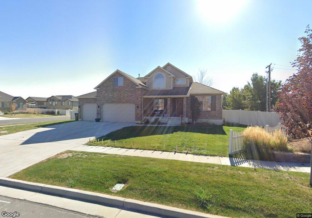
4483 W 1315 S Syracuse, UT 84075
Estimated Value: $692,000 - $810,000
5
Beds
3
Baths
3,929
Sq Ft
$187/Sq Ft
Est. Value
About This Home
This home is located at 4483 W 1315 S, Syracuse, UT 84075 and is currently estimated at $736,584, approximately $187 per square foot. 4483 W 1315 S is a home located in Davis County with nearby schools including Buffalo Point School, Syracuse Junior High School, and Syracuse High School.
Ownership History
Date
Name
Owned For
Owner Type
Purchase Details
Closed on
Jul 31, 2020
Sold by
Packer Jaron T and Packer Vanesa A
Bought by
Lawlor Clark William and Lawlor Lisa L
Current Estimated Value
Home Financials for this Owner
Home Financials are based on the most recent Mortgage that was taken out on this home.
Original Mortgage
$451,250
Outstanding Balance
$400,139
Interest Rate
3.1%
Mortgage Type
New Conventional
Estimated Equity
$336,445
Purchase Details
Closed on
Feb 20, 2009
Sold by
Elite Craft Homes Llc
Bought by
Ashdown Travis and Ashdown Bonnie
Home Financials for this Owner
Home Financials are based on the most recent Mortgage that was taken out on this home.
Original Mortgage
$314,900
Interest Rate
5.08%
Mortgage Type
Purchase Money Mortgage
Purchase Details
Closed on
Dec 29, 2006
Sold by
Bridgeway Island Llc
Bought by
Elite Craft Homes
Create a Home Valuation Report for This Property
The Home Valuation Report is an in-depth analysis detailing your home's value as well as a comparison with similar homes in the area
Home Values in the Area
Average Home Value in this Area
Purchase History
| Date | Buyer | Sale Price | Title Company |
|---|---|---|---|
| Lawlor Clark William | -- | Us Title Company O | |
| Ashdown Travis | -- | Bonneville Superior Title Co | |
| Elite Craft Homes | -- | Bonneville Superior Title |
Source: Public Records
Mortgage History
| Date | Status | Borrower | Loan Amount |
|---|---|---|---|
| Open | Lawlor Clark William | $451,250 | |
| Previous Owner | Ashdown Travis | $314,900 |
Source: Public Records
Tax History Compared to Growth
Tax History
| Year | Tax Paid | Tax Assessment Tax Assessment Total Assessment is a certain percentage of the fair market value that is determined by local assessors to be the total taxable value of land and additions on the property. | Land | Improvement |
|---|---|---|---|---|
| 2025 | $3,877 | $374,000 | $105,452 | $268,548 |
| 2024 | $3,675 | $356,950 | $85,675 | $271,275 |
| 2023 | $3,452 | $611,000 | $128,572 | $482,428 |
| 2022 | $3,322 | $322,300 | $65,218 | $257,082 |
| 2021 | $2,916 | $438,000 | $94,982 | $343,018 |
| 2020 | $2,593 | $377,000 | $77,463 | $299,537 |
| 2019 | $2,480 | $356,000 | $80,658 | $275,342 |
| 2018 | $2,323 | $331,000 | $78,188 | $252,812 |
| 2016 | $2,237 | $167,145 | $32,297 | $134,848 |
| 2015 | $2,379 | $169,345 | $32,297 | $137,048 |
| 2014 | $2,022 | $146,685 | $32,297 | $114,388 |
| 2013 | -- | $140,361 | $30,233 | $110,128 |
Source: Public Records
Map
Nearby Homes
- 1155 S 4475 W
- 1139 S 4475 W
- 1157 S 4425 W
- 1125 S 4475 W
- 4578 W 1150 S
- 1141 S 4700 W
- 1068 S 4425 W
- 4662 W 1100 S
- 982 S 4475 W Unit 122
- 4580 W 1700 S
- 964 S 4475 W Unit 123
- 4443 W 920 S Unit 110
- 4411 W 920 S Unit 111
- 4236 W 975 S
- 3951 Baltimore Cir
- 835 S Criddle Rd
- 3867 Rungsted Cir
- 696 S 4500 W
- 1430 Heather Ln
- 3661 W 800 S
- 4484 W 1315 S
- 1298 S 4465 W Unit 210
- 1346 S 4465 W Unit 208
- 1346 S 4465 W
- 1333 S 4465 W
- 4429 W 1315 S Unit 223
- 1332 S Homestead Ln Unit 112
- 4444 W 1350 S Unit 233
- 1301 S 4465 W
- 1292 S Homestead Ln
- 1292 S Homestead Ln Unit 111
- 1278 S 4465 W Unit 211
- 1366 S 4465 W Unit 207
- 1352 S Homestead Ln
- 1281 S 4465 W
- 1293 S Homestead Ln
- 4420 W 1350 S Unit 234
- 4420 W 1350 S Unit 30
- 4391 W 1315 S
- 1372 S Homestead Ln