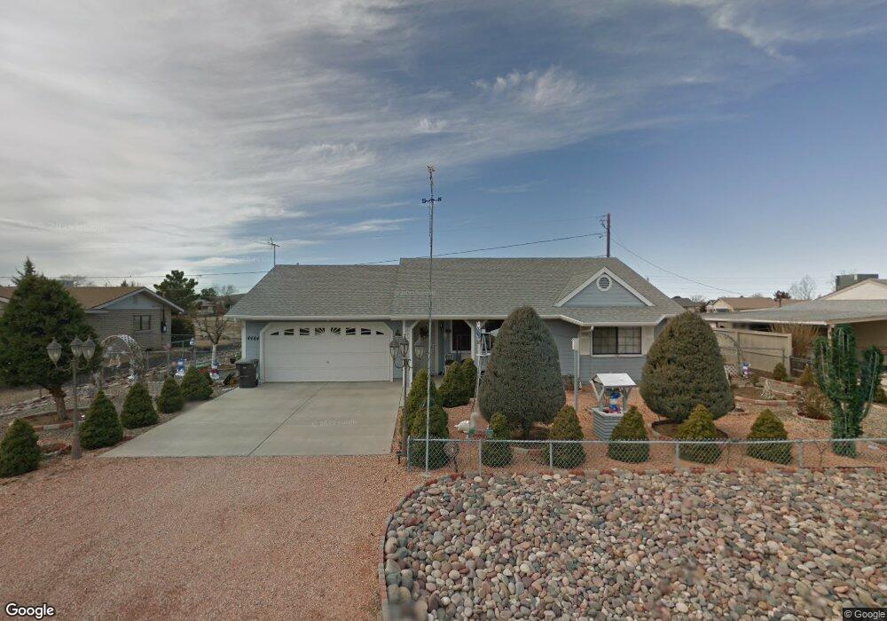
4484 N Sauter Dr W Prescott Valley, AZ 86314
Estimated Value: $378,905 - $392,000
--
Bed
--
Bath
1,401
Sq Ft
$276/Sq Ft
Est. Value
About This Home
This home is located at 4484 N Sauter Dr W, Prescott Valley, AZ 86314 and is currently estimated at $386,976, approximately $276 per square foot. 4484 N Sauter Dr W is a home located in Yavapai County with nearby schools including Granville Elementary School, Bradshaw Mountain Middle School, and Bradshaw Mountain High School.
Ownership History
Date
Name
Owned For
Owner Type
Purchase Details
Closed on
Jul 25, 2024
Sold by
Hurtado John Joseph
Bought by
John Joseph Hurtado 2022 Living Trust and Hurtado
Current Estimated Value
Purchase Details
Closed on
Jul 9, 2024
Sold by
Hurtado John Joseph
Bought by
John Joseph Hurtado 2022 Living Trust and Hurtado
Purchase Details
Closed on
Mar 1, 2017
Sold by
Myers Gerald D and Myers Alice M
Bought by
Hurtado John Joseph
Home Financials for this Owner
Home Financials are based on the most recent Mortgage that was taken out on this home.
Original Mortgage
$199,500
Interest Rate
4.19%
Mortgage Type
VA
Purchase Details
Closed on
Dec 12, 1997
Sold by
Parker Lyle A and Parker Ruth C
Bought by
Myers Gerald D and Myers Alice M
Create a Home Valuation Report for This Property
The Home Valuation Report is an in-depth analysis detailing your home's value as well as a comparison with similar homes in the area
Home Values in the Area
Average Home Value in this Area
Purchase History
| Date | Buyer | Sale Price | Title Company |
|---|---|---|---|
| John Joseph Hurtado 2022 Living Trust | -- | None Listed On Document | |
| John Joseph Hurtado 2022 Living Trust | -- | None Listed On Document | |
| Hurtado John Joseph | -- | Yavapai Title | |
| Myers Gerald D | $13,000 | Yavapai Coconino Title Agenc |
Source: Public Records
Mortgage History
| Date | Status | Borrower | Loan Amount |
|---|---|---|---|
| Previous Owner | Hurtado John Joseph | $199,500 |
Source: Public Records
Tax History Compared to Growth
Tax History
| Year | Tax Paid | Tax Assessment Tax Assessment Total Assessment is a certain percentage of the fair market value that is determined by local assessors to be the total taxable value of land and additions on the property. | Land | Improvement |
|---|---|---|---|---|
| 2026 | $1,318 | $31,959 | -- | -- |
| 2024 | $1,209 | $32,979 | -- | -- |
| 2023 | $1,209 | $27,461 | $0 | $0 |
| 2022 | $1,189 | $22,147 | $2,868 | $19,279 |
| 2021 | $1,242 | $20,254 | $2,883 | $17,371 |
| 2020 | $1,194 | $0 | $0 | $0 |
| 2019 | $1,179 | $0 | $0 | $0 |
| 2018 | $1,121 | $0 | $0 | $0 |
| 2017 | $1,099 | $0 | $0 | $0 |
| 2016 | $1,062 | $0 | $0 | $0 |
| 2015 | -- | $0 | $0 | $0 |
| 2014 | -- | $0 | $0 | $0 |
Source: Public Records
Map
Nearby Homes
- 4441 N Tonto Way
- 7316 Spouse Dr
- 7869 E Spouse Dr
- 4500 N Phillip Dr Unit 4
- 4461 N Phillip Dr
- 7940 E Loos Dr
- 7764 E Cocopah Dr
- 4148 N Jay Ct
- 38-A1 N Norman Rd
- 4112 N Edith Ct
- 3981 N Robert Rd
- 4395 N Katie Cir W
- 4096 N Jay Ct
- 4881 N Tonto Way
- 7959 E Las Flores Ave
- 4921 N Miner Rd
- 7855 E Larkspur Ln
- 7874 E Siesta Ln
- 4400 N Verde Vista Dr
- 4895 N Arnold Dr
- 4484 N Sauter Dr W
- 4470 N Sauter Dr W Unit 3
- 4500 N Sauter Dr W
- 4483 N Miner Rd
- 4501 N Miner Rd
- 4469 N Miner Rd
- 4469 N Miner Rd Unit 2
- 4456 N Sauter Dr W
- 4485 N Sauter Dr W
- 4501 N Sauter Dr W
- 4501 N Sauter Dr W
- 4455 N Miner
- 4517 N Miner Rd Unit 2
- 4517 N Miner Rd
- 4515 N Sauter Dr W
- 4515 N Sauter Dr W Unit 3
- 4457 N Sauter Dr W
- 4442 N Sauter Dr W Unit 3
- 4531 N Miner Rd
- 4441 N Miner Rd