Estimated Value: $336,000 - $362,000
3
Beds
2
Baths
1,702
Sq Ft
$206/Sq Ft
Est. Value
About This Home
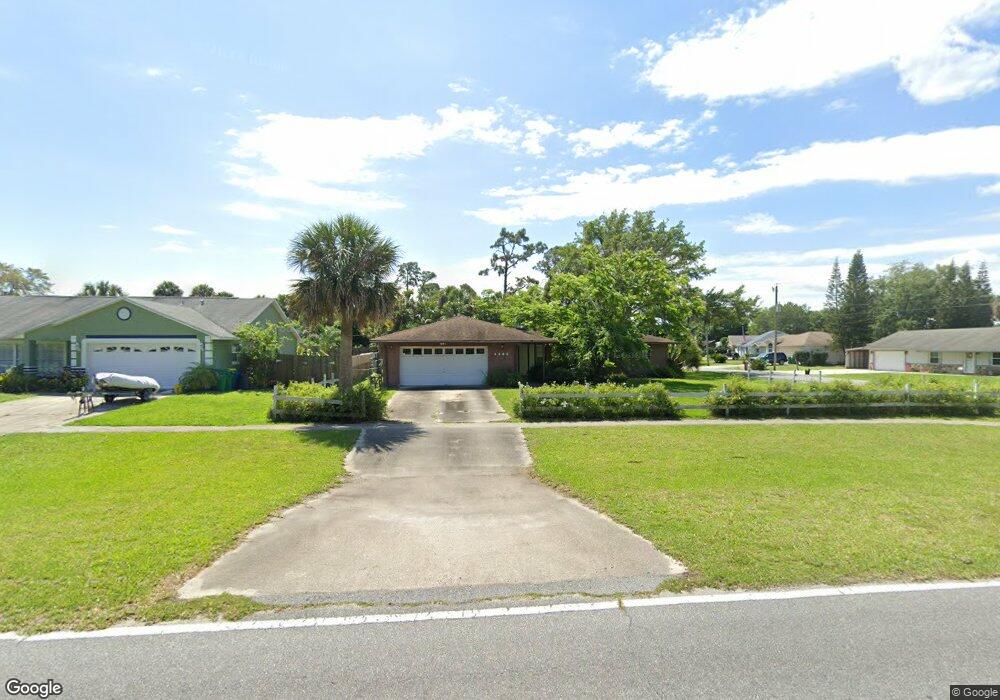
This home is located at 4485 Curtis Blvd, Cocoa, FL 32927 and is currently estimated at $349,799, approximately $205 per square foot. 4485 Curtis Blvd is a home located in Brevard County with nearby schools including Atlantis Elementary School, Space Coast Junior/Senior High School, and Sculptor Charter School.
Ownership History
Date
Name
Owned For
Owner Type
Purchase Details
Closed on
May 7, 2008
Sold by
Ellison James E and Ellison Linda M
Bought by
Fitzgerald James E
Current Estimated Value
Home Financials for this Owner
Home Financials are based on the most recent Mortgage that was taken out on this home.
Original Mortgage
$178,585
Outstanding Balance
$112,860
Interest Rate
5.84%
Estimated Equity
$236,939
Purchase Details
Closed on
Sep 24, 1998
Sold by
Lapointe Ronald R
Bought by
Ellison James E and Ellison Linda M
Home Financials for this Owner
Home Financials are based on the most recent Mortgage that was taken out on this home.
Original Mortgage
$43,500
Interest Rate
6.92%
Create a Home Valuation Report for This Property
The Home Valuation Report is an in-depth analysis detailing your home's value as well as a comparison with similar homes in the area
Home Values in the Area
Average Home Value in this Area
Purchase History
| Date | Buyer | Sale Price | Title Company |
|---|---|---|---|
| Fitzgerald James E | $180,000 | Security First Title Partner | |
| Ellison James E | $94,000 | -- |
Source: Public Records
Mortgage History
| Date | Status | Borrower | Loan Amount |
|---|---|---|---|
| Open | Fitzgerald James E | $178,585 | |
| Previous Owner | Ellison James E | $43,500 |
Source: Public Records
Tax History
| Year | Tax Paid | Tax Assessment Tax Assessment Total Assessment is a certain percentage of the fair market value that is determined by local assessors to be the total taxable value of land and additions on the property. | Land | Improvement |
|---|---|---|---|---|
| 2025 | $1,415 | $105,400 | -- | -- |
| 2024 | $1,377 | $100,100 | -- | -- |
| 2023 | $1,377 | $97,190 | $0 | $0 |
| 2022 | $1,283 | $94,360 | $0 | $0 |
| 2021 | $1,279 | $91,620 | $0 | $0 |
| 2020 | $1,216 | $90,360 | $0 | $0 |
| 2019 | $1,151 | $88,330 | $0 | $0 |
| 2018 | $1,143 | $86,690 | $0 | $0 |
| 2017 | $1,134 | $84,910 | $0 | $0 |
| 2016 | $1,133 | $83,170 | $18,000 | $65,170 |
| 2015 | $1,144 | $82,600 | $15,000 | $67,600 |
| 2014 | $1,144 | $81,950 | $11,000 | $70,950 |
Source: Public Records
Map
Nearby Homes
- 7065 Bright Ave
- 7160 Carlowe Ave
- 4625 Curtis Blvd
- 7081 Bayfront Rd
- 7155 Ackerman Ave
- 6990 Camden Ave
- 4285 Glover St
- 6820 Caliph Ave
- 4550 Flood St
- 4760 Ivan St
- 4395 Comfort St
- 4340 Comfort St
- 7070 Bismarck Rd
- 7350 Bartow Ave
- 4824 Curtis Blvd
- 7450 Calmoso Ave
- 7245 Madison St
- 0000 Unknown St
- 7456 Camio Ave
- 7245 Grissom Pkwy
- 4475 Curtis Blvd Unit 8
- 4475 Curtis Blvd
- None Curtis Blvd
- 7044 Carlowe Ave
- 4465 Curtis Blvd
- 7025 Carlowe Ave
- 7060 Bright Ave
- 7032 Carlowe Ave
- 4480 Curtis Blvd
- 4525 Curtis Blvd
- 7040 Bright Ave
- 7020 Carlowe Ave
- 4460 Curtis Blvd
- 4510 Curtis Blvd
- 7019 Carlowe Ave
- 7020 Bright Ave
- 7113 Carlowe Ave
- 7015 Briggs Ave
- 4445 Curtis Blvd
- 4535 Curtis Blvd
Your Personal Tour Guide
Ask me questions while you tour the home.