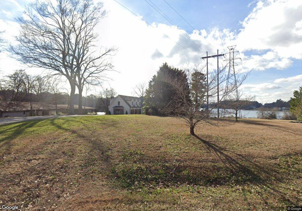
4485 Harbor Inn Rd Rock Hill, SC 29732
Estimated Value: $854,000 - $1,633,971
--
Bed
1
Bath
4,604
Sq Ft
$268/Sq Ft
Est. Value
About This Home
This home is located at 4485 Harbor Inn Rd, Rock Hill, SC 29732 and is currently estimated at $1,233,993, approximately $268 per square foot. 4485 Harbor Inn Rd is a home with nearby schools including Mount Gallant Elementary School, Dutchman Creek Middle School, and Northwestern High School.
Ownership History
Date
Name
Owned For
Owner Type
Purchase Details
Closed on
Aug 1, 2025
Sold by
Deborde Kara G
Bought by
Kara G Deborde Living Trust and Deborde
Current Estimated Value
Purchase Details
Closed on
Jun 24, 2021
Sold by
Gault Carolyn R
Bought by
Deborde Kara G
Purchase Details
Closed on
Feb 28, 2000
Sold by
Good Robert E
Bought by
Gault Carolyn R
Create a Home Valuation Report for This Property
The Home Valuation Report is an in-depth analysis detailing your home's value as well as a comparison with similar homes in the area
Home Values in the Area
Average Home Value in this Area
Purchase History
| Date | Buyer | Sale Price | Title Company |
|---|---|---|---|
| Kara G Deborde Living Trust | -- | None Listed On Document | |
| Deborde Kara G | -- | None Available | |
| Gault Carolyn R | $312,500 | -- |
Source: Public Records
Mortgage History
| Date | Status | Borrower | Loan Amount |
|---|---|---|---|
| Previous Owner | Deborde Kara G | $499,000 | |
| Previous Owner | Deborde Kara G | $920,000 |
Source: Public Records
Tax History Compared to Growth
Tax History
| Year | Tax Paid | Tax Assessment Tax Assessment Total Assessment is a certain percentage of the fair market value that is determined by local assessors to be the total taxable value of land and additions on the property. | Land | Improvement |
|---|---|---|---|---|
| 2024 | $5,603 | $39,993 | $13,000 | $26,993 |
| 2023 | $7,155 | $19,500 | $19,500 | $0 |
| 2022 | $10,829 | $31,380 | $19,500 | $11,880 |
| 2021 | -- | $26,723 | $19,500 | $7,223 |
| 2020 | $8,974 | $26,723 | $0 | $0 |
| 2019 | $8,483 | $24,510 | $0 | $0 |
| 2018 | $8,314 | $24,510 | $0 | $0 |
| 2017 | $7,956 | $24,510 | $0 | $0 |
| 2016 | $7,743 | $24,510 | $0 | $0 |
| 2014 | $6,370 | $24,510 | $19,680 | $4,830 |
| 2013 | $6,370 | $21,318 | $16,008 | $5,310 |
Source: Public Records
Map
Nearby Homes
- 716 Millstream Dr
- 704 Millstream Dr
- 808 Painted Lady Ct
- 4222 Mount Gallant Rd
- 1620 Enon Ct Unit 9
- 4026 Palmetto Dr
- 4445 Homestead Rd
- 0 Marlette Dr Unit 7
- 1623 E Lakewood Dr
- Lake Wylie Dr
- Lot 6 Lake Wylie Dr
- Lot 5 Lake Wylie Dr
- Lot 4 Lake Wylie Dr
- Lot 3 Lake Wylie Dr
- 7042 Chelsea Day Ln
- Lot B Sandlapper Dr Unit B
- Lot A Sandlapper Dr Unit A
- 1593 Bloomfield Rd
- 1832 Marthas Vineyard Rd
- 4066 Triton Dr
- 4491 Harbor Inn Rd
- 4477 Harbor Inn Rd
- 4475 Harbor Inn Rd
- 4497 Harbor Inn Rd
- Lot 14 Lake Club Dr
- 292 Lake Club Dr Unit 14
- 601 Lake Club Dr
- 603 Lake Club Dr Unit 603
- 605 Lake Club Dr Unit 605
- 505 Lake Club Dr Unit 505
- Lot 3 Lake Club Dr
- 503 Lake Club Dr
- 295 Lake Club Dr
- 602 Lake Club Dr
- 604 Lake Club Dr Unit 604
- 305 Lake Club Dr
- 305 Lake Club Dr Unit 305
- 606 Lake Club Dr Unit 606
- 501 Lake Club Dr Unit 501
- 303 Lake Club Dr