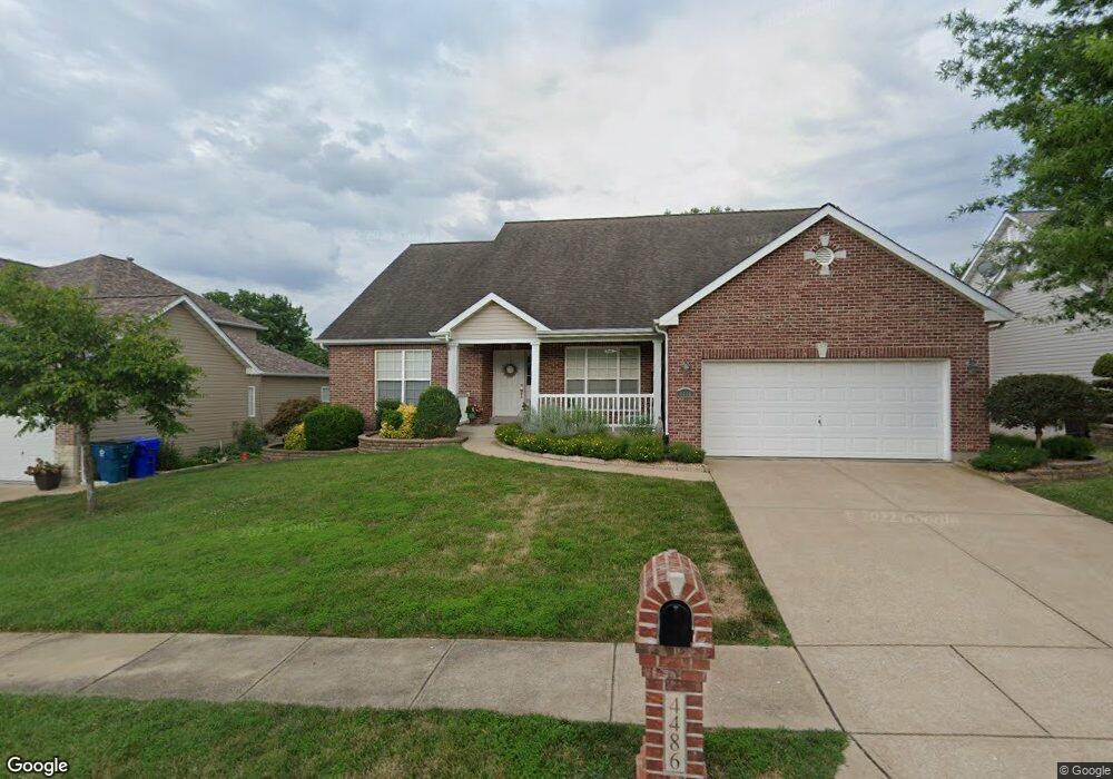
4486 Forder Grove Ct Saint Louis, MO 63129
Mehlville NeighborhoodEstimated Value: $352,000 - $558,000
3
Beds
2
Baths
2,226
Sq Ft
$196/Sq Ft
Est. Value
About This Home
This home is located at 4486 Forder Grove Ct, Saint Louis, MO 63129 and is currently estimated at $437,074, approximately $196 per square foot. 4486 Forder Grove Ct is a home located in St. Louis County with nearby schools including Blades Elementary School, Bernard Middle School, and Oakville Senior High School.
Ownership History
Date
Name
Owned For
Owner Type
Purchase Details
Closed on
Aug 7, 2006
Sold by
Realty Sales By Knopf Inc
Bought by
Bronson Kenneth E and Bronson Mary J
Current Estimated Value
Home Financials for this Owner
Home Financials are based on the most recent Mortgage that was taken out on this home.
Original Mortgage
$258,398
Outstanding Balance
$155,307
Interest Rate
6.78%
Mortgage Type
Purchase Money Mortgage
Estimated Equity
$281,767
Create a Home Valuation Report for This Property
The Home Valuation Report is an in-depth analysis detailing your home's value as well as a comparison with similar homes in the area
Home Values in the Area
Average Home Value in this Area
Purchase History
| Date | Buyer | Sale Price | Title Company |
|---|---|---|---|
| Bronson Kenneth E | $368,148 | None Available |
Source: Public Records
Mortgage History
| Date | Status | Borrower | Loan Amount |
|---|---|---|---|
| Open | Bronson Kenneth E | $258,398 |
Source: Public Records
Tax History Compared to Growth
Tax History
| Year | Tax Paid | Tax Assessment Tax Assessment Total Assessment is a certain percentage of the fair market value that is determined by local assessors to be the total taxable value of land and additions on the property. | Land | Improvement |
|---|---|---|---|---|
| 2025 | $4,731 | $80,440 | $22,910 | $57,530 |
| 2024 | $4,731 | $70,530 | $9,820 | $60,710 |
| 2023 | $4,670 | $70,530 | $9,820 | $60,710 |
| 2022 | $4,121 | $62,530 | $13,090 | $49,440 |
| 2021 | $3,988 | $62,530 | $13,090 | $49,440 |
| 2020 | $3,708 | $55,260 | $8,990 | $46,270 |
| 2019 | $3,697 | $55,260 | $8,990 | $46,270 |
| 2018 | $3,793 | $51,210 | $8,190 | $43,020 |
| 2017 | $3,787 | $51,210 | $8,190 | $43,020 |
| 2016 | $3,968 | $51,490 | $8,190 | $43,300 |
| 2015 | $3,642 | $51,490 | $8,190 | $43,300 |
| 2014 | $3,204 | $44,800 | $15,960 | $28,840 |
Source: Public Records
Map
Nearby Homes
- 4376 Tavistock Cir Unit 18D
- 4363 Tavistock Cir Unit 22C
- 1076 Humber Cir
- 1020 Mersey Bend Dr Unit 1D
- 1057 Mersey Bend Dr Unit C
- 1084 Mersey Bend Dr Unit F
- 4923 Southridge Park Dr
- 4347 Chateau de Ville Dr Unit G
- 4374 Forest de Ville Dr Unit 32A
- 826 Crosswood Ct
- 9 Berview Cir Unit H
- 4353 Chateau de Ville Dr Unit D
- 1207 Saltash Ct
- 4300 Forder Gardens Place Unit G
- 4248 Kingbolt Blvd Unit D
- 4298 Chateau de Ville Dr Unit A
- 4343 Chateau de Ville Dr
- 4314 Forder Gardens Place Unit B
- 35 Berview Cir Unit E
- 1141 Sunbolt Dr Unit C
- 4482 Forder Grove Ct
- 4490 Forder Grove Ct
- 4487 Forder Grove Ct
- 4421 Nazareth Hills Dr
- 4478 Forder Grove Ct
- 4494 Forder Grove Ct
- 4411 Nazareth Hills Dr
- 4491 Forder Grove Ct
- 4498 Forder Grove Ct
- 4431 Nazareth Hills Dr
- 4495 Forder Grove Ct
- 1010 Forder Rd
- 4474 Forder Grove Ct
- 4499 Forder Grove Ct
- 4401 Nazareth Hills Dr
- 1016 Forder Rd
- 4441 Nazareth Hills Dr
- 1028 Forder Rd
- 1022 Forder Rd
- 4420 Nazareth Hills Dr