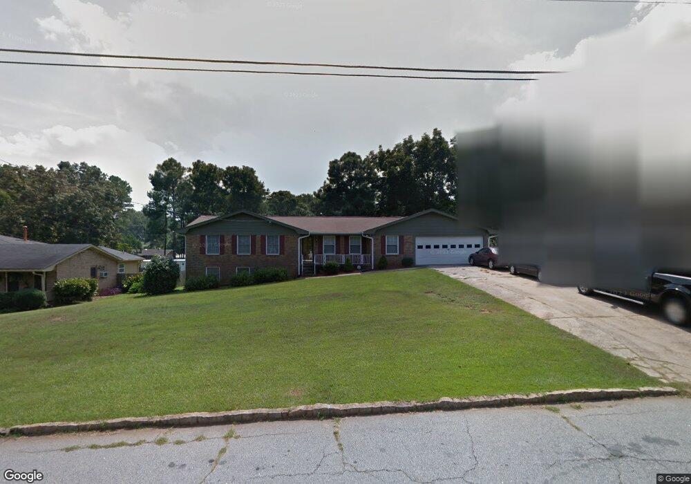
4487 Raleigh Dr Unit 3 Decatur, GA 30034
Southwest DeKalb NeighborhoodEstimated Value: $244,283 - $357,000
3
Beds
2
Baths
1,710
Sq Ft
$172/Sq Ft
Est. Value
About This Home
This home is located at 4487 Raleigh Dr Unit 3, Decatur, GA 30034 and is currently estimated at $293,571, approximately $171 per square foot. 4487 Raleigh Dr Unit 3 is a home located in DeKalb County with nearby schools including Browns Mill Elementary School, Salem Middle School, and Martin Luther King- Jr. High School.
Ownership History
Date
Name
Owned For
Owner Type
Purchase Details
Closed on
Jan 27, 1998
Sold by
Harden Marva S and Harden David
Bought by
Wilson Larry D and Wilson Wanda S
Current Estimated Value
Purchase Details
Closed on
Aug 25, 1994
Sold by
Baker Maggie H
Bought by
Armstrong Willie W
Home Financials for this Owner
Home Financials are based on the most recent Mortgage that was taken out on this home.
Original Mortgage
$67,500
Interest Rate
8.74%
Create a Home Valuation Report for This Property
The Home Valuation Report is an in-depth analysis detailing your home's value as well as a comparison with similar homes in the area
Home Values in the Area
Average Home Value in this Area
Purchase History
| Date | Buyer | Sale Price | Title Company |
|---|---|---|---|
| Wilson Larry D | $117,700 | -- | |
| Armstrong Willie W | $75,100 | -- |
Source: Public Records
Mortgage History
| Date | Status | Borrower | Loan Amount |
|---|---|---|---|
| Previous Owner | Armstrong Willie W | $67,500 | |
| Closed | Wilson Larry D | -- |
Source: Public Records
Tax History Compared to Growth
Tax History
| Year | Tax Paid | Tax Assessment Tax Assessment Total Assessment is a certain percentage of the fair market value that is determined by local assessors to be the total taxable value of land and additions on the property. | Land | Improvement |
|---|---|---|---|---|
| 2025 | $3,468 | $105,360 | $11,000 | $94,360 |
| 2024 | $3,639 | $105,840 | $11,000 | $94,840 |
| 2023 | $3,639 | $100,840 | $11,000 | $89,840 |
| 2022 | $2,517 | $74,400 | $4,120 | $70,280 |
| 2021 | $2,349 | $69,520 | $4,120 | $65,400 |
| 2020 | $2,097 | $62,040 | $4,120 | $57,920 |
| 2019 | $1,630 | $48,960 | $4,120 | $44,840 |
| 2018 | $1,101 | $41,960 | $4,120 | $37,840 |
| 2017 | $1,292 | $37,920 | $4,120 | $33,800 |
| 2016 | $1,067 | $32,240 | $4,120 | $28,120 |
| 2014 | $439 | $13,760 | $4,040 | $9,720 |
Source: Public Records
Map
Nearby Homes
- 4480 Raleigh Dr
- 4494 Huntsman Bend
- 4505 Wonder Valley Trail
- 2855 Thompson Cir
- 4426 Sterling Forest Dr
- 4669 Huntsman Bend
- 2687 Paxton Place
- 2922 Snapfinger Rd
- 4281 Arcadia Dr
- 4282 Callum Ct
- 4671 Jakes Trail
- 4279 & 4281 Sebring Walk
- 4716 Jakes Trail
- 2826 Snapfinger Manor Unit 106
- 4469 Wellington Terrace Unit 1
- 2742 Snapfinger Manor Unit 128
- 4683 Thompson Mill Rd
- 4748 Shire Dr
- 3042 Cobb Trail
- 4695 Thompson Mill Rd
- 4495 Raleigh Dr
- 4477 Raleigh Dr
- 4503 Raleigh Dr
- 4809 Huntsman Bend
- 4801 Huntsman Bend
- 4463 Raleigh Dr
- 4492 Raleigh Dr
- 4793 Huntsman Bend
- 4511 Raleigh Dr
- 4500 Raleigh Dr
- 2863 Raleigh Ct
- 4825 Huntlea Ct
- 4787 Huntsman Bend
- 4508 Raleigh Dr
- 4460 Raleigh Dr Unit 3
- 4453 Raleigh Dr Unit 3
- 4519 Raleigh Dr
- 4833 Huntlea Ct
- 4516 Raleigh Dr
- 0 Raleigh Ct & Raleigh Dr Ga (Id 369)