Estimated Value: $150,122 - $196,000
3
Beds
2
Baths
1,350
Sq Ft
$134/Sq Ft
Est. Value
About This Home
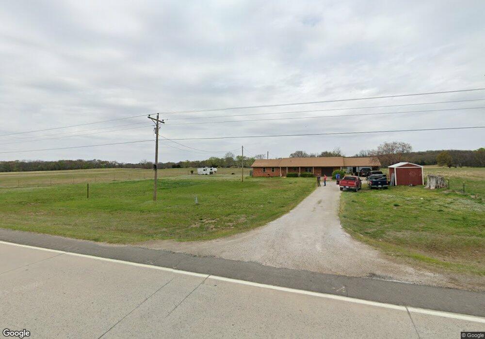
This home is located at 448743 Highway 64, Vian, OK 74962 and is currently estimated at $181,031, approximately $134 per square foot. 448743 Highway 64 is a home located in Sequoyah County with nearby schools including Gore Upper Elementary School and Gore High School.
Ownership History
Date
Name
Owned For
Owner Type
Purchase Details
Closed on
Jun 28, 2013
Sold by
Cato Janeen Marie
Bought by
Byrd Kenneth and Byrd Haley
Current Estimated Value
Home Financials for this Owner
Home Financials are based on the most recent Mortgage that was taken out on this home.
Original Mortgage
$91,836
Outstanding Balance
$66,523
Interest Rate
3.83%
Mortgage Type
New Conventional
Estimated Equity
$114,508
Purchase Details
Closed on
Sep 12, 2011
Sold by
Cato Richard Dean and Cato Janeen Marie
Bought by
Cato Janeen Marlo and Cato Richard Dean
Create a Home Valuation Report for This Property
The Home Valuation Report is an in-depth analysis detailing your home's value as well as a comparison with similar homes in the area
Home Values in the Area
Average Home Value in this Area
Purchase History
| Date | Buyer | Sale Price | Title Company |
|---|---|---|---|
| Byrd Kenneth | $85,000 | None Available | |
| Cato Janeen Marlo | -- | None Available |
Source: Public Records
Mortgage History
| Date | Status | Borrower | Loan Amount |
|---|---|---|---|
| Open | Byrd Kenneth | $91,836 |
Source: Public Records
Tax History Compared to Growth
Tax History
| Year | Tax Paid | Tax Assessment Tax Assessment Total Assessment is a certain percentage of the fair market value that is determined by local assessors to be the total taxable value of land and additions on the property. | Land | Improvement |
|---|---|---|---|---|
| 2024 | $730 | $7,960 | $660 | $7,300 |
| 2023 | $730 | $7,728 | $660 | $7,068 |
| 2022 | $677 | $7,728 | $660 | $7,068 |
| 2021 | $623 | $7,728 | $660 | $7,068 |
| 2020 | $651 | $7,728 | $660 | $7,068 |
| 2019 | $705 | $7,612 | $660 | $6,952 |
| 2018 | $729 | $7,865 | $660 | $7,205 |
| 2017 | $759 | $8,107 | $660 | $7,447 |
| 2016 | $603 | $8,360 | $660 | $7,700 |
| 2015 | $615 | $8,602 | $660 | $7,942 |
| 2014 | $677 | $8,729 | $660 | $8,069 |
Source: Public Records
Map
Nearby Homes
- 103759 S 4490 Rd
- 01 E 1050 Rd
- 105148 S 4500
- 0 S 4475 Rd
- 0 1030 Rd Unit 2520454
- 106641 S 4475 Rd
- 447008 E 1058 Rd
- 802 Schley St
- 613 S Rodgers St
- 54 N Rodgers St
- 304 Blackstone St
- 0 Leftwich St
- 108 S Thornton St
- 0 Ranch Rd Unit 2541667
- 109 W Lee St
- 000 Schley St
- 1 State Highway 82
- 102 E Thompson
- 448159 E 979 Rd
- 457848 E 1013 Rd
- 104263 S 4490 Rd
- 448287 Highway 64
- 449066 E 1041 Rd
- 449011 E 1041 Rd
- 449099 E 1041 Rd Unit 1
- 104013 S 4490 Rd
- 704 S Thornton St
- 449327 Highway 64 Unit U
- 448130 Highway 64
- 0 1044 Loop Unit 2141571
- 449454 E 1044 Loop
- 449172 E 1050 Rd
- 0 1050 Rd Unit 2001678
- 0 1050 Rd Unit 2011634
- 103686 S 4490 Rd
- 55A Rr 1
- 154 Rr 2
- 449598 E 1042 Rd