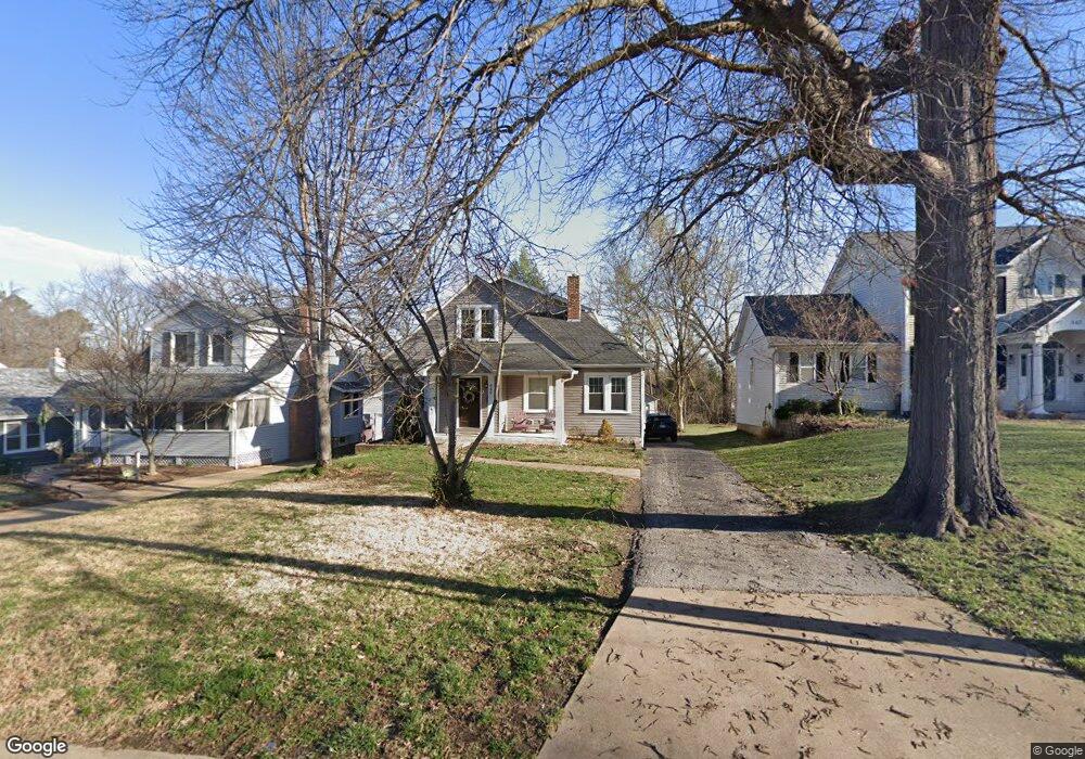
449 Bacon Ave Saint Louis, MO 63119
Estimated Value: $376,000 - $649,000
3
Beds
3
Baths
1,924
Sq Ft
$275/Sq Ft
Est. Value
About This Home
This home is located at 449 Bacon Ave, Saint Louis, MO 63119 and is currently estimated at $529,682, approximately $275 per square foot. 449 Bacon Ave is a home located in St. Louis County with nearby schools including Bristol Elementary School, Hixson Middle School, and Webster Groves High School.
Ownership History
Date
Name
Owned For
Owner Type
Purchase Details
Closed on
Nov 15, 2002
Sold by
Galloway James M and Galloway Marilyn J
Bought by
Miller John and Miller Kathryn
Current Estimated Value
Home Financials for this Owner
Home Financials are based on the most recent Mortgage that was taken out on this home.
Original Mortgage
$130,800
Outstanding Balance
$54,262
Interest Rate
5.89%
Estimated Equity
$475,420
Purchase Details
Closed on
Oct 8, 1998
Sold by
Galloway James M and Galloway Marilyn J
Bought by
Galloway Scott Randall and Galloway Stacey Lea
Create a Home Valuation Report for This Property
The Home Valuation Report is an in-depth analysis detailing your home's value as well as a comparison with similar homes in the area
Home Values in the Area
Average Home Value in this Area
Purchase History
| Date | Buyer | Sale Price | Title Company |
|---|---|---|---|
| Miller John | $163,500 | -- | |
| Galloway Scott Randall | -- | -- |
Source: Public Records
Mortgage History
| Date | Status | Borrower | Loan Amount |
|---|---|---|---|
| Open | Miller John | $130,800 | |
| Closed | Miller John | $24,500 |
Source: Public Records
Tax History
| Year | Tax Paid | Tax Assessment Tax Assessment Total Assessment is a certain percentage of the fair market value that is determined by local assessors to be the total taxable value of land and additions on the property. | Land | Improvement |
|---|---|---|---|---|
| 2025 | $5,764 | $85,270 | $55,210 | $30,060 |
| 2024 | $5,764 | $82,900 | $46,000 | $36,900 |
| 2023 | $5,736 | $82,900 | $46,000 | $36,900 |
| 2022 | $5,186 | $69,540 | $33,140 | $36,400 |
| 2021 | $5,168 | $69,540 | $33,140 | $36,400 |
| 2020 | $5,299 | $66,450 | $33,140 | $33,310 |
| 2019 | $5,262 | $66,450 | $33,140 | $33,310 |
| 2018 | $4,913 | $55,080 | $25,780 | $29,300 |
| 2016 | $4,034 | $43,510 | $18,390 | $25,120 |
Source: Public Records
Map
Nearby Homes
- 500 Bacon Ave
- 433 Bismark Ave
- 519 Bismark Ave
- 619 N Rock Hill Rd
- 404 W Kirkham Ave
- 9840 Madison Ave
- 810 N Rock Hill Rd
- 10 Barbre Ct
- 7 Barbre Ct
- 739 Glenvista Place
- 901 Ennis Ave
- 112 W Thornton Ave
- 203 Almentor Ave
- 789 Glenvista Place
- 9816 Obrien Ct
- 725 Cornell Ave
- 112 Oakwood Ave
- 900 N Elm Ave
- 815 Cornell Ave
- 18 Southridge Dr
Your Personal Tour Guide
Ask me questions while you tour the home.