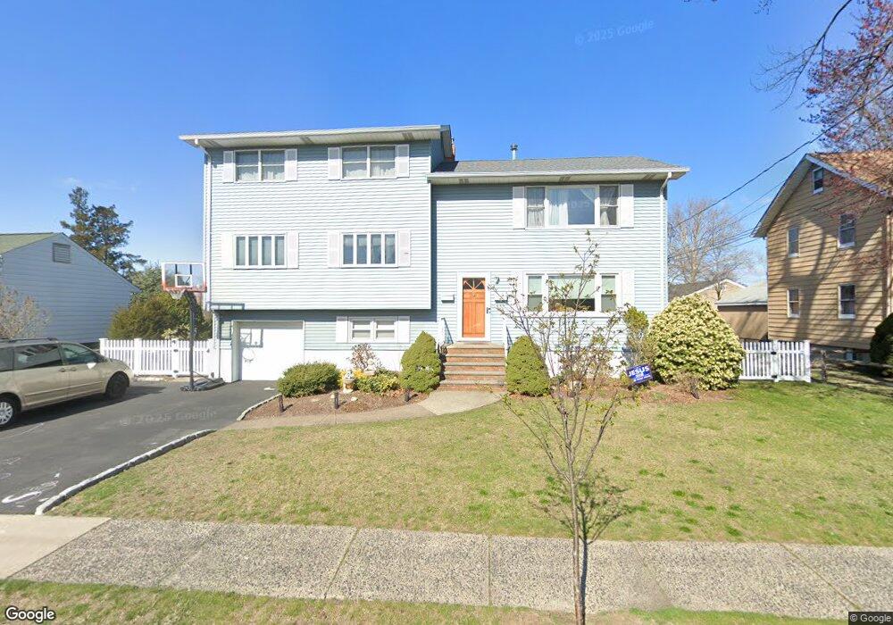
449 Chestnut Ave South Hackensack, NJ 07606
Estimated Value: $752,790 - $849,000
Studio
--
Bath
2,612
Sq Ft
$311/Sq Ft
Est. Value
About This Home
This home is located at 449 Chestnut Ave, South Hackensack, NJ 07606 and is currently estimated at $813,198, approximately $311 per square foot. 449 Chestnut Ave is a home located in Bergen County with nearby schools including Memorial Elementary School and George Washington School.
Ownership History
Date
Name
Owned For
Owner Type
Purchase Details
Closed on
May 3, 2002
Sold by
Teklits Vincent
Bought by
Reinhardt Philip and Reinhardt Adina
Current Estimated Value
Home Financials for this Owner
Home Financials are based on the most recent Mortgage that was taken out on this home.
Original Mortgage
$344,000
Outstanding Balance
$146,076
Interest Rate
7.01%
Estimated Equity
$667,122
Create a Home Valuation Report for This Property
The Home Valuation Report is an in-depth analysis detailing your home's value as well as a comparison with similar homes in the area
Home Values in the Area
Average Home Value in this Area
Purchase History
| Date | Buyer | Sale Price | Title Company |
|---|---|---|---|
| Reinhardt Philip | $430,000 | -- |
Source: Public Records
Mortgage History
| Date | Status | Borrower | Loan Amount |
|---|---|---|---|
| Open | Reinhardt Philip | $344,000 |
Source: Public Records
Tax History
| Year | Tax Paid | Tax Assessment Tax Assessment Total Assessment is a certain percentage of the fair market value that is determined by local assessors to be the total taxable value of land and additions on the property. | Land | Improvement |
|---|---|---|---|---|
| 2025 | $10,257 | $566,100 | $268,400 | $297,700 |
| 2024 | $9,999 | $523,600 | $245,200 | $278,400 |
| 2023 | $9,512 | $469,200 | $227,700 | $241,500 |
| 2022 | $9,512 | $431,400 | $203,300 | $228,100 |
| 2021 | $9,531 | $377,900 | $183,300 | $194,600 |
| 2020 | $8,908 | $331,900 | $165,700 | $166,200 |
| 2019 | $9,003 | $329,400 | $163,700 | $165,700 |
| 2018 | $8,956 | $324,600 | $161,700 | $162,900 |
| 2017 | $8,890 | $320,000 | $157,700 | $162,300 |
| 2016 | $8,610 | $311,500 | $152,700 | $158,800 |
| 2015 | $8,441 | $307,400 | $148,700 | $158,700 |
| 2014 | $8,208 | $303,100 | $145,800 | $157,300 |
Source: Public Records
Map
Nearby Homes
- 418 Taylor Ave
- 467 Hudson St
- 9 Vreeland Ave Unit 3A
- 460 Liberty St Unit 205
- 85 Grove St
- 468 Liberty St Unit 201
- 337 Hudson St
- 462 Liberty St Unit 462A Unit 101
- 462C Liberty St Unit 312
- 468a Liberty St Unit 101
- 333 Liberty St Unit 15
- 333 Liberty St Unit 4
- 151 4th St
- 23 Grand St
- 12 Brandt St
- 221 4th St
- 113 Franklin St
- 39 Summit St
- 115 River Rd
- 43 Poplar Ave
- 443 Chestnut Ave
- 455 Chestnut Ave
- 433 Chestnut Ave
- 120 Phillips Ave
- 440 N Taylor Ave
- 128 Phillips Ave
- 469 Chestnut Ave
- 112 Phillips Ave
- 423 Taylor Ave
- 433 Taylor Ave
- 437 Taylor Ave
- 439 N Taylor Ave
- 436 N Taylor Ave
- 436 N Taylor Ave Unit 1
- 436 N Taylor Ave Unit 2
- 477 Chestnut Ave
- 460 Chestnut Ave
- 429 Chestnut Ave
- 110 Phillips Ave
- 440 Chestnut Ave
Your Personal Tour Guide
Ask me questions while you tour the home.