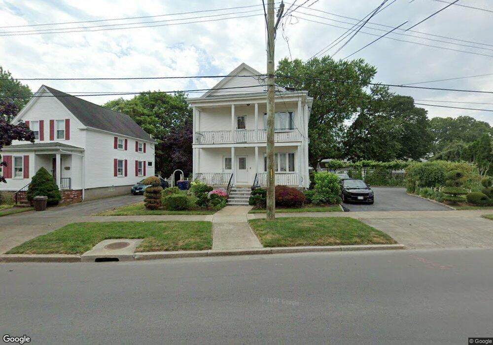
449 Rockdale Ave Unit 451 New Bedford, MA 02740
The South End NeighborhoodEstimated Value: $506,000 - $676,000
6
Beds
2
Baths
2,520
Sq Ft
$225/Sq Ft
Est. Value
About This Home
This home is located at 449 Rockdale Ave Unit 451, New Bedford, MA 02740 and is currently estimated at $566,157, approximately $224 per square foot. 449 Rockdale Ave Unit 451 is a home located in Bristol County with nearby schools including Betsey B. Winslow Elementary School, Keith Middle School, and New Bedford High School.
Ownership History
Date
Name
Owned For
Owner Type
Purchase Details
Closed on
Mar 29, 2022
Sold by
Sousa Jose J and Sousa Laurinda C
Bought by
Sousa Ft and Sousa
Current Estimated Value
Purchase Details
Closed on
Feb 7, 2002
Sold by
Dealmeida Antonio and Dealmeida Elisa C
Bought by
Sousa Jose J and Sousa Laurinda C
Purchase Details
Closed on
Jul 24, 1989
Sold by
Silvi Est Of Geor C
Bought by
Dealmeida Antonio
Home Financials for this Owner
Home Financials are based on the most recent Mortgage that was taken out on this home.
Original Mortgage
$48,000
Interest Rate
10.07%
Mortgage Type
Purchase Money Mortgage
Create a Home Valuation Report for This Property
The Home Valuation Report is an in-depth analysis detailing your home's value as well as a comparison with similar homes in the area
Home Values in the Area
Average Home Value in this Area
Purchase History
| Date | Buyer | Sale Price | Title Company |
|---|---|---|---|
| Sousa Ft | -- | None Available | |
| Sousa Ft | -- | None Available | |
| Sousa Jose J | $80,000 | -- | |
| Sousa Jose J | $80,000 | -- | |
| Dealmeida Antonio | $148,000 | -- | |
| Dealmeida Antonio | $148,000 | -- |
Source: Public Records
Mortgage History
| Date | Status | Borrower | Loan Amount |
|---|---|---|---|
| Previous Owner | Dealmeida Antonio | $35,000 | |
| Previous Owner | Dealmeida Antonio | $48,000 |
Source: Public Records
Tax History Compared to Growth
Tax History
| Year | Tax Paid | Tax Assessment Tax Assessment Total Assessment is a certain percentage of the fair market value that is determined by local assessors to be the total taxable value of land and additions on the property. | Land | Improvement |
|---|---|---|---|---|
| 2025 | $5,812 | $513,900 | $127,700 | $386,200 |
| 2024 | $5,276 | $439,700 | $129,800 | $309,900 |
| 2023 | $5,123 | $358,500 | $111,900 | $246,600 |
| 2022 | $4,690 | $301,800 | $106,400 | $195,400 |
| 2021 | $4,705 | $301,800 | $106,400 | $195,400 |
| 2020 | $4,549 | $281,500 | $106,400 | $175,100 |
| 2019 | $4,463 | $271,000 | $106,400 | $164,600 |
| 2018 | $4,216 | $253,500 | $106,400 | $147,100 |
| 2017 | $3,849 | $230,600 | $106,400 | $124,200 |
| 2016 | $3,715 | $225,300 | $106,400 | $118,900 |
| 2015 | $3,481 | $221,300 | $106,400 | $114,900 |
| 2014 | $3,268 | $215,600 | $100,000 | $115,600 |
Source: Public Records
Map
Nearby Homes
- 445 Rockdale Ave
- 439 Rockdale Ave
- 22 Mandell St
- 457 Rockdale Ave
- 16 Mandell St
- 32 Mandell St
- 452 Rockdale Ave Unit 454
- 23 Brier St
- 17 Brier St
- 448 Rockdale Ave Unit 450
- 456 Rockdale Ave
- 444 Rockdale Ave
- 435 Rockdale Ave
- 8 Mandell St
- 40 Mandell St
- 442 Rockdale Ave
- 462 Rockdale Ave
- 465 Rockdale Ave
- 464 Rockdale Ave
- 432 Rockdale Ave