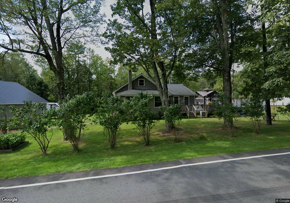
449 Samsonville Rd Kerhonkson, NY 12446
Rochester NeighborhoodEstimated Value: $386,000 - $481,000
2
Beds
2
Baths
1,152
Sq Ft
$378/Sq Ft
Est. Value
About This Home
This home is located at 449 Samsonville Rd, Kerhonkson, NY 12446 and is currently estimated at $435,084, approximately $377 per square foot. 449 Samsonville Rd is a home located in Ulster County with nearby schools including Rondout Valley High School.
Ownership History
Date
Name
Owned For
Owner Type
Purchase Details
Closed on
Jul 11, 2002
Sold by
Gunderman Lawrence and Gunderman Grace
Bought by
Gunderman Lawrence
Current Estimated Value
Purchase Details
Closed on
Mar 19, 2002
Sold by
Scuderi Charles M and Scuderi Delores E
Bought by
Bland Donald Jeff and Bland Sandra Dawn
Purchase Details
Closed on
May 1, 2000
Sold by
Nester Walter T and Nester Pamela S
Bought by
Nester Pamela S
Purchase Details
Closed on
Sep 20, 1993
Create a Home Valuation Report for This Property
The Home Valuation Report is an in-depth analysis detailing your home's value as well as a comparison with similar homes in the area
Home Values in the Area
Average Home Value in this Area
Purchase History
| Date | Buyer | Sale Price | Title Company |
|---|---|---|---|
| Gunderman Lawrence | -- | -- | |
| Bland Donald Jeff | -- | -- | |
| Nester Pamela S | -- | -- | |
| -- | $60,000 | -- |
Source: Public Records
Tax History Compared to Growth
Tax History
| Year | Tax Paid | Tax Assessment Tax Assessment Total Assessment is a certain percentage of the fair market value that is determined by local assessors to be the total taxable value of land and additions on the property. | Land | Improvement |
|---|---|---|---|---|
| 2024 | $5,111 | $198,000 | $40,000 | $158,000 |
| 2023 | $5,027 | $198,000 | $40,000 | $158,000 |
| 2022 | $4,599 | $198,000 | $40,000 | $158,000 |
| 2021 | $4,599 | $198,000 | $40,000 | $158,000 |
| 2020 | $4,176 | $198,000 | $40,000 | $158,000 |
| 2019 | $3,763 | $185,000 | $40,000 | $145,000 |
| 2018 | $4,053 | $175,000 | $52,500 | $122,500 |
| 2017 | $3,925 | $175,000 | $52,500 | $122,500 |
| 2016 | $3,913 | $175,000 | $52,500 | $122,500 |
| 2015 | -- | $150,000 | $52,500 | $97,500 |
| 2014 | -- | $150,000 | $52,500 | $97,500 |
Source: Public Records
Map
Nearby Homes
- 25 Upper Cherrytown Rd
- 165 Ridgeview Rd
- 410 Samsonville Rd
- 42 Markle Rd
- 26 Iken Rd
- 72 van Tine Rd
- 100 Upper Cherrytown Rd
- 78 Beehive Rd
- 0 Samsonville Rd Unit KEY815196
- 767 Cherrytown Rd
- 119 Mt Laurel Rd
- 00 Mount Laurel Rd
- 214 Wright Rd
- 300 Mt Laurel Rd
- 130 Cedar Dr
- 673 Samsonville Rd
- 46 Pine Grove Rd
- 16 Pine Grove Rd
- 2 Burpo Ln
- 203 Samsonville Rd
- 445 Samsonville Rd
- 6 Leg Horn Rd
- 441 Samsonville Rd
- 1 Upper Cherrytown Rd
- 1 Upper Cherrytown Rd
- 1 Upper Cherrytown Rd
- 1 Upper Cherrytown Rd
- 1 Upper Cherrytown Rd
- 1 Upper Cherrytown Rd
- 1 Upper Cherrytown Rd
- 1 Upper Cherrytown Rd
- 454 Samsonville Rd
- 0 Upper Cherrytown Rd Unit 20081152
- 11 Upper Cherrytown Rd
- 435 Samsonville Rd
- 35 Leg Horn Rd
- 465 Samsonville Rd
- 36 Leg Horn Rd
- 12 Upper Cherrytown Rd
- 12 Upper Cherrytown Rd Unit Upper Cherrytown Rd