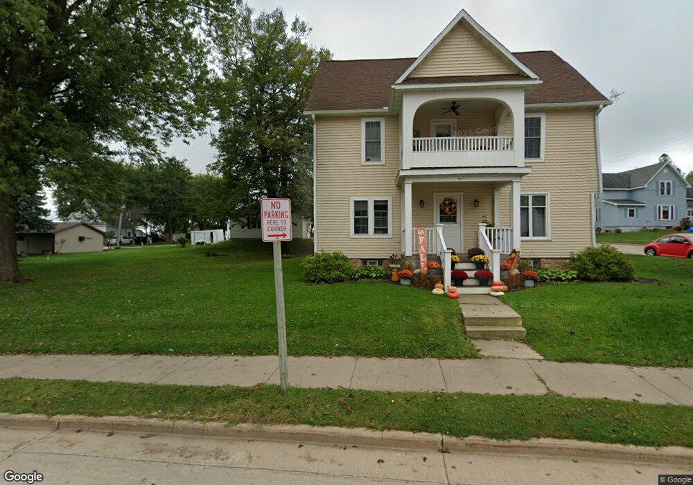
449 South St Cashton, WI 54619
Estimated Value: $227,000 - $250,961
--
Bed
--
Bath
--
Sq Ft
10,454
Sq Ft Lot
About This Home
This home is located at 449 South St, Cashton, WI 54619 and is currently estimated at $242,240. 449 South St is a home located in Monroe County with nearby schools including Cashton Elementary School, Cashton Middle/High School, and Sacred Heart Catholic Elementary School.
Ownership History
Date
Name
Owned For
Owner Type
Purchase Details
Closed on
Jan 15, 2021
Sold by
Kabat David H and Kabat Mari Jo
Bought by
Mytas Martin E
Current Estimated Value
Home Financials for this Owner
Home Financials are based on the most recent Mortgage that was taken out on this home.
Original Mortgage
$148,000
Outstanding Balance
$132,091
Interest Rate
2.71%
Mortgage Type
New Conventional
Estimated Equity
$110,150
Purchase Details
Closed on
Mar 25, 2011
Sold by
Mavis J Mavis J and Moore Richard L
Bought by
Kabat David H and Kabat Mari Jo
Create a Home Valuation Report for This Property
The Home Valuation Report is an in-depth analysis detailing your home's value as well as a comparison with similar homes in the area
Home Values in the Area
Average Home Value in this Area
Purchase History
| Date | Buyer | Sale Price | Title Company |
|---|---|---|---|
| Mytas Martin E | $185,000 | Monroe County Title | |
| Kabat David H | -- | -- | |
| Moore Richad L | -- | -- |
Source: Public Records
Mortgage History
| Date | Status | Borrower | Loan Amount |
|---|---|---|---|
| Open | Mytas Martin E | $148,000 |
Source: Public Records
Tax History Compared to Growth
Tax History
| Year | Tax Paid | Tax Assessment Tax Assessment Total Assessment is a certain percentage of the fair market value that is determined by local assessors to be the total taxable value of land and additions on the property. | Land | Improvement |
|---|---|---|---|---|
| 2024 | $2,619 | $176,500 | $12,000 | $164,500 |
| 2023 | $2,930 | $176,500 | $12,000 | $164,500 |
| 2022 | $2,310 | $88,500 | $6,000 | $82,500 |
| 2021 | $2,242 | $88,500 | $6,000 | $82,500 |
| 2020 | $2,264 | $88,500 | $6,000 | $82,500 |
| 2019 | $2,316 | $88,500 | $6,000 | $82,500 |
| 2018 | $2,420 | $88,500 | $6,000 | $82,500 |
| 2017 | $2,098 | $88,500 | $6,000 | $82,500 |
| 2016 | $2,133 | $88,500 | $6,000 | $82,500 |
| 2015 | $2,420 | $88,500 | $6,000 | $82,500 |
| 2014 | $1,999 | $77,800 | $6,000 | $71,800 |
| 2011 | $798 | $36,200 | $6,000 | $30,200 |
Source: Public Records
Map
Nearby Homes
- 332 Coe St
- 920 Wisconsin St
- 630 Albion St
- Lot 53 Stenslien Hills
- Lot 17 Stenslien Hills
- Lot 57 Stenslien Hills
- Lot 62 Stenslien Hills
- Lot 52 Stenslien Hills
- Lot 16 Stenslien Hills
- Lot 54 Stenslien Hills
- Lot 56 Stenslien Hills
- Lot 18 Stenslien Hills
- Lot 30 Stenslien Hills
- 17155 County Highway F
- 17161 County Highway F
- 313 Black River Ave
- E8287 E Ridge Rd
- 111 Monroe St
- 310 Ontario Ave
- 553 Schneider St
- 301 Broadway St
- 508 Broadway St
- 426 Broadway St
- 434 Broadway St
- 418 Broadway St
- 517 Broadway St
- 509 Broadway St
- 413 Broadway St
- 405 Broadway St
- 813 Ontario Ave
- 809 Ontario Ave
- 420 South St
- 518 South St
- 523 South St
- 503 Coe St
- 440 Brody Ave
- 518 Brody Ave
- 530 Brody Ave