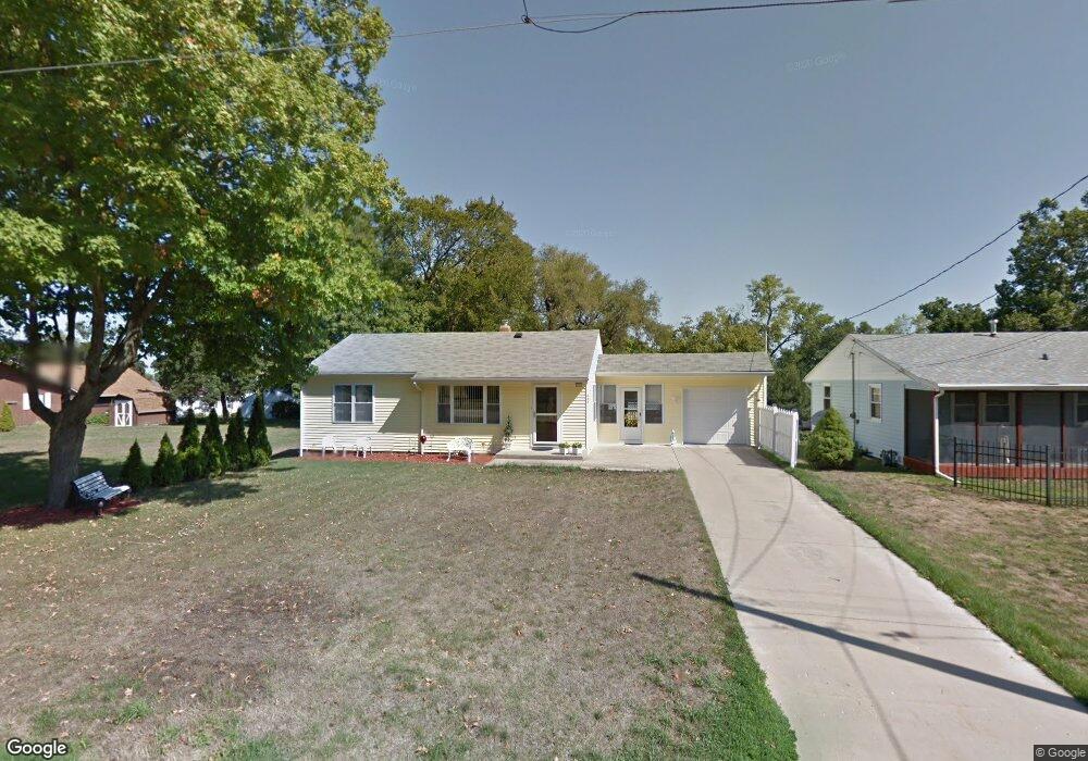
449 W 5th St Pecatonica, IL 61063
Estimated Value: $126,712 - $156,000
Studio
--
Bath
864
Sq Ft
$164/Sq Ft
Est. Value
About This Home
This home is located at 449 W 5th St, Pecatonica, IL 61063 and is currently estimated at $141,428, approximately $163 per square foot. 449 W 5th St is a home located in Winnebago County with nearby schools including Pecatonica Elementary School, Pecatonica Community Middle School, and Pecatonica High School.
Ownership History
Date
Name
Owned For
Owner Type
Purchase Details
Closed on
Dec 13, 2021
Sold by
Richard A Zimmerman Trust
Bought by
Crozier Jaymes Patrick
Current Estimated Value
Home Financials for this Owner
Home Financials are based on the most recent Mortgage that was taken out on this home.
Original Mortgage
$103,740
Outstanding Balance
$95,754
Interest Rate
3.38%
Mortgage Type
New Conventional
Estimated Equity
$45,674
Purchase Details
Closed on
Oct 28, 2013
Bought by
Zimmerman Richard
Create a Home Valuation Report for This Property
The Home Valuation Report is an in-depth analysis detailing your home's value as well as a comparison with similar homes in the area
Purchase History
| Date | Buyer | Sale Price | Title Company |
|---|---|---|---|
| Crozier Jaymes Patrick | $109,500 | Reno & Zahm Llp | |
| Zimmerman Richard | $65,000 | -- |
Source: Public Records
Mortgage History
| Date | Status | Borrower | Loan Amount |
|---|---|---|---|
| Open | Crozier Jaymes Patrick | $103,740 |
Source: Public Records
Tax History
| Year | Tax Paid | Tax Assessment Tax Assessment Total Assessment is a certain percentage of the fair market value that is determined by local assessors to be the total taxable value of land and additions on the property. | Land | Improvement |
|---|---|---|---|---|
| 2024 | $2,835 | $42,463 | $4,545 | $37,918 |
| 2022 | $2,610 | $36,001 | $3,854 | $32,147 |
| 2021 | $2,493 | $27,906 | $3,624 | $24,282 |
| 2020 | $2,457 | $26,884 | $3,491 | $23,393 |
| 2019 | $2,819 | $25,575 | $3,321 | $22,254 |
| 2018 | $2,922 | $27,289 | $3,223 | $24,066 |
| 2017 | $2,978 | $26,738 | $3,158 | $23,580 |
| 2016 | $2,853 | $26,474 | $3,127 | $23,347 |
| 2015 | $2,817 | $26,210 | $3,096 | $23,114 |
| 2014 | $3,026 | $29,071 | $3,096 | $25,975 |
Source: Public Records
Map
Nearby Homes
- 633 Park View St Unit 47A
- 423 Main St
- 418 Main St
- 24xx Jackson St
- 16905 W State Rd
- 15685 W State Rd
- 16524 Grove Creek Cir
- 14949 Saunders Rd
- 6259 N Pecatonica Rd
- 3810 Foxglove Ln
- 13116 Springhill Dr
- 12909 Springhill Dr
- 3765 Lakeview Dr
- 4010 Lakeshore Dr
- 12432 Barberry Dr
- 00 Judd Rd
- 12411 Barberry Dr
- 3771 & 3773 Lakeview Dr
- 7980 E Ridott Rd
- 11XXX Smith Rd
Your Personal Tour Guide
Ask me questions while you tour the home.