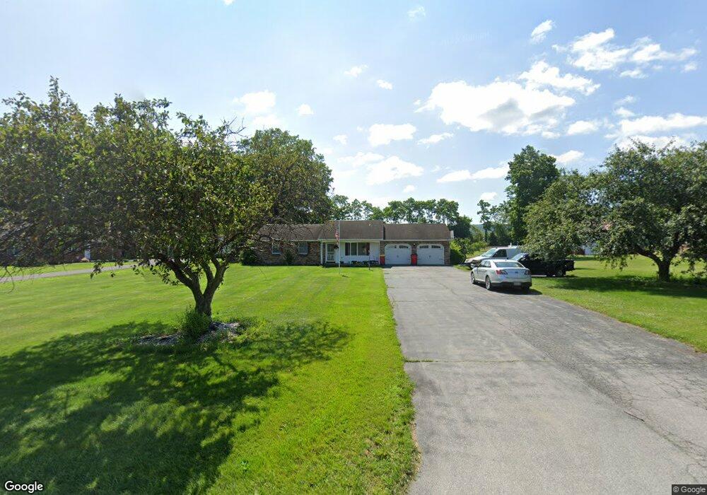
449 W Main St Walnut Bottom, PA 17266
Estimated Value: $261,000 - $288,239
3
Beds
2
Baths
1,288
Sq Ft
$212/Sq Ft
Est. Value
About This Home
This home is located at 449 W Main St, Walnut Bottom, PA 17266 and is currently estimated at $273,560, approximately $212 per square foot. 449 W Main St is a home located in Cumberland County with nearby schools including Oak Flat El School, Big Spring Middle School, and Big Spring High School.
Ownership History
Date
Name
Owned For
Owner Type
Purchase Details
Closed on
Sep 11, 2007
Sold by
Houseman Ella J
Bought by
Beam Keith E
Current Estimated Value
Home Financials for this Owner
Home Financials are based on the most recent Mortgage that was taken out on this home.
Original Mortgage
$159,315
Outstanding Balance
$101,537
Interest Rate
6.7%
Mortgage Type
New Conventional
Estimated Equity
$172,023
Create a Home Valuation Report for This Property
The Home Valuation Report is an in-depth analysis detailing your home's value as well as a comparison with similar homes in the area
Home Values in the Area
Average Home Value in this Area
Purchase History
| Date | Buyer | Sale Price | Title Company |
|---|---|---|---|
| Beam Keith E | $167,700 | -- |
Source: Public Records
Mortgage History
| Date | Status | Borrower | Loan Amount |
|---|---|---|---|
| Open | Beam Keith E | $159,315 |
Source: Public Records
Tax History Compared to Growth
Tax History
| Year | Tax Paid | Tax Assessment Tax Assessment Total Assessment is a certain percentage of the fair market value that is determined by local assessors to be the total taxable value of land and additions on the property. | Land | Improvement |
|---|---|---|---|---|
| 2025 | $3,255 | $169,100 | $53,000 | $116,100 |
| 2024 | $3,200 | $169,100 | $53,000 | $116,100 |
| 2023 | $3,104 | $169,100 | $53,000 | $116,100 |
| 2022 | $3,039 | $169,100 | $53,000 | $116,100 |
| 2021 | $2,956 | $169,100 | $53,000 | $116,100 |
| 2020 | $2,895 | $169,100 | $53,000 | $116,100 |
| 2019 | $2,837 | $169,100 | $53,000 | $116,100 |
| 2018 | $2,790 | $169,100 | $53,000 | $116,100 |
| 2017 | $2,732 | $169,100 | $53,000 | $116,100 |
| 2016 | -- | $169,100 | $53,000 | $116,100 |
| 2015 | -- | $169,100 | $53,000 | $116,100 |
| 2014 | -- | $169,100 | $53,000 | $116,100 |
Source: Public Records
Map
Nearby Homes
- 180 Gutshall Rd
- 212 Walnut Dale Rd
- 341 Airport Rd
- 23 Short Ln
- 19 Short Ln
- 140 Blackbird Ln
- 106 Cardinal Dr
- 309 Oakville Rd
- 15 Courtney Dr
- 803 Greenwich Ln
- 0 Rr Ritner Unit PACB2043350
- 806 Greenwich Ln
- 304 Amberleigh Ln
- 54 Airport Rd
- 94 White House Rd
- 85 Airport Rd
- 39 Colonial Ct
- 19 Burke Dr
- 11 Michael Ct
- 302 Rine Dr