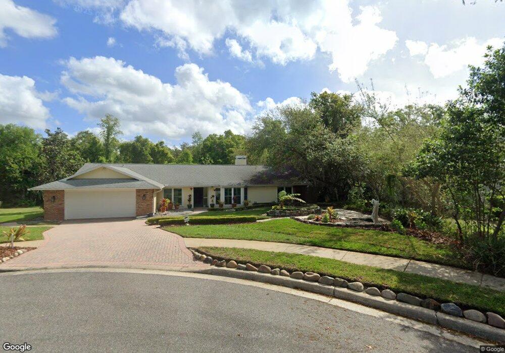
449 Wild Oak Cir Longwood, FL 32779
Estimated Value: $587,000 - $709,000
4
Beds
4
Baths
2,506
Sq Ft
$256/Sq Ft
Est. Value
About This Home
This home is located at 449 Wild Oak Cir, Longwood, FL 32779 and is currently estimated at $640,627, approximately $255 per square foot. 449 Wild Oak Cir is a home located in Seminole County with nearby schools including Sabal Point Elementary School, Rock Lake Middle School, and Lake Brantley High School.
Ownership History
Date
Name
Owned For
Owner Type
Purchase Details
Closed on
May 7, 2025
Sold by
Hill Barbara Hand
Bought by
Wild Oak Land Trust and Hill
Current Estimated Value
Purchase Details
Closed on
Jun 4, 1993
Sold by
Ellington Gary L and Ellington Carolyn A
Bought by
Hill H Michael and Hill Barbara Hand
Home Financials for this Owner
Home Financials are based on the most recent Mortgage that was taken out on this home.
Original Mortgage
$157,500
Interest Rate
6.97%
Mortgage Type
Purchase Money Mortgage
Purchase Details
Closed on
Dec 1, 1987
Bought by
Hill H Michael H and Hill Barbara H
Purchase Details
Closed on
Nov 1, 1982
Bought by
Hill H Michael H and Hill Barbara H
Create a Home Valuation Report for This Property
The Home Valuation Report is an in-depth analysis detailing your home's value as well as a comparison with similar homes in the area
Home Values in the Area
Average Home Value in this Area
Purchase History
| Date | Buyer | Sale Price | Title Company |
|---|---|---|---|
| Wild Oak Land Trust | $100 | None Listed On Document | |
| Wild Oak Land Trust | $100 | None Listed On Document | |
| Hill H Michael | $175,000 | -- | |
| Hill H Michael H | $210,000 | -- | |
| Hill H Michael H | $52,000 | -- |
Source: Public Records
Mortgage History
| Date | Status | Borrower | Loan Amount |
|---|---|---|---|
| Previous Owner | Hill H Michael | $157,500 |
Source: Public Records
Tax History Compared to Growth
Tax History
| Year | Tax Paid | Tax Assessment Tax Assessment Total Assessment is a certain percentage of the fair market value that is determined by local assessors to be the total taxable value of land and additions on the property. | Land | Improvement |
|---|---|---|---|---|
| 2024 | $3,614 | $287,278 | -- | -- |
| 2023 | $3,529 | $278,911 | $0 | $0 |
| 2021 | $3,366 | $262,900 | $0 | $0 |
| 2020 | $3,338 | $259,270 | $0 | $0 |
| 2019 | $3,305 | $253,441 | $0 | $0 |
| 2018 | $3,276 | $248,715 | $0 | $0 |
| 2017 | $3,257 | $243,599 | $0 | $0 |
| 2016 | $3,316 | $240,259 | $0 | $0 |
| 2015 | $3,071 | $236,930 | $0 | $0 |
| 2014 | $3,071 | $235,050 | $0 | $0 |
Source: Public Records
Map
Nearby Homes
- 805 S Sweetwater Blvd
- 800 Crooked Oak Ct
- 107 Wayland Cir
- 114 Countryside Dr
- 212 E Sweetwater Creek Dr
- 2390 Clay Ct
- 201 S Sweetwater Cove Blvd
- 203 Stonebridge Dr
- 401 Magnolia Oak Dr
- 2681 Azalea Dr
- 204 Green Lake Cir
- 501 Smokerise Blvd
- 800 Magnolia Oak Ct
- 208 Green Lake Cir
- 110 Tedworth Ct
- 2208 Cove Ct
- 206 N Sweetwater Cove Blvd
- 501 Riverbend Blvd
- 414 Timbercove Cir
- 2330 Pleasant Dr
- 445 Wild Oak Cir
- 453 Wild Oak Cir
- 441 Wild Oak Cir
- 457 Wild Oak Cir
- 807 S Sweetwater Blvd
- 461 Wild Oak Cir
- 300 Hunt Club Ct
- 811 S Sweetwater Blvd
- 437 Wild Oak Cir
- 803 S Sweetwater Blvd
- 444 Wild Oak Cir
- 448 Wild Oak Cir
- 452 Wild Oak Cir
- 456 Wild Oak Cir
- 434 Wild Oak Cir
- 465 Wild Oak Cir
- 200 Hunt Club Ct
- 433 Wild Oak Cir
- 460 Wild Oak Cir
- 105 Creekwood Ct