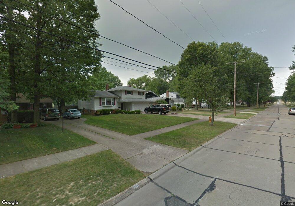
4490 Michael Ave North Olmsted, OH 44070
Estimated Value: $296,000 - $340,684
4
Beds
3
Baths
3,000
Sq Ft
$107/Sq Ft
Est. Value
About This Home
This home is located at 4490 Michael Ave, North Olmsted, OH 44070 and is currently estimated at $320,921, approximately $106 per square foot. 4490 Michael Ave is a home located in Cuyahoga County with nearby schools including Maple Intermediate Elementary School, Pine Intermediate School, and North Olmsted Middle School.
Ownership History
Date
Name
Owned For
Owner Type
Purchase Details
Closed on
Apr 30, 2010
Sold by
Gleba Mark S and Gleba Lynn M
Bought by
Vazquez Joseph T and Vazquez Wendy J
Current Estimated Value
Home Financials for this Owner
Home Financials are based on the most recent Mortgage that was taken out on this home.
Original Mortgage
$168,547
Outstanding Balance
$110,336
Interest Rate
5.05%
Mortgage Type
VA
Estimated Equity
$210,585
Purchase Details
Closed on
Jun 19, 1987
Sold by
Null Kathleen M
Bought by
Sonnendecker George E
Purchase Details
Closed on
Apr 3, 1987
Sold by
Null Rubert E
Bought by
Null Kathleen M
Purchase Details
Closed on
Aug 24, 1979
Sold by
Prescher Edwin R and Prescher Susan F
Bought by
Null Rubert E
Purchase Details
Closed on
Jan 1, 1975
Bought by
Prescher Edwin R and Prescher Susan F
Create a Home Valuation Report for This Property
The Home Valuation Report is an in-depth analysis detailing your home's value as well as a comparison with similar homes in the area
Home Values in the Area
Average Home Value in this Area
Purchase History
| Date | Buyer | Sale Price | Title Company |
|---|---|---|---|
| Vazquez Joseph T | $165,000 | Chicago Title Insurance Co | |
| Sonnendecker George E | $104,300 | -- | |
| Null Kathleen M | -- | -- | |
| Null Rubert E | $87,000 | -- | |
| Prescher Edwin R | -- | -- |
Source: Public Records
Mortgage History
| Date | Status | Borrower | Loan Amount |
|---|---|---|---|
| Open | Vazquez Joseph T | $168,547 |
Source: Public Records
Tax History
| Year | Tax Paid | Tax Assessment Tax Assessment Total Assessment is a certain percentage of the fair market value that is determined by local assessors to be the total taxable value of land and additions on the property. | Land | Improvement |
|---|---|---|---|---|
| 2025 | $6,546 | $96,565 | $17,850 | $78,715 |
| 2024 | $6,618 | $96,565 | $17,850 | $78,715 |
| 2023 | $6,252 | $76,550 | $16,520 | $60,030 |
| 2022 | $6,219 | $76,545 | $16,520 | $60,025 |
| 2021 | $5,628 | $76,550 | $16,520 | $60,030 |
| 2020 | $5,166 | $62,230 | $13,440 | $48,790 |
| 2019 | $5,027 | $177,800 | $38,400 | $139,400 |
| 2018 | $4,948 | $62,230 | $13,440 | $48,790 |
| 2017 | $4,879 | $54,820 | $11,030 | $43,790 |
| 2016 | $4,836 | $54,820 | $11,030 | $43,790 |
| 2015 | $4,767 | $54,820 | $11,030 | $43,790 |
| 2014 | $4,767 | $53,730 | $10,820 | $42,910 |
Source: Public Records
Map
Nearby Homes
- 4408 Brendan Ln
- 4666 Brendan Cir
- 4430 Bentley Dr
- 4642 Grace Rd
- 4057 Brendan Ln
- 23052 Mastick Rd
- 22900 Mastick Rd
- 4777 Columbia Rd Unit 203
- 22934 Mastick Rd Unit 102
- 22550 Lenox Dr
- 22624 Lenox Dr Unit 712
- 0 Mastick Rd Unit 5112571
- 4179 Columbia Rd Unit 213
- 4179 Columbia Rd
- 4183 Columbia Rd Unit 121
- 23993 Fairlawn Dr
- 0 V L Clareshire Dr
- 3675 Clague Rd Unit 302
- 22506 Sharon Ln
- 4620 W 227th St
- 4478 Michael Ave
- 4502 Michael Ave
- 4466 Michael Ave
- 4514 Michael Ave
- 4503 Georgette Ave
- 4489 Georgette Ave
- 4515 Georgette Ave
- 4454 Michael Ave
- 4526 Michael Ave
- 4477 Georgette Ave
- 4527 Georgette Ave
- 4489 Michael Ave
- 4465 Georgette Ave
- 4501 Michael Ave
- 4477 Michael Ave
- 4442 Michael Ave
- 4538 Michael Ave
- 4539 Georgette Ave
- 4513 Michael Ave
- 4465 Michael Ave
Your Personal Tour Guide
Ask me questions while you tour the home.