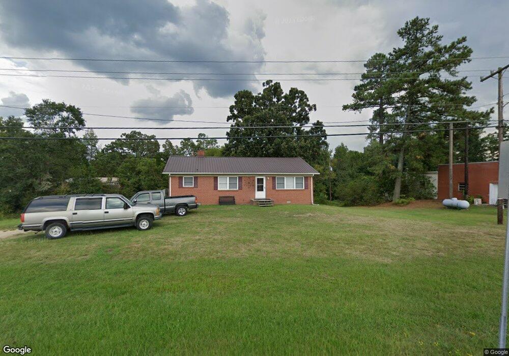
4490 Old Highway 29 Thomasville, NC 27360
Estimated Value: $158,000 - $240,000
3
Beds
2
Baths
1,848
Sq Ft
$110/Sq Ft
Est. Value
About This Home
This home is located at 4490 Old Highway 29, Thomasville, NC 27360 and is currently estimated at $203,640, approximately $110 per square foot. 4490 Old Highway 29 is a home located in Davidson County with nearby schools including Pilot Elementary School, E. Lawson Brown Middle School, and East Davidson High School.
Ownership History
Date
Name
Owned For
Owner Type
Purchase Details
Closed on
May 11, 2005
Sold by
Hundley Emma Mozelle Hege
Bought by
Macdonald Ventures Llc
Current Estimated Value
Home Financials for this Owner
Home Financials are based on the most recent Mortgage that was taken out on this home.
Original Mortgage
$110,000
Outstanding Balance
$57,207
Interest Rate
5.8%
Mortgage Type
Purchase Money Mortgage
Estimated Equity
$146,433
Create a Home Valuation Report for This Property
The Home Valuation Report is an in-depth analysis detailing your home's value as well as a comparison with similar homes in the area
Home Values in the Area
Average Home Value in this Area
Purchase History
| Date | Buyer | Sale Price | Title Company |
|---|---|---|---|
| Macdonald Ventures Llc | $75,000 | None Available |
Source: Public Records
Mortgage History
| Date | Status | Borrower | Loan Amount |
|---|---|---|---|
| Open | Macdonald Ventures Llc | $110,000 |
Source: Public Records
Tax History Compared to Growth
Tax History
| Year | Tax Paid | Tax Assessment Tax Assessment Total Assessment is a certain percentage of the fair market value that is determined by local assessors to be the total taxable value of land and additions on the property. | Land | Improvement |
|---|---|---|---|---|
| 2025 | $977 | $85,520 | $0 | $0 |
| 2024 | $977 | $85,520 | $0 | $0 |
| 2023 | $977 | $85,520 | $0 | $0 |
| 2022 | $977 | $85,520 | $0 | $0 |
| 2021 | $977 | $85,520 | $0 | $0 |
| 2020 | $919 | $81,860 | $0 | $0 |
| 2019 | $933 | $81,860 | $0 | $0 |
| 2018 | $933 | $81,860 | $0 | $0 |
| 2017 | $933 | $81,860 | $0 | $0 |
| 2016 | $900 | $81,860 | $0 | $0 |
| 2015 | $900 | $81,860 | $0 | $0 |
| 2014 | $943 | $85,730 | $0 | $0 |
Source: Public Records
Map
Nearby Homes
- 207 Bethlehem Ave
- 253 Myers Dr
- 171 Stemp Everhart Rd
- Robie Plan at Willow Mill
- ELSTON Plan at Willow Mill
- Aisle Plan at Willow Mill
- Darwin Plan at Willow Mill
- Taylor Plan at Willow Mill
- 116 Linden Dr
- 114 Linden Dr
- 112 Linden Dr
- 104 Linden Dr
- 115 Linden Dr
- 113 Linden Dr
- 2 Horizon Cir
- 111 Linden Dr
- 109 Linden Dr
- 200 Moose Ct
- 0 Coral Ln
- 170 Garrett Ln
- 1818 Augusta Dr
- 1816 Augusta Dr
- 1825 Augusta Dr
- 1821 Augusta Dr
- 1819 Augusta Dr Unit 12-17
- 1819 Augusta Dr
- 102 Black Ave
- 1814 Augusta Dr
- 104 Black Ave
- 1812 Augusta Dr
- 1813 Augusta Dr
- 108 Black Ave
- 1810 Augusta Dr
- 105 Black Ave
- 1809 Augusta Dr
- 1809 Augusta Dr
- 1808 Augusta Dr
- 107 Black Ave
- 503 Pilot Lions Club Rd
- 1807 Augusta Dr