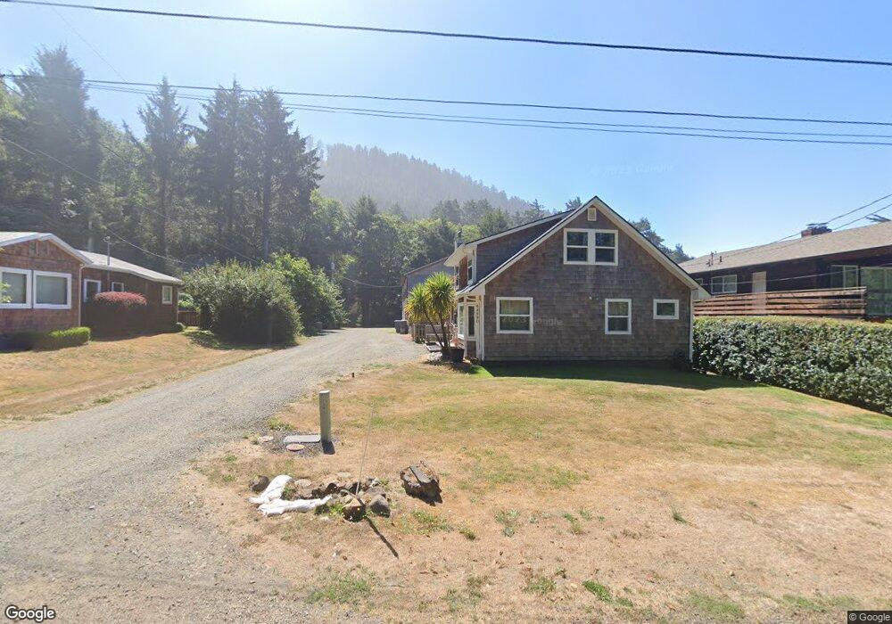
44920 Second Ave Falcon Cove, OR 97102
Estimated Value: $795,000 - $943,321
4
Beds
3
Baths
2,262
Sq Ft
$392/Sq Ft
Est. Value
About This Home
This home is located at 44920 Second Ave, Falcon Cove, OR 97102 and is currently estimated at $885,580, approximately $391 per square foot. 44920 Second Ave is a home located in Tillamook County with nearby schools including Nehalem Elementary School, Garibaldi Elementary School, and Neah-Kah-Nie Middle School.
Ownership History
Date
Name
Owned For
Owner Type
Purchase Details
Closed on
Mar 28, 2022
Sold by
Falcon Cove Llc
Bought by
Arbaugh Matthew and Arbaugh Kristine
Current Estimated Value
Home Financials for this Owner
Home Financials are based on the most recent Mortgage that was taken out on this home.
Original Mortgage
$425,000
Outstanding Balance
$397,263
Interest Rate
4.42%
Mortgage Type
New Conventional
Estimated Equity
$488,317
Purchase Details
Closed on
Jul 1, 2020
Sold by
Alvey Ronald J and Alvey Rosan T
Bought by
Falcon Cove Llc
Create a Home Valuation Report for This Property
The Home Valuation Report is an in-depth analysis detailing your home's value as well as a comparison with similar homes in the area
Purchase History
| Date | Buyer | Sale Price | Title Company |
|---|---|---|---|
| Arbaugh Matthew | $87,000 | None Listed On Document | |
| Falcon Cove Llc | $554,000 | First American |
Source: Public Records
Mortgage History
| Date | Status | Borrower | Loan Amount |
|---|---|---|---|
| Open | Arbaugh Matthew | $425,000 |
Source: Public Records
Tax History
| Year | Tax Paid | Tax Assessment Tax Assessment Total Assessment is a certain percentage of the fair market value that is determined by local assessors to be the total taxable value of land and additions on the property. | Land | Improvement |
|---|---|---|---|---|
| 2025 | $5,309 | $403,300 | $122,660 | $280,640 |
| 2024 | $4,924 | $391,560 | $119,090 | $272,470 |
| 2023 | $4,541 | $380,160 | $115,620 | $264,540 |
| 2022 | $4,272 | $369,090 | $112,250 | $256,840 |
| 2021 | $4,148 | $358,340 | $108,980 | $249,360 |
| 2020 | $3,986 | $347,910 | $105,810 | $242,100 |
| 2019 | $3,692 | $337,780 | $102,730 | $235,050 |
| 2018 | $3,575 | $327,950 | $99,740 | $228,210 |
| 2017 | $3,477 | $318,400 | $96,830 | $221,570 |
| 2016 | $3,379 | $309,130 | $94,010 | $215,120 |
| 2015 | $1,683 | $152,650 | $91,280 | $61,370 |
| 2014 | $1,668 | $148,210 | $88,630 | $59,580 |
| 2013 | $1,625 | $143,900 | $86,060 | $57,840 |
Source: Public Records
Map
Nearby Homes
- 79274 Ray Brown Rd
- 0 Clatsop Ln Unit Lot 408
- 31911 Clatsop Ln
- 79519 Ray Brown Rd
- 0 Walsh Ln
- 0 Wildwood Ln Unit 2904
- 0 Wildwood Ln Unit 26-225
- 79906 Greenleaf Rd
- 0 Greenleaf Rd
- 32073 Cedar Ln
- 80444 Carnahan Rd
- 0 Tl 2701 Beulah Reed Rd
- 0 Meadow Loop Unit 26-241
- 0 Braeridge Dr Unit 10
- 0 Braeridge Dr Unit Lot 62 192646082
- 0 Braeridge Dr Unit 25-729
- Vantage Rd
- TL 2701 Beulah Reed Rd
- 0 Beulah Reed Rd Unit 2701
- 0 Vantage Rd Unit 623429248
- 44920 2nd Ave
- 44855 Second Ave
- 44935 Second Ave
- 44895 Tide Ave
- 44935 2nd Ave
- 6105 Columbia St
- 44915 2nd Ave
- 44990 2nd Ave
- 44900 Third St
- 0 2nd Ave
- 6085 Columbia St
- 44925 Tide Ave
- 0 3rd Ave
- 44925 Tide Ave
- 0 3rd St Unit 9-782
- 0 3rd St Unit 9-779
- 0 3rd St Unit 9-777
- 0 3rd St Unit 3102
- 0 Second Ave
- 78953 Cove Beach Rd
Your Personal Tour Guide
Ask me questions while you tour the home.