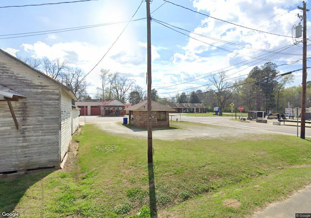
4495 Luckys Bridge Rd Dearing, GA 30808
Estimated Value: $171,471 - $329,000
3
Beds
1
Bath
1,216
Sq Ft
$201/Sq Ft
Est. Value
About This Home
This home is located at 4495 Luckys Bridge Rd, Dearing, GA 30808 and is currently estimated at $244,490, approximately $201 per square foot. 4495 Luckys Bridge Rd is a home with nearby schools including Thomson High School.
Ownership History
Date
Name
Owned For
Owner Type
Purchase Details
Closed on
Nov 15, 2016
Sold by
Delton W
Bought by
Mccorkle Delton W and Mccorkle Deborah W
Current Estimated Value
Purchase Details
Closed on
Jul 18, 2012
Sold by
Whitaker Dorothy S
Bought by
Mccorkle Delton W
Purchase Details
Closed on
Apr 23, 2007
Sold by
Whitaker Dorothy S
Bought by
Whitaker Glenn S and Whitaker Teresa A
Purchase Details
Closed on
Dec 7, 2004
Sold by
Whitaker Dorothy S
Bought by
Whitaker Dorothy S
Purchase Details
Closed on
Dec 6, 2004
Sold by
Whitaker Dorothy S Etal
Bought by
Whitaker Dorothy S
Purchase Details
Closed on
Nov 27, 1981
Bought by
Whitaker Dorothy S Etal
Create a Home Valuation Report for This Property
The Home Valuation Report is an in-depth analysis detailing your home's value as well as a comparison with similar homes in the area
Purchase History
| Date | Buyer | Sale Price | Title Company |
|---|---|---|---|
| Mccorkle Delton W | -- | -- | |
| Mccorkle Delton W | $30,000 | -- | |
| Whitaker Glenn S | -- | -- | |
| Whitaker Dorothy S | -- | -- | |
| Whitaker Dorothy S | -- | -- | |
| Whitaker Dorothy S Etal | -- | -- |
Source: Public Records
Tax History
| Year | Tax Paid | Tax Assessment Tax Assessment Total Assessment is a certain percentage of the fair market value that is determined by local assessors to be the total taxable value of land and additions on the property. | Land | Improvement |
|---|---|---|---|---|
| 2025 | $1,122 | $46,070 | $2,418 | $43,652 |
| 2024 | $1,122 | $50,411 | $2,178 | $48,233 |
| 2023 | $1,238 | $21,600 | $1,020 | $20,580 |
| 2022 | $615 | $21,600 | $1,020 | $20,580 |
| 2021 | $1,002 | $36,336 | $2,114 | $34,222 |
| 2020 | $409 | $14,507 | $2,170 | $12,337 |
| 2019 | $413 | $14,507 | $2,170 | $12,337 |
| 2018 | $413 | $14,507 | $2,170 | $12,337 |
| 2017 | $399 | $14,507 | $2,170 | $12,337 |
| 2016 | $344 | $14,507 | $2,170 | $12,337 |
| 2015 | $219 | $11,232 | $2,660 | $8,573 |
| 2014 | $219 | $11,233 | $2,660 | $8,573 |
| 2013 | -- | $11,232 | $2,660 | $8,572 |
Source: Public Records
Map
Nearby Homes
- 4327 Fish Hatchery Rd
- 0 Whitaker Rd Unit 540660
- 3553 Gant Jackson Rd
- 3619,3627, Bethany Ct
- 2135 Rd
- 2111 Fort Creek Rd
- 5861 Luckeys Bridge Rd
- 0 Mitchner Rd Unit 548843
- 3191 Old Augusta Rd
- 3175 Old Augusta Rd
- 3796 Wire Rd
- 3786 Wire Rd
- 4095 Wildwood Dr
- 840 Sweet Grass Cir
- 833 Sweet Grass Cir
- 852 Sweet Grass Cir
- 854 Sweet Grass Cir
- 829 Sweet Grass Cir
- 856 Sweet Grass Cir
- 828 Sweet Grass Cir
- 4474 Luckys Bridge Rd
- 4548 Luckeys Bridge Rd
- 1851 Adams Reeves Rd
- 4414 Luckys Bridge Rd
- 4548 Luckys Bridge Rd
- 4432 Luckys Bridge Rd
- 4530 Luckys Bridge Rd
- 4448 Luckys Bridge Rd
- 4381 Luckys Bridge Rd
- 4370 Luckys Bridge Rd
- 4620 Luckys Bridge Rd
- 2232 Tudor Rd
- 1960 Adams Reeves Rd
- 1967 Adams Reeves Rd
- 4322 Luckys Bridge Rd
- 4674 Luckys Bridge Rd
- 1979 Adams Reeves Rd
- 2287 Tudor Rd
- 1982 Adams Reeves Rd
- 2004 Adams Reeves Rd
Your Personal Tour Guide
Ask me questions while you tour the home.
