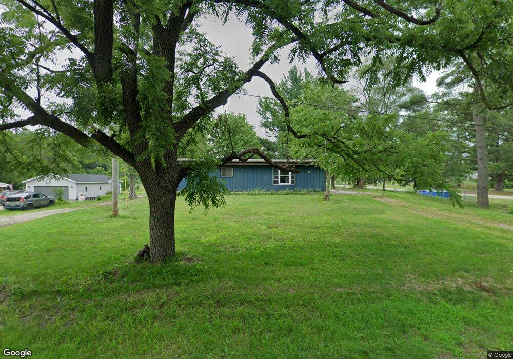
4498 S Sheridan Dr Muskegon, MI 49444
Estimated Value: $274,000 - $307,000
--
Bed
1
Bath
1,500
Sq Ft
$193/Sq Ft
Est. Value
About This Home
This home is located at 4498 S Sheridan Dr, Muskegon, MI 49444 and is currently estimated at $288,926, approximately $192 per square foot. 4498 S Sheridan Dr is a home located in Muskegon County with nearby schools including Fruitport High School, Edgewood Elementary Academy, and Broadway Baptist School.
Ownership History
Date
Name
Owned For
Owner Type
Purchase Details
Closed on
Sep 9, 2024
Sold by
Charles E Taylor Revocable Living Trust and Taylor Richard A
Bought by
Taylor Kathie A
Current Estimated Value
Purchase Details
Closed on
Feb 5, 2007
Sold by
Taylor Charles E
Bought by
Westwind Golf Course Inc
Purchase Details
Closed on
Aug 7, 2006
Sold by
Taylor Charles E and Taylor Corrine J
Bought by
Taylor Charles E and Charles E Taylor Revocable Living Trust
Purchase Details
Closed on
Mar 9, 2006
Sold by
Taylor Charles E and Taylor Corrine J
Bought by
Taylor Charles E
Create a Home Valuation Report for This Property
The Home Valuation Report is an in-depth analysis detailing your home's value as well as a comparison with similar homes in the area
Home Values in the Area
Average Home Value in this Area
Purchase History
| Date | Buyer | Sale Price | Title Company |
|---|---|---|---|
| Taylor Kathie A | -- | None Listed On Document | |
| Westwind Golf Course Inc | -- | None Available | |
| Taylor Charles E | -- | None Available | |
| Taylor Charles E | -- | None Available |
Source: Public Records
Tax History Compared to Growth
Tax History
| Year | Tax Paid | Tax Assessment Tax Assessment Total Assessment is a certain percentage of the fair market value that is determined by local assessors to be the total taxable value of land and additions on the property. | Land | Improvement |
|---|---|---|---|---|
| 2025 | $2,118 | $130,000 | $0 | $0 |
| 2024 | $1,507 | $121,000 | $0 | $0 |
| 2023 | $1,441 | $106,400 | $0 | $0 |
| 2022 | $1,865 | $94,400 | $0 | $0 |
| 2021 | $1,812 | $88,400 | $0 | $0 |
| 2020 | $1,793 | $79,400 | $0 | $0 |
| 2019 | $1,760 | $75,700 | $0 | $0 |
| 2018 | $1,719 | $71,700 | $0 | $0 |
| 2017 | $1,683 | $65,700 | $0 | $0 |
| 2016 | $1,023 | $58,200 | $0 | $0 |
| 2015 | -- | $56,400 | $0 | $0 |
| 2014 | -- | $59,400 | $0 | $0 |
| 2013 | -- | $54,600 | $0 | $0 |
Source: Public Records
Map
Nearby Homes
- 4441 S Sheridan Dr
- 2171 Monte Ave
- 4563 Keener St
- 2322 Cline Rd
- 2355 Cress Creek Dr
- V/L S Sheridan Dr
- 2509 August Ave
- 4697 S Quarterline Rd
- 5005 Airline Rd
- 4769 Harvey St
- 4677 Harvey St
- 3835 Ellen St
- 2025 E Sternberg Rd
- 1454 Airport Rd
- 4543 Poulin St
- 1404 E Ellis Rd
- 2523 Heights Ravenna Rd
- 3705 S Dangl Rd
- V/L 4535 Thompson Rd
- 3471 Kersting Dr
- 4468 S Sheridan Dr
- 2456 Pratt Ln
- 4534 S Sheridan Dr
- 4464 S Sheridan Dr
- 4505 S Sheridan Dr
- 2455 Pratt Ln
- 4471 S Sheridan Dr
- 4521 S Sheridan Dr
- 4452 S Sheridan Dr
- 4566 S Sheridan Dr
- 2472 Pratt Ln
- 4451 S Sheridan Dr
- 4440 S Sheridan Dr
- 2471 Pratt Ln
- 4588 S Sheridan Dr
- 4420 S Sheridan Dr
- 2498 Pratt Ln
- 2430 E Hile Rd
- 2497 Pratt Ln
- 581332 Crosswinds Dr