--
Bed
--
Bath
5,334
Sq Ft
3.22
Acres
About This Home
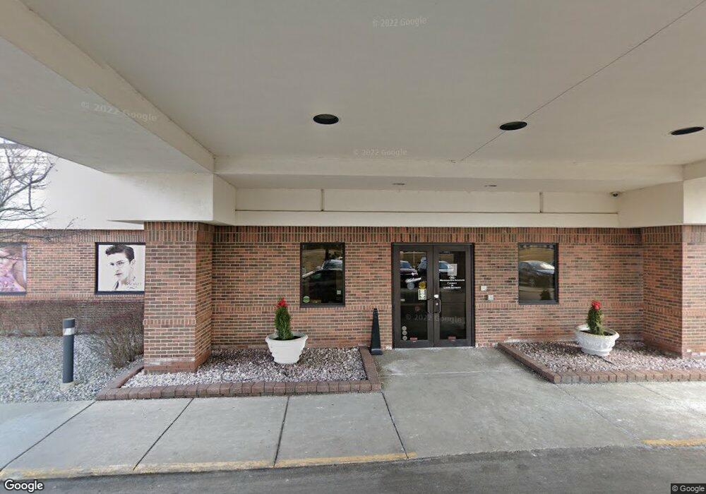
This home is located at 4499 Town Center Pkwy Unit 9, Flint, MI 48532. 4499 Town Center Pkwy Unit 9 is a home located in Genesee County with nearby schools including Carman-Ainsworth High School, Genesee STEM Academy, and St. Paul Lutheran School.
Ownership History
Date
Name
Owned For
Owner Type
Purchase Details
Closed on
Nov 29, 2010
Sold by
Joseph Fenton Land Llc
Bought by
Mei Fenton Holdings Llc
Purchase Details
Closed on
Apr 4, 2006
Sold by
Hood Joseph W
Bought by
Joseph Fenton Land Llc
Purchase Details
Closed on
Aug 25, 1999
Sold by
Fenton Venture Associates Ltd Prtnrshp
Bought by
Hood Joseph W
Create a Home Valuation Report for This Property
The Home Valuation Report is an in-depth analysis detailing your home's value as well as a comparison with similar homes in the area
Home Values in the Area
Average Home Value in this Area
Purchase History
| Date | Buyer | Sale Price | Title Company |
|---|---|---|---|
| Mei Fenton Holdings Llc | $600,000 | Cislo Title Co | |
| Joseph Fenton Land Llc | -- | Cislo Title Co | |
| Hood Joseph W | -- | Cislo Title Company |
Source: Public Records
Tax History Compared to Growth
Tax History
| Year | Tax Paid | Tax Assessment Tax Assessment Total Assessment is a certain percentage of the fair market value that is determined by local assessors to be the total taxable value of land and additions on the property. | Land | Improvement |
|---|---|---|---|---|
| 2025 | $36,949 | $740,200 | $0 | $0 |
| 2024 | $28,633 | $729,300 | $0 | $0 |
| 2023 | $38,467 | $1,051,500 | $0 | $0 |
| 2022 | $47,454 | $1,298,200 | $0 | $0 |
| 2021 | $43,536 | $1,093,100 | $0 | $0 |
| 2020 | $32,910 | $1,058,500 | $0 | $0 |
| 2019 | $32,488 | $973,500 | $0 | $0 |
| 2018 | $41,366 | $950,900 | $0 | $0 |
| 2017 | $40,049 | $786,300 | $0 | $0 |
| 2016 | $39,737 | $700,200 | $0 | $0 |
| 2015 | $40,310 | $658,300 | $0 | $0 |
| 2012 | -- | $688,800 | $688,800 | $0 |
Source: Public Records
Map
Nearby Homes
- 2 Charter Dr
- 0 Charter Dr Unit 50153638
- 1193 Normandy Terrace Dr
- 3.9 Acres W Court St
- 000 Devenish Ln
- 4480 Corunna Rd
- 4474 Corunna Rd
- 1090 Cabot Dr
- 5345 Birchtree Ct
- 5325 N Dyewood Dr
- 5297 Oaktree Dr
- 1159 N Linden Rd
- 10 Acres T A Mansour Blvd
- 1455 S Linden Rd
- 1460 S Dye Rd
- 0000 Reuben Reuben St
- 1260 Gilbert St
- 1068 S Graham Rd
- 18.41 Taft Rd
- 1540 Pound Dr
- 1295 S Linden Rd
- 1289 S Linden Rd
- 1289 S Linden Rd Unit B
- 1289 S Linden Rd Unit D
- 1289 S Linden Rd Unit Suite B
- 1289 S Linden Rd Unit Suite D
- 15 Charter Dr
- #15 Charter Dr
- 1170 Charter Dr
- 1309 S Linden Rd
- 1295 S Linden Rd
- 1268 S Linden Rd
- 1303 S Linden Rd
- 1286 S Linden Rd
- 1311 S Linden Rd
- 1311 S Linden Rd
- 1140 S Linden Rd
- 1104 S Linden Rd
- 1335 S Linden Rd Unit C
- 1335 S Linden Rd Unit B