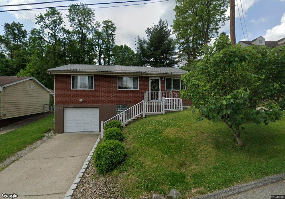
45 8th St Uniontown, PA 15401
Estimated Value: $104,000 - $181,000
3
Beds
1
Bath
1,064
Sq Ft
$135/Sq Ft
Est. Value
About This Home
This home is located at 45 8th St, Uniontown, PA 15401 and is currently estimated at $144,133, approximately $135 per square foot. 45 8th St is a home located in Fayette County with nearby schools including Laurel Highlands Senior High School, St. John the Evangelist School, and Chestnut Ridge Christian Academy.
Ownership History
Date
Name
Owned For
Owner Type
Purchase Details
Closed on
Jul 29, 2020
Sold by
Becker Tracy W and Becker Laura
Bought by
Steadman Gabriella M and Kasper Brendan J
Current Estimated Value
Home Financials for this Owner
Home Financials are based on the most recent Mortgage that was taken out on this home.
Original Mortgage
$150,817
Outstanding Balance
$134,032
Interest Rate
3.1%
Mortgage Type
FHA
Estimated Equity
$10,101
Purchase Details
Closed on
Feb 17, 2014
Sold by
Buchanan Jeffrey A and Buchanan Sue Ann
Bought by
Becker Tracy W
Home Financials for this Owner
Home Financials are based on the most recent Mortgage that was taken out on this home.
Original Mortgage
$76,000
Interest Rate
4.5%
Mortgage Type
New Conventional
Create a Home Valuation Report for This Property
The Home Valuation Report is an in-depth analysis detailing your home's value as well as a comparison with similar homes in the area
Home Values in the Area
Average Home Value in this Area
Purchase History
| Date | Buyer | Sale Price | Title Company |
|---|---|---|---|
| Steadman Gabriella M | $153,600 | None Available | |
| Becker Tracy W | $96,000 | None Available |
Source: Public Records
Mortgage History
| Date | Status | Borrower | Loan Amount |
|---|---|---|---|
| Open | Steadman Gabriella M | $150,817 | |
| Previous Owner | Becker Tracy W | $76,000 |
Source: Public Records
Tax History Compared to Growth
Tax History
| Year | Tax Paid | Tax Assessment Tax Assessment Total Assessment is a certain percentage of the fair market value that is determined by local assessors to be the total taxable value of land and additions on the property. | Land | Improvement |
|---|---|---|---|---|
| 2025 | $814 | $28,520 | $10,080 | $18,440 |
| 2024 | $791 | $28,520 | $10,080 | $18,440 |
| 2023 | $1,521 | $28,520 | $10,080 | $18,440 |
| 2022 | $1,507 | $28,520 | $10,080 | $18,440 |
| 2021 | $1,465 | $28,520 | $10,080 | $18,440 |
| 2020 | $1,465 | $28,520 | $10,080 | $18,440 |
| 2019 | $1,345 | $28,520 | $10,080 | $18,440 |
| 2018 | $1,305 | $28,520 | $10,080 | $18,440 |
| 2017 | $1,305 | $28,520 | $10,080 | $18,440 |
| 2016 | -- | $28,520 | $10,080 | $18,440 |
| 2015 | -- | $28,520 | $10,080 | $18,440 |
| 2014 | -- | $57,040 | $20,160 | $36,880 |
Source: Public Records
Map
Nearby Homes
- 101 Connor St
- 15 Dawson Ave
- 21 Dawson Ave
- 74 Mullen St
- 58 Mullen St
- 26 Wilmac St
- 26 Coal Lick Run
- 220 Clarendon Ave
- 113 Washington Ave
- 120 Shaffer St
- 122 Shaffer St
- 34 Chestnut St
- 71 Lebanon Ave
- 390 Braddock Ave
- 600 Braddock Ave
- 124 Clarendon Ave
- 114 Clarendon Ave
- 372 Braddock Ave
- 520 Royalty Dr
- 354 Braddock Ave