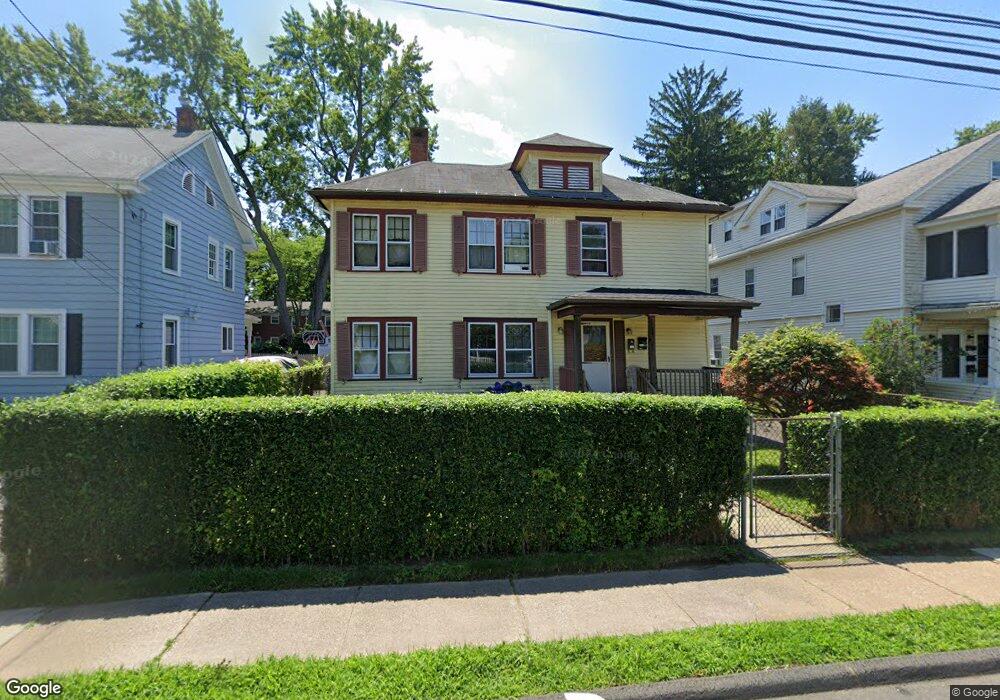
45 Adams St Unit 47 East Hartford, CT 06108
Estimated Value: $203,000 - $274,000
3
Beds
2
Baths
1,516
Sq Ft
$151/Sq Ft
Est. Value
About This Home
This home is located at 45 Adams St Unit 47, East Hartford, CT 06108 and is currently estimated at $229,479, approximately $151 per square foot. 45 Adams St Unit 47 is a home located in Hartford County with nearby schools including Anna E. Norris School, East Hartford Middle School, and East Hartford High School.
Ownership History
Date
Name
Owned For
Owner Type
Purchase Details
Closed on
Feb 13, 2020
Sold by
Chfa
Bought by
Usa Hud
Current Estimated Value
Purchase Details
Closed on
Sep 6, 2012
Sold by
Lazure George J
Bought by
Martinez Nestor M
Home Financials for this Owner
Home Financials are based on the most recent Mortgage that was taken out on this home.
Original Mortgage
$147,200
Interest Rate
3.3%
Mortgage Type
FHA
Purchase Details
Closed on
Apr 4, 2001
Sold by
Blackmore Samuel D and Blackmore Victoria S
Bought by
Lazure George J
Home Financials for this Owner
Home Financials are based on the most recent Mortgage that was taken out on this home.
Original Mortgage
$113,100
Interest Rate
7.05%
Purchase Details
Closed on
Sep 26, 1995
Sold by
Larson Robert
Bought by
Voss Cheryl
Create a Home Valuation Report for This Property
The Home Valuation Report is an in-depth analysis detailing your home's value as well as a comparison with similar homes in the area
Home Values in the Area
Average Home Value in this Area
Purchase History
| Date | Buyer | Sale Price | Title Company |
|---|---|---|---|
| Usa Hud | -- | None Available | |
| Martinez Nestor M | $150,000 | -- | |
| Lazure George J | $114,900 | -- | |
| Voss Cheryl | $71,000 | -- |
Source: Public Records
Mortgage History
| Date | Status | Borrower | Loan Amount |
|---|---|---|---|
| Previous Owner | Voss Cheryl | $147,200 | |
| Previous Owner | Voss Cheryl | $8,300 | |
| Previous Owner | Voss Cheryl | $113,100 |
Source: Public Records
Tax History Compared to Growth
Tax History
| Year | Tax Paid | Tax Assessment Tax Assessment Total Assessment is a certain percentage of the fair market value that is determined by local assessors to be the total taxable value of land and additions on the property. | Land | Improvement |
|---|---|---|---|---|
| 2025 | $5,775 | $125,810 | $26,800 | $99,010 |
| 2024 | $5,536 | $125,810 | $26,800 | $99,010 |
| 2023 | $5,352 | $125,810 | $26,800 | $99,010 |
| 2022 | $5,158 | $125,810 | $26,800 | $99,010 |
| 2021 | $5,126 | $103,880 | $25,000 | $78,880 |
| 2020 | $5,186 | $103,880 | $25,000 | $78,880 |
| 2019 | $5,102 | $103,880 | $25,000 | $78,880 |
| 2018 | $4,951 | $103,880 | $25,000 | $78,880 |
| 2017 | $4,888 | $103,880 | $25,000 | $78,880 |
| 2016 | $4,671 | $101,860 | $25,000 | $76,860 |
| 2015 | $4,671 | $101,860 | $25,000 | $76,860 |
| 2014 | $4,624 | $101,860 | $25,000 | $76,860 |
Source: Public Records
Map
Nearby Homes
- 1589 Main St
- 52 Burnside Ave
- 59 Tolland St
- 181 Burnside Ave
- 98 Olmsted St
- 62 Wells Ave
- 47 Elm St
- 85R Olmsted St
- 41 Bissell St
- 10 Kenyon Place
- 279 Prospect St
- 265 Burnside Ave
- 11 Westbrook St
- 30 Oakwood St
- 88 Governor St Unit 90
- 67 Laurel St
- 347 Prospect St Unit 349
- 39 Tiffany Rd
- 115 Governor St
- 61 Central Ave Unit 63
- 43 Adams St
- 51 Adams St Unit 53
- 51-53 Adams St
- 39 Adams St
- 55 Adams St
- 50 Adams St
- 35 Adams St
- 59 Adams St Unit 61
- 45 Murray St
- 45 Murray St Unit 45 Murray ST
- 59-61 Adams St
- 58 Adams St
- 55 Murray St
- 31 Adams St
- 39 Murray St
- 63 Adams St
- 62 Adams St
- 61 Murray St
- 27 Adams St Unit 29
- 65 Adams St Unit 67