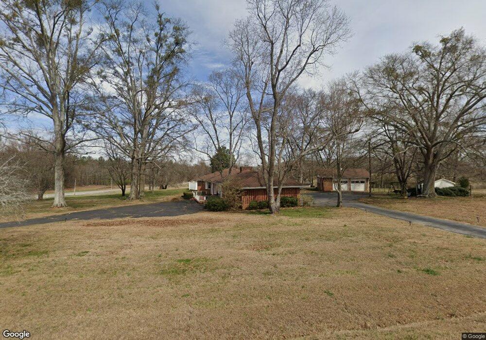
45 Azalea Ln Colbert, GA 30628
Estimated Value: $324,090 - $399,000
Studio
2
Baths
2,554
Sq Ft
$143/Sq Ft
Est. Value
About This Home
This home is located at 45 Azalea Ln, Colbert, GA 30628 and is currently estimated at $365,523, approximately $143 per square foot. 45 Azalea Ln is a home located in Madison County with nearby schools including Madison County High School.
Ownership History
Date
Name
Owned For
Owner Type
Purchase Details
Closed on
Mar 22, 2024
Sold by
Bray Amy G
Bought by
Powell Marypaige
Current Estimated Value
Purchase Details
Closed on
Mar 12, 2024
Sold by
Griffeth Jacqueline S
Bought by
Bray Amy G and Powell Tressa G
Purchase Details
Closed on
Sep 2, 2015
Sold by
Griffeth Kenneth
Bought by
Griffeth Jackie S
Create a Home Valuation Report for This Property
The Home Valuation Report is an in-depth analysis detailing your home's value as well as a comparison with similar homes in the area
Purchase History
| Date | Buyer | Sale Price | Title Company |
|---|---|---|---|
| Powell Marypaige | -- | -- | |
| Bray Amy G | -- | -- | |
| Griffeth Jackie S | -- | -- |
Source: Public Records
Tax History Compared to Growth
Tax History
| Year | Tax Paid | Tax Assessment Tax Assessment Total Assessment is a certain percentage of the fair market value that is determined by local assessors to be the total taxable value of land and additions on the property. | Land | Improvement |
|---|---|---|---|---|
| 2025 | $2,827 | $111,263 | $13,941 | $97,322 |
| 2024 | $28 | $108,597 | $13,941 | $94,656 |
| 2023 | $2,626 | $100,898 | $11,618 | $89,280 |
| 2022 | $2,434 | $88,262 | $7,987 | $80,275 |
| 2021 | $2,226 | $72,905 | $7,987 | $64,918 |
| 2020 | $2,205 | $71,743 | $6,825 | $64,918 |
| 2019 | $2,197 | $70,652 | $6,825 | $63,827 |
| 2018 | $2,169 | $69,544 | $6,244 | $63,300 |
| 2017 | $1,999 | $69,426 | $5,809 | $63,617 |
| 2016 | $1,770 | $61,648 | $5,284 | $56,364 |
| 2015 | $1,770 | $61,648 | $5,284 | $56,364 |
| 2014 | $1,781 | $61,648 | $5,284 | $56,364 |
| 2013 | -- | $61,648 | $5,284 | $56,364 |
Source: Public Records
Map
Nearby Homes
- 4106 Highway 29 S
- 4106 U S 29
- 1330 McCannon-morris Rd
- 975 Diamond Hill Neese Rd
- 1175 Diamond Hill Colbert Rd
- 65 Spratlin Way
- 100 Lakeview Dr
- 210 Joe Graham Rd
- 162 Brittany Pointe Dr
- 0 Old Kincaid Rd Unit CL336310
- 0 Old Kincaid Rd Unit 10582354
- 14 Sourwood Trail Unit 53
- 1097 Garnett Ward Rd Unit 1
- 1067 Garnett Ward Rd Unit 2
- 77 Sugar Maple Way Unit 44
- 45 Sugar Maple Way Unit 43
- 0 Spratlin Mill Dr Unit 7665837
- 0 Spratlin Mill Dr Unit LOT 14-C
- 103 Three Rivers Ct
- 450 Candlestick Dr
- 4653 Highway 29 S
- 0 Hwy 29 S Unit 20130931
- 78 Moons Grove Church Rd
- 4764 Highway 29 S
- 205 Azalea Ln
- 124 Moons Grove Church Rd
- 4768 Highway 29 S
- 4776 U S 29
- 4776 Highway 29 S
- 0 Highway 29 S Unit 8388474
- 0 Highway 29 S Unit CM909374
- 0 Highway 29 S Unit CM979936
- 0 Highway 29 S Unit 970157
- 0 Highway 29 S Unit 8932585
- 3281 Diamond Hill Colbert Rd
- 4424 Highway 29 S
- 394 Strickland Cir
- 3115 Diamond Hill Colbert Rd
- 4888 Highway 29 S
- 3405 Diamond Hill Colbert Rd
