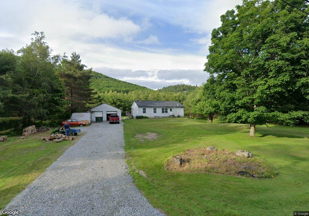
45 Barnestown Rd Camden, ME 04843
Estimated Value: $466,470 - $764,000
3
Beds
2
Baths
1,196
Sq Ft
$489/Sq Ft
Est. Value
About This Home
This home is located at 45 Barnestown Rd, Camden, ME 04843 and is currently estimated at $585,118, approximately $489 per square foot. 45 Barnestown Rd is a home located in Knox County with nearby schools including Camden-Rockport Elementary School, Camden-Rockport Middle School, and Camden Hills Regional High School.
Ownership History
Date
Name
Owned For
Owner Type
Purchase Details
Closed on
Aug 3, 2012
Sold by
Pushaw Gerald K and Pushaw Tammy S
Bought by
Merchant Henry A
Current Estimated Value
Home Financials for this Owner
Home Financials are based on the most recent Mortgage that was taken out on this home.
Original Mortgage
$163,265
Outstanding Balance
$113,262
Interest Rate
3.7%
Mortgage Type
New Conventional
Estimated Equity
$471,856
Create a Home Valuation Report for This Property
The Home Valuation Report is an in-depth analysis detailing your home's value as well as a comparison with similar homes in the area
Home Values in the Area
Average Home Value in this Area
Purchase History
| Date | Buyer | Sale Price | Title Company |
|---|---|---|---|
| Merchant Henry A | -- | -- |
Source: Public Records
Mortgage History
| Date | Status | Borrower | Loan Amount |
|---|---|---|---|
| Open | Merchant Henry A | $163,265 |
Source: Public Records
Tax History Compared to Growth
Tax History
| Year | Tax Paid | Tax Assessment Tax Assessment Total Assessment is a certain percentage of the fair market value that is determined by local assessors to be the total taxable value of land and additions on the property. | Land | Improvement |
|---|---|---|---|---|
| 2024 | $4,490 | $427,600 | $164,100 | $263,500 |
| 2023 | $3,875 | $280,800 | $69,100 | $211,700 |
| 2022 | $3,707 | $280,800 | $69,100 | $211,700 |
| 2021 | $3,727 | $242,800 | $74,600 | $168,200 |
| 2020 | $3,649 | $242,800 | $74,600 | $168,200 |
| 2019 | $3,620 | $242,800 | $74,600 | $168,200 |
| 2018 | $3,174 | $213,300 | $70,400 | $142,900 |
| 2017 | $3,067 | $213,300 | $70,400 | $142,900 |
| 2016 | $2,616 | $167,800 | $41,200 | $126,600 |
| 2015 | $2,539 | $167,800 | $41,200 | $126,600 |
| 2014 | $2,421 | $167,800 | $41,200 | $126,600 |
| 2013 | $2,356 | $167,800 | $41,200 | $126,600 |
Source: Public Records
Map
Nearby Homes
- 6 Rd
- 2 Bald Mountain Rd
- 424 Molyneaux Rd
- 43 Melvin Heights Rd
- 24 White Tail Dr
- 315 Beaucaire Ave
- 4 Ministerial Rd
- 91 Simonton Rd
- 76 Park St
- TBD Map 15 Lot 150 Mt Pleasant St
- 111 Start Rd
- 159 Mechanic St
- 80 Cobb Rd
- 161 Beaucaire Ave
- Lot 25 West St
- 10 Glenfield Cir
- 92 Camden Rd
- 646 West St
- 319 West St
- 180 Mistic Ave
- 37 Barnestown Rd
- 55 Barnestown Rd
- 48 Barnestown Rd
- 42 Barnestown Rd
- 27 Barnestown Rd
- 64 Barnestown Rd
- 53 Brandy Brook Rd
- 54 Brandy Brook Rd
- 70 Barnestown Rd
- 8 Brandy Brook Rd
- 25 Brandy Brook Rd
- 9 Brandy Brook Rd
- 80 Barnstown Rd
- 80 Barnestown Rd
- 4524 Molyneaux & Barnstown
- 89 Barnestown Rd
- 547 Molyneaux Rd
- 576 Molyneaux Rd
- 550 Molyneaux Rd
- 399 Hosmer Pond Rd