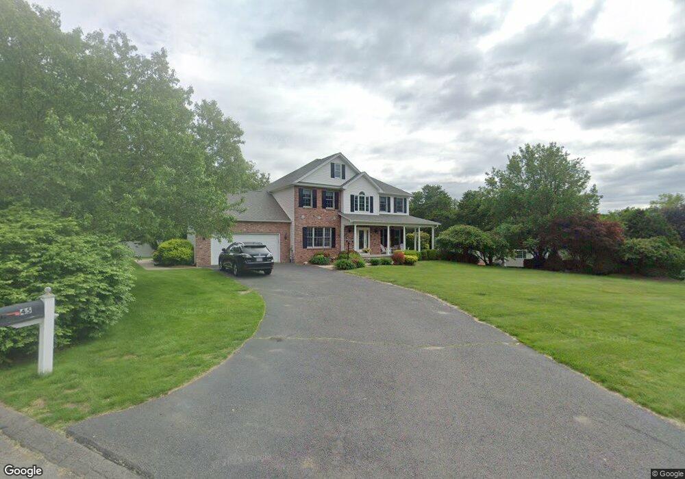
45 Barrister Cir Westfield, MA 01085
Estimated Value: $627,000 - $704,000
4
Beds
3
Baths
2,572
Sq Ft
$253/Sq Ft
Est. Value
About This Home
This home is located at 45 Barrister Cir, Westfield, MA 01085 and is currently estimated at $650,090, approximately $252 per square foot. 45 Barrister Cir is a home located in Hampden County with nearby schools including Westfield High School and Saint Mary High School.
Ownership History
Date
Name
Owned For
Owner Type
Purchase Details
Closed on
Aug 13, 2007
Sold by
Babinski Holly F and Babinski Peter G
Bought by
Hughes Cynthia M and Hughes Douglas D
Current Estimated Value
Purchase Details
Closed on
Apr 2, 1999
Sold by
Aube Dennis J
Bought by
Babinski Peter G and Babinski Holly F
Purchase Details
Closed on
Nov 12, 1998
Sold by
Tuckahoe Dev Corp
Bought by
Aube Dennis J
Create a Home Valuation Report for This Property
The Home Valuation Report is an in-depth analysis detailing your home's value as well as a comparison with similar homes in the area
Home Values in the Area
Average Home Value in this Area
Purchase History
| Date | Buyer | Sale Price | Title Company |
|---|---|---|---|
| Hughes Cynthia M | $430,000 | -- | |
| Babinski Peter G | $236,000 | -- | |
| Aube Dennis J | $60,000 | -- |
Source: Public Records
Mortgage History
| Date | Status | Borrower | Loan Amount |
|---|---|---|---|
| Closed | Aube Dennis J | $119,000 | |
| Closed | Aube Dennis J | $138,000 | |
| Closed | Aube Dennis J | $50,000 |
Source: Public Records
Tax History Compared to Growth
Tax History
| Year | Tax Paid | Tax Assessment Tax Assessment Total Assessment is a certain percentage of the fair market value that is determined by local assessors to be the total taxable value of land and additions on the property. | Land | Improvement |
|---|---|---|---|---|
| 2025 | $8,407 | $553,800 | $146,500 | $407,300 |
| 2024 | $8,458 | $529,600 | $133,300 | $396,300 |
| 2023 | $7,912 | $483,000 | $126,900 | $356,100 |
| 2022 | $7,912 | $427,900 | $113,300 | $314,600 |
| 2021 | $7,669 | $406,200 | $106,600 | $299,600 |
| 2020 | $7,511 | $390,200 | $106,600 | $283,600 |
| 2019 | $7,121 | $362,000 | $101,700 | $260,300 |
| 2018 | $7,008 | $362,000 | $101,700 | $260,300 |
| 2017 | $6,844 | $352,400 | $103,200 | $249,200 |
| 2016 | $6,851 | $352,400 | $103,200 | $249,200 |
| 2015 | $6,461 | $348,500 | $103,200 | $245,300 |
| 2014 | $4,838 | $348,500 | $103,200 | $245,300 |
Source: Public Records
Map
Nearby Homes
- 22 Rosewood Ln
- 42 Rosewood Ln
- 386 Hillside Rd
- 112 Sunnyside Rd
- 69 Beveridge Blvd
- 240 Hillside Rd
- 2 Gableview
- 7 Sawgrass Ln
- 172 Valley View Dr
- 82 S Maple St Unit 43
- 82 S Maple St Unit 11
- 74 S Maple St
- 1037 Shaker Rd
- 70 S Maple St
- 128 Crane Ave
- 70-74 S Maple St
- 451 Falley Dr
- 929 Shaker Rd Unit 18
- 78 Granville Rd Unit 11
- 0 Fox Hill Dr
- 2 Radisson Ln
- 10 Waterford Dr
- 6 Radisson Ln
- 51 Barrister Cir
- 44 Barrister Cir
- 50 Barrister Cir
- 16 Waterford Dr
- 56 Barrister Cir
- 54 Barrister Cir
- 40 Barrister Cir
- 5 Radisson Ln
- 36 Barrister Cir
- 4 Radisson Ln
- 20 Waterford Dr
- 18 Radisson Ln
- 11 Radisson Ln
- 9 Waterford Dr
- 17 Radisson Ln
- 15 Waterford Dr
- 24 Waterford Dr