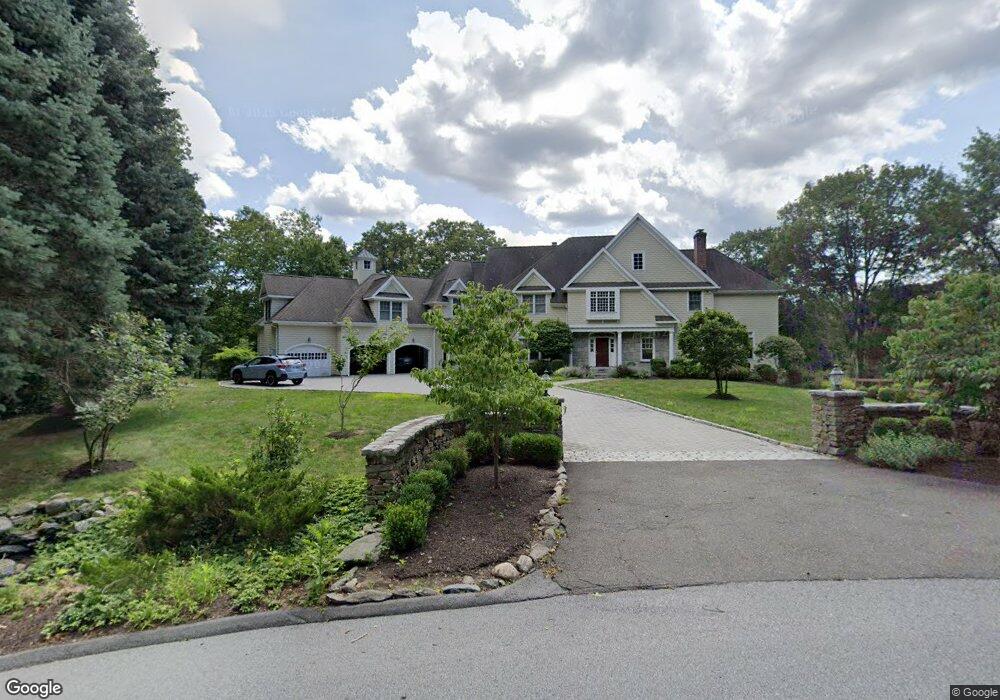
45 Branch Brook Rd Wilton, CT 06897
Estimated Value: $2,024,325 - $2,536,000
5
Beds
8
Baths
5,548
Sq Ft
$399/Sq Ft
Est. Value
About This Home
This home is located at 45 Branch Brook Rd, Wilton, CT 06897 and is currently estimated at $2,215,331, approximately $399 per square foot. 45 Branch Brook Rd is a home located in Fairfield County with nearby schools including Miller-Driscoll School, Cider Mill School, and Middlebrook School.
Ownership History
Date
Name
Owned For
Owner Type
Purchase Details
Closed on
Dec 11, 2017
Sold by
Kumar Vijay B
Bought by
Kumar Vijay B and Kumar Vijay B
Current Estimated Value
Create a Home Valuation Report for This Property
The Home Valuation Report is an in-depth analysis detailing your home's value as well as a comparison with similar homes in the area
Home Values in the Area
Average Home Value in this Area
Purchase History
| Date | Buyer | Sale Price | Title Company |
|---|---|---|---|
| Kumar Vijay B | -- | -- | |
| Kumar Sujatha B | -- | -- | |
| Kumar Sujatha B | -- | -- |
Source: Public Records
Mortgage History
| Date | Status | Borrower | Loan Amount |
|---|---|---|---|
| Previous Owner | Kumar Sujatha B | $352,000 | |
| Previous Owner | Kumar Sujatha B | $361,775 |
Source: Public Records
Tax History Compared to Growth
Tax History
| Year | Tax Paid | Tax Assessment Tax Assessment Total Assessment is a certain percentage of the fair market value that is determined by local assessors to be the total taxable value of land and additions on the property. | Land | Improvement |
|---|---|---|---|---|
| 2025 | $25,931 | $1,062,320 | $272,510 | $789,810 |
| 2024 | $25,432 | $1,062,320 | $272,510 | $789,810 |
| 2023 | $24,204 | $827,190 | $246,190 | $581,000 |
| 2022 | $23,033 | $815,920 | $246,190 | $569,730 |
| 2021 | $22,740 | $815,920 | $246,190 | $569,730 |
| 2020 | $22,405 | $815,920 | $246,190 | $569,730 |
| 2019 | $23,192 | $812,630 | $246,190 | $566,440 |
| 2018 | $27,397 | $971,880 | $258,860 | $713,020 |
| 2017 | $26,989 | $971,880 | $258,860 | $713,020 |
| 2016 | $26,571 | $971,880 | $258,860 | $713,020 |
| 2015 | $26,076 | $971,880 | $258,860 | $713,020 |
| 2014 | $25,765 | $971,880 | $258,860 | $713,020 |
Source: Public Records
Map
Nearby Homes
- 35 Branch Brook Rd
- 55 Tanners Dr
- 112 Middlebrook Farm Rd
- 13 Indian Hill Rd
- 175 Mountain Rd
- 330 Ridgefield Rd
- 38 Honey Hill Rd
- 33 Middlebrook Farm Rd
- 111 Deforest Rd
- 00 Old Mill Rd
- 33 Cannon Rd
- Lot 6 Cattle Pen Ln
- 54 Mountain Rd
- 0 Old Mill Rd
- 10 Woodhill Rd
- 1 Canaan Cir
- 131 Fieldcrest Dr
- 9 Read Place
- 0 Mountain Rd
- 25 Samuelson Rd
- 49 Branch Brook Rd
- 53 Branch Brook Rd
- 22 Branch Brook Rd
- 30 Branch Brook Rd
- 20 Branch Brook Rd
- 50 Branch Brook Rd
- 58 Branch Brook Rd
- 64 Branch Brook Rd
- 40 Branch Brook Rd
- 31 Branch Brook Rd
- 68 Branch Brook Rd
- 322 Nod Hill Rd
- 9 Pipers Hill Rd
- 312 Nod Hill Rd
- 294 Nod Hill Rd
- 314 Nod Hill Rd
- 262 Nod Hill Rd
- 274 Nod Hill Rd
- 324 Nod Hill Rd
- 262 Nod Hill Rd