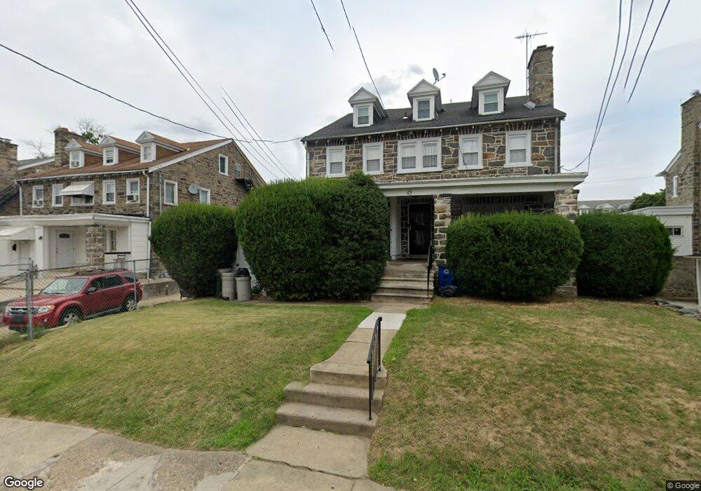
45 Brandon Rd Upper Darby, PA 19082
Estimated Value: $272,000 - $323,000
6
Beds
3
Baths
2,060
Sq Ft
$145/Sq Ft
Est. Value
About This Home
This home is located at 45 Brandon Rd, Upper Darby, PA 19082 and is currently estimated at $297,775, approximately $144 per square foot. 45 Brandon Rd is a home located in Delaware County with nearby schools including Bywood Elementary School, Upper Darby Kdg Center, and Upper Darby High School.
Ownership History
Date
Name
Owned For
Owner Type
Purchase Details
Closed on
Apr 15, 2002
Sold by
Lim Cheang and Lim Ieng
Bought by
Burroughs Gail
Current Estimated Value
Home Financials for this Owner
Home Financials are based on the most recent Mortgage that was taken out on this home.
Original Mortgage
$64,800
Interest Rate
6.85%
Mortgage Type
Purchase Money Mortgage
Purchase Details
Closed on
Jul 10, 2000
Sold by
Lim Khy
Bought by
Lim Huy and Lim Cheang
Create a Home Valuation Report for This Property
The Home Valuation Report is an in-depth analysis detailing your home's value as well as a comparison with similar homes in the area
Home Values in the Area
Average Home Value in this Area
Purchase History
| Date | Buyer | Sale Price | Title Company |
|---|---|---|---|
| Burroughs Gail | $67,000 | Commonwealth Land Title Ins | |
| Lim Huy | $43,000 | -- |
Source: Public Records
Mortgage History
| Date | Status | Borrower | Loan Amount |
|---|---|---|---|
| Closed | Burroughs Gail | $64,800 |
Source: Public Records
Tax History
| Year | Tax Paid | Tax Assessment Tax Assessment Total Assessment is a certain percentage of the fair market value that is determined by local assessors to be the total taxable value of land and additions on the property. | Land | Improvement |
|---|---|---|---|---|
| 2025 | $6,527 | $154,340 | $30,150 | $124,190 |
| 2024 | $6,527 | $154,340 | $30,150 | $124,190 |
| 2023 | $6,466 | $154,340 | $30,150 | $124,190 |
| 2022 | $6,292 | $154,340 | $30,150 | $124,190 |
| 2021 | $8,484 | $154,340 | $30,150 | $124,190 |
| 2020 | $4,810 | $74,360 | $17,820 | $56,540 |
| 2019 | $4,726 | $74,360 | $17,820 | $56,540 |
| 2018 | $4,671 | $74,360 | $0 | $0 |
| 2017 | $4,550 | $74,360 | $0 | $0 |
| 2016 | $416 | $74,360 | $0 | $0 |
| 2015 | $416 | $74,360 | $0 | $0 |
| 2014 | $416 | $74,360 | $0 | $0 |
Source: Public Records
Map
Nearby Homes
Your Personal Tour Guide
Ask me questions while you tour the home.