Estimated Value: $439,000 - $521,000
2
Beds
2
Baths
1,544
Sq Ft
$300/Sq Ft
Est. Value
About This Home
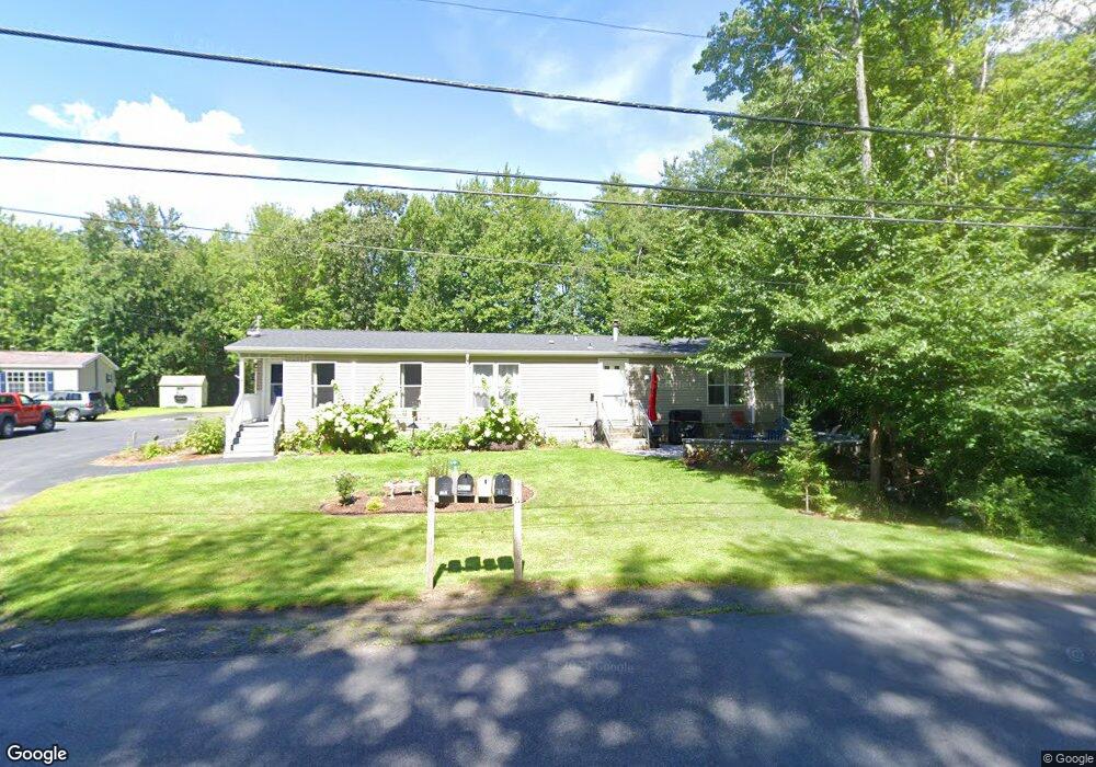
This home is located at 45 Burnt Mill Rd Unit 2, Wells, ME 04090 and is currently estimated at $463,257, approximately $300 per square foot. 45 Burnt Mill Rd Unit 2 is a home located in York County with nearby schools including Wells Junior High School, Wells Elementary School, and Wells High School.
Ownership History
Date
Name
Owned For
Owner Type
Purchase Details
Closed on
Dec 1, 2010
Sold by
Manchester Nicole and Grube Peter
Bought by
Laverty Nancy E
Current Estimated Value
Home Financials for this Owner
Home Financials are based on the most recent Mortgage that was taken out on this home.
Original Mortgage
$93,000
Outstanding Balance
$60,963
Interest Rate
4.22%
Mortgage Type
Purchase Money Mortgage
Estimated Equity
$402,294
Purchase Details
Closed on
May 5, 2005
Sold by
Grube Marisue
Bought by
Grube Peter and Grube Marisue
Create a Home Valuation Report for This Property
The Home Valuation Report is an in-depth analysis detailing your home's value as well as a comparison with similar homes in the area
Home Values in the Area
Average Home Value in this Area
Purchase History
| Date | Buyer | Sale Price | Title Company |
|---|---|---|---|
| Laverty Nancy E | -- | -- | |
| Laverty Nancy E | -- | -- | |
| Grube Peter | -- | -- | |
| Grube Peter | -- | -- |
Source: Public Records
Mortgage History
| Date | Status | Borrower | Loan Amount |
|---|---|---|---|
| Open | Grube Peter | $93,000 | |
| Closed | Grube Peter | $93,000 |
Source: Public Records
Tax History Compared to Growth
Tax History
| Year | Tax Paid | Tax Assessment Tax Assessment Total Assessment is a certain percentage of the fair market value that is determined by local assessors to be the total taxable value of land and additions on the property. | Land | Improvement |
|---|---|---|---|---|
| 2024 | $1,618 | $266,120 | $156,150 | $109,970 |
| 2023 | $1,586 | $266,120 | $156,150 | $109,970 |
| 2022 | $1,701 | $162,660 | $47,380 | $115,280 |
| 2021 | $1,711 | $162,660 | $47,380 | $115,280 |
| 2020 | $1,663 | $158,650 | $47,380 | $111,270 |
| 2019 | $1,653 | $158,650 | $47,380 | $111,270 |
| 2018 | $1,587 | $153,740 | $47,380 | $106,360 |
| 2017 | $1,562 | $153,740 | $47,380 | $106,360 |
| 2016 | $1,547 | $153,740 | $47,380 | $106,360 |
| 2015 | $1,530 | $153,740 | $47,380 | $106,360 |
| 2013 | $1,402 | $153,740 | $47,380 | $106,360 |
Source: Public Records
Map
Nearby Homes
- 1762 Post Rd Unit 206
- 1762 Post Rd Unit 233
- 1801 Post Rd Unit 174
- 1801 Post Rd Unit 190
- 1830 Post Rd
- 105 Harbor Rd
- 99 Harbor Rd Unit Lot 52
- 99 Harbor Rd Unit Lot 54
- 47 Whistle Stop Cir
- 89 Skyline Cir
- 21 Whistle Stop Cir
- 2073 Post Rd Unit 5
- 1413 Post Rd Unit 58
- 2090 Post Rd Unit 4B
- 1373 Post Rd Unit 10A
- 1373 Post Rd Unit 4E
- 1373 Post Rd Unit 2C
- 1373 Post Rd Unit 6B
- 1373 Post Rd Unit 1F
- 1372 Post Rd Unit 1C
- 45 Burnt Mill Rd Unit 1
- 45 Burnt Mill Rd Unit 4
- 45 Burnt Mill Rd Unit 3
- 35 Burnt Mill Rd
- 35 Burnt Mill Rd Unit B
- 35 Burnt Mill Rd Unit A
- 63 Burnt Mill Rd
- 21 Burnt Mill Rd
- Lot 021 Burnt Mill Rd
- 543 Burnt Mill Rd
- 57 Burnt Mill Rd
- 83 Burnt Mill Rd
- 1762 Post Rd Unit 240
- 1762 Post Rd Unit 239
- 1762 Post Rd Unit 238
- 1762 Post Rd Unit 237
- 1762 Post Rd Unit 236
- 1762 Post Rd Unit 235
- 1762 Post Rd Unit 234
- 1762 Post Rd Unit 232