Estimated Value: $211,000 - $251,655
3
Beds
1
Bath
1,360
Sq Ft
$173/Sq Ft
Est. Value
About This Home
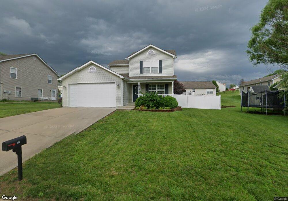
This home is located at 45 C C Camp Rd, Union, MO 63084 and is currently estimated at $235,552, approximately $173 per square foot. 45 C C Camp Rd is a home located in Franklin County with nearby schools including Union High School and Immaculate Conception School.
Ownership History
Date
Name
Owned For
Owner Type
Purchase Details
Closed on
Aug 10, 2010
Sold by
Bac Home Loans Servicing L P
Bought by
Glandon Sharon Ann
Current Estimated Value
Home Financials for this Owner
Home Financials are based on the most recent Mortgage that was taken out on this home.
Original Mortgage
$75,500
Interest Rate
4.54%
Mortgage Type
New Conventional
Purchase Details
Closed on
Feb 21, 2008
Sold by
Kozeny & Mccubbin Lc
Bought by
Bac Home Loans Servicing Lp
Home Financials for this Owner
Home Financials are based on the most recent Mortgage that was taken out on this home.
Original Mortgage
$139,830
Interest Rate
5.88%
Mortgage Type
Purchase Money Mortgage
Create a Home Valuation Report for This Property
The Home Valuation Report is an in-depth analysis detailing your home's value as well as a comparison with similar homes in the area
Home Values in the Area
Average Home Value in this Area
Purchase History
| Date | Buyer | Sale Price | Title Company |
|---|---|---|---|
| Glandon Sharon Ann | $110,500 | None Available | |
| Bac Home Loans Servicing Lp | $119,250 | None Available | |
| Pelton Joseph | -- | None Available |
Source: Public Records
Mortgage History
| Date | Status | Borrower | Loan Amount |
|---|---|---|---|
| Closed | Glandon Sharon Ann | $75,500 | |
| Previous Owner | Pelton Joseph | $139,830 |
Source: Public Records
Tax History
| Year | Tax Paid | Tax Assessment Tax Assessment Total Assessment is a certain percentage of the fair market value that is determined by local assessors to be the total taxable value of land and additions on the property. | Land | Improvement |
|---|---|---|---|---|
| 2025 | $1,769 | $32,123 | $0 | $0 |
| 2024 | $1,769 | $29,420 | $0 | $0 |
| 2023 | $1,773 | $29,420 | $0 | $0 |
| 2022 | $1,935 | $32,040 | $0 | $0 |
| 2021 | $1,938 | $32,040 | $0 | $0 |
| 2020 | $1,782 | $28,990 | $0 | $0 |
| 2019 | $1,778 | $28,990 | $0 | $0 |
| 2018 | $1,553 | $26,568 | $0 | $0 |
| 2017 | $1,557 | $26,568 | $0 | $0 |
| 2016 | $1,470 | $24,531 | $0 | $0 |
| 2015 | $1,447 | $24,531 | $0 | $0 |
| 2014 | $1,516 | $25,677 | $0 | $0 |
Source: Public Records
Map
Nearby Homes
- 1227 N Washington Ave
- 323 Park Hill Dr
- 1008 N Washington Ave
- 435 Water Tower Dr
- 1016 Westmoreland Blvd
- 406 Emma Ln
- 105 E Roosevelt Ave
- 1157 Rock Rd
- 0 Highway V
- 000 Mo-V
- 21 Forest Ln
- 23 Forest Ln
- 413 W State St
- 3732 Highway A
- 613 W State St
- 1122 Old County Farm Rd
- 614 E State St
- 5950 Highway V
- 54 Hickory Cir
- 607 E Main St