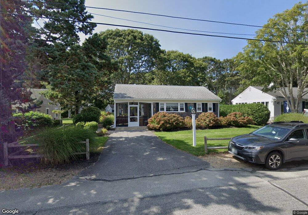
45 Captain Chase Rd Dennis Port, MA 02639
Dennis Port NeighborhoodEstimated Value: $495,000 - $609,000
2
Beds
1
Bath
865
Sq Ft
$660/Sq Ft
Est. Value
About This Home
This home is located at 45 Captain Chase Rd, Dennis Port, MA 02639 and is currently estimated at $571,300, approximately $660 per square foot. 45 Captain Chase Rd is a home located in Barnstable County with nearby schools including Dennis-Yarmouth Regional High School and St. Pius X. School.
Ownership History
Date
Name
Owned For
Owner Type
Purchase Details
Closed on
Sep 13, 2005
Sold by
Clarke Robert W
Bought by
Speanburg Kirk R and Speanburg Michelle M
Current Estimated Value
Home Financials for this Owner
Home Financials are based on the most recent Mortgage that was taken out on this home.
Original Mortgage
$260,000
Outstanding Balance
$138,576
Interest Rate
5.79%
Mortgage Type
Purchase Money Mortgage
Estimated Equity
$432,724
Create a Home Valuation Report for This Property
The Home Valuation Report is an in-depth analysis detailing your home's value as well as a comparison with similar homes in the area
Home Values in the Area
Average Home Value in this Area
Purchase History
| Date | Buyer | Sale Price | Title Company |
|---|---|---|---|
| Speanburg Kirk R | $325,000 | -- |
Source: Public Records
Mortgage History
| Date | Status | Borrower | Loan Amount |
|---|---|---|---|
| Open | Speanburg Kirk R | $260,000 |
Source: Public Records
Tax History Compared to Growth
Tax History
| Year | Tax Paid | Tax Assessment Tax Assessment Total Assessment is a certain percentage of the fair market value that is determined by local assessors to be the total taxable value of land and additions on the property. | Land | Improvement |
|---|---|---|---|---|
| 2025 | $2,215 | $511,500 | $190,100 | $321,400 |
| 2024 | $2,049 | $466,700 | $182,800 | $283,900 |
| 2023 | $1,932 | $413,800 | $166,200 | $247,600 |
| 2022 | $1,863 | $332,700 | $149,700 | $183,000 |
| 2021 | $1,915 | $317,500 | $167,700 | $149,800 |
| 2020 | $1,724 | $282,700 | $146,700 | $136,000 |
| 2019 | $1,634 | $264,900 | $143,900 | $121,000 |
| 2018 | $0 | $247,100 | $137,000 | $110,100 |
| 2017 | $1,438 | $233,800 | $127,200 | $106,600 |
| 2016 | $1,491 | $228,300 | $137,000 | $91,300 |
| 2015 | $1,461 | $228,300 | $137,000 | $91,300 |
| 2014 | $1,325 | $208,700 | $117,400 | $91,300 |
Source: Public Records
Map
Nearby Homes
- 31 Easy St
- 22 Wixon Rd
- 19 Standish Way
- 80 Michaels Ave
- 72 Bassett Ln
- 4 Coffey Ln
- 125 Main St Unit 3
- 71 Main St
- 268 Main St
- 22 Ferncliff Rd
- 37 Beach Hills Rd
- 37 Ocean Dr Unit 2
- 37-A Beach Hills Rd
- 64 Beaten Rd
- 262 Old Wharf Rd Unit 67
- 262 Old Wharf Rd Unit 5
- 262 Old Wharf Rd Unit 5
- 262 Old Wharf Rd Unit 20
- 262 Old Wharf Rd Unit 87
- 12 Spoonbill Rd
- 43 Captain Chase Rd
- 49 Captain Chase Rd
- 39 Captain Chase Rd
- 46 Captain Chase Rd
- 51 Captain Chase Rd
- 10 Siasconset Ave
- 44 Captain Chase Rd
- 4 3rd Mate Row
- 54 Captain Chase Rd
- 55 Captain Chase Rd
- 35 Captain Chase Rd
- 3 Quartermaster Row
- 8 3rd Mate Row
- 57 Siasconset Ave
- 53 Siasconset Ave
- 3 3rd Mate Row
- 59 Siasconset Ave
- 51 Siasconset Ave
- 51 Siasconset Ave Unit 1
- 57 Captain Chase Rd