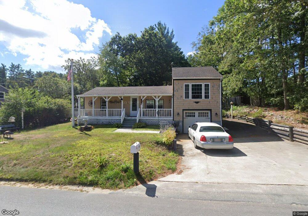
45 Chipaway Rd East Freetown, MA 02717
Estimated Value: $368,000 - $531,000
3
Beds
1
Bath
976
Sq Ft
$439/Sq Ft
Est. Value
About This Home
This home is located at 45 Chipaway Rd, East Freetown, MA 02717 and is currently estimated at $428,049, approximately $438 per square foot. 45 Chipaway Rd is a home located in Bristol County with nearby schools including Freetown Elementary School, George R Austin Intermediate School, and Freetown-Lakeville Middle School.
Ownership History
Date
Name
Owned For
Owner Type
Purchase Details
Closed on
Jan 30, 1978
Bought by
Place Kevin J and Place Vivian I
Current Estimated Value
Create a Home Valuation Report for This Property
The Home Valuation Report is an in-depth analysis detailing your home's value as well as a comparison with similar homes in the area
Home Values in the Area
Average Home Value in this Area
Purchase History
| Date | Buyer | Sale Price | Title Company |
|---|---|---|---|
| Place Kevin J | -- | -- |
Source: Public Records
Mortgage History
| Date | Status | Borrower | Loan Amount |
|---|---|---|---|
| Open | Place Kevin J | $106,000 | |
| Closed | Place Kevin J | $111,252 | |
| Closed | Place Kevin J | $40,000 |
Source: Public Records
Tax History Compared to Growth
Tax History
| Year | Tax Paid | Tax Assessment Tax Assessment Total Assessment is a certain percentage of the fair market value that is determined by local assessors to be the total taxable value of land and additions on the property. | Land | Improvement |
|---|---|---|---|---|
| 2025 | $3,283 | $331,300 | $153,900 | $177,400 |
| 2024 | $3,261 | $312,700 | $145,100 | $167,600 |
| 2023 | $3,042 | $284,000 | $130,700 | $153,300 |
| 2022 | $2,903 | $240,700 | $110,700 | $130,000 |
| 2021 | $2,786 | $219,400 | $100,700 | $118,700 |
| 2020 | $2,660 | $204,300 | $96,800 | $107,500 |
| 2019 | $2,525 | $192,000 | $92,200 | $99,800 |
| 2018 | $2,421 | $181,900 | $92,200 | $89,700 |
| 2017 | $2,371 | $178,000 | $92,200 | $85,800 |
| 2016 | $2,279 | $174,100 | $89,600 | $84,500 |
| 2015 | $2,225 | $172,500 | $89,600 | $82,900 |
| 2014 | $2,146 | $170,200 | $87,700 | $82,500 |
Source: Public Records
Map
Nearby Homes
- 595 Quanapoag Rd
- 599 Quanapoag Rd
- 1599 Braley Rd Unit 68
- 1573 Braley Rd Unit 39
- 0 Costa Dr
- 13 Luscomb Ln
- 122 Quanapoag Rd
- 16 Swallow St
- 1069 Cherokee St
- 4597 Acushnet Ave
- 3 Elaine Ave
- 150 Quanapoag Rd
- 64 Blaze Rd
- 210 Heritage Dr
- 34 Poplar Rd
- Lot 2/3 Quanapoag Rd
- 145 Heritage Dr
- 26 Blueberry Dr
- 23 Parker Dr
- 1063 Westgate St