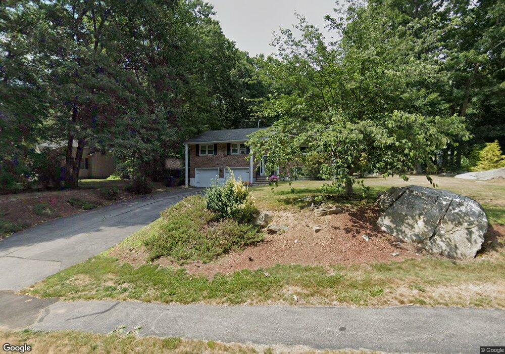
45 Countryside Rd North Grafton, MA 01536
Estimated Value: $560,988 - $632,000
3
Beds
2
Baths
1,400
Sq Ft
$419/Sq Ft
Est. Value
About This Home
This home is located at 45 Countryside Rd, North Grafton, MA 01536 and is currently estimated at $586,997, approximately $419 per square foot. 45 Countryside Rd is a home located in Worcester County with nearby schools including Grafton High School and Silver Spruce Montessori School.
Ownership History
Date
Name
Owned For
Owner Type
Purchase Details
Closed on
Jun 28, 2001
Sold by
Consoli Joseph A and Consoli Catherine M
Bought by
Cable Ryan and Cable Dorene
Current Estimated Value
Home Financials for this Owner
Home Financials are based on the most recent Mortgage that was taken out on this home.
Original Mortgage
$208,000
Interest Rate
7.14%
Mortgage Type
Purchase Money Mortgage
Purchase Details
Closed on
Feb 10, 1999
Sold by
Villa James M and Villa Patricia A
Bought by
Consoli Joseph A and Consloi Catherine M
Purchase Details
Closed on
Apr 24, 1998
Sold by
Forte Paul S and Forte Patricia M
Bought by
Villa James M and Villa Patricia A
Purchase Details
Closed on
Aug 3, 1992
Sold by
Sasso Debbie C and Sasso Thomas
Bought by
Forte Paul S and Forte Patricia
Create a Home Valuation Report for This Property
The Home Valuation Report is an in-depth analysis detailing your home's value as well as a comparison with similar homes in the area
Home Values in the Area
Average Home Value in this Area
Purchase History
| Date | Buyer | Sale Price | Title Company |
|---|---|---|---|
| Cable Ryan | $260,000 | -- | |
| Cable Ryan | $260,000 | -- | |
| Consoli Joseph A | $183,500 | -- | |
| Consoli Joseph A | $183,500 | -- | |
| Villa James M | $169,000 | -- | |
| Villa James M | $169,000 | -- | |
| Forte Paul S | $153,200 | -- | |
| Forte Paul S | $153,200 | -- |
Source: Public Records
Mortgage History
| Date | Status | Borrower | Loan Amount |
|---|---|---|---|
| Open | Forte Paul S | $240,000 | |
| Closed | Forte Paul S | $208,000 |
Source: Public Records
Tax History Compared to Growth
Tax History
| Year | Tax Paid | Tax Assessment Tax Assessment Total Assessment is a certain percentage of the fair market value that is determined by local assessors to be the total taxable value of land and additions on the property. | Land | Improvement |
|---|---|---|---|---|
| 2025 | $6,903 | $495,200 | $184,100 | $311,100 |
| 2024 | $6,829 | $477,200 | $175,300 | $301,900 |
| 2023 | $6,188 | $393,900 | $175,300 | $218,600 |
| 2022 | $5,802 | $343,700 | $150,500 | $193,200 |
| 2021 | $5,283 | $307,500 | $136,800 | $170,700 |
| 2020 | $5,006 | $303,400 | $136,800 | $166,600 |
| 2019 | $4,936 | $296,300 | $132,500 | $163,800 |
| 2018 | $4,849 | $292,300 | $131,700 | $160,600 |
| 2017 | $4,667 | $284,600 | $124,000 | $160,600 |
| 2016 | $4,033 | $240,800 | $99,600 | $141,200 |
| 2015 | $3,983 | $241,400 | $98,500 | $142,900 |
| 2014 | $3,632 | $238,000 | $116,300 | $121,700 |
Source: Public Records
Map
Nearby Homes
- 3 Abby Rd
- 1 Doris Dr
- 23 Institute Rd
- 0 East St
- 25 Clearview St
- 16 Clearview St
- 9 Logan Path
- 4 Abby Rd
- 167 Worcester St
- 6 Overlook St
- 17 Hingham Rd
- 66 North St
- 63 North St
- 60 Wesson St
- 61 Wesson St
- 72 Westborough Rd Unit 1
- 72 Westborough Rd Unit 2
- 17 Worcester St
- 14 Northgate Ct Unit 14
- 194 Worcester St
- 43 Countryside Rd
- 47 Countryside Rd
- 47 Countryside Rd
- 44 Countryside Rd
- 46 Countryside Rd
- 41 Countryside Rd
- 49 Countryside Rd
- 39 Countryside Rd
- 42 Countryside Rd
- 48 Countryside Rd
- 51 Countryside Rd
- 40 Countryside Rd
- 54 Countryside Rd
- 22 Countryside Rd
- 56 Countryside Rd
- 26 Countryside Rd
- 37 Countryside Rd
- 20 Countryside Rd
- 53 Countryside Rd
- 18 Countryside Rd