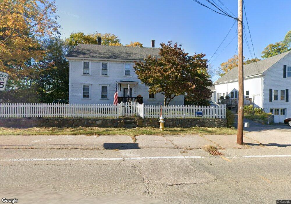
45 Dedham St Wrentham, MA 02093
Estimated Value: $779,688
4
Beds
4
Baths
3,450
Sq Ft
$226/Sq Ft
Est. Value
About This Home
This home is located at 45 Dedham St, Wrentham, MA 02093 and is currently estimated at $779,688, approximately $225 per square foot. 45 Dedham St is a home located in Norfolk County with nearby schools including Delaney Elementary School, Charles E Roderick, and Discovery Daycare Center.
Ownership History
Date
Name
Owned For
Owner Type
Purchase Details
Closed on
Feb 10, 2022
Sold by
Cgw Nt and Burt
Bought by
Rainy Bit Llc
Current Estimated Value
Purchase Details
Closed on
Mar 16, 2001
Sold by
Spiro Scott A
Bought by
Marshall Brian N and Marshall Susan M
Home Financials for this Owner
Home Financials are based on the most recent Mortgage that was taken out on this home.
Original Mortgage
$241,000
Interest Rate
7.01%
Mortgage Type
Purchase Money Mortgage
Purchase Details
Closed on
Apr 27, 1995
Sold by
Hsu Dick P
Bought by
Spiro Scott A
Home Financials for this Owner
Home Financials are based on the most recent Mortgage that was taken out on this home.
Original Mortgage
$121,000
Interest Rate
8.33%
Mortgage Type
Purchase Money Mortgage
Create a Home Valuation Report for This Property
The Home Valuation Report is an in-depth analysis detailing your home's value as well as a comparison with similar homes in the area
Purchase History
| Date | Buyer | Sale Price | Title Company |
|---|---|---|---|
| Rainy Bit Llc | -- | None Available | |
| Rainy Bit Llc | -- | None Available | |
| Marshall Brian N | $281,000 | -- | |
| Spiro Scott A | $171,000 | -- |
Source: Public Records
Mortgage History
| Date | Status | Borrower | Loan Amount |
|---|---|---|---|
| Previous Owner | Spiro Scott A | $241,000 | |
| Previous Owner | Spiro Scott A | $121,000 |
Source: Public Records
Tax History
| Year | Tax Paid | Tax Assessment Tax Assessment Total Assessment is a certain percentage of the fair market value that is determined by local assessors to be the total taxable value of land and additions on the property. | Land | Improvement |
|---|---|---|---|---|
| 2025 | $0 | $631,600 | $253,700 | $377,900 |
| 2024 | $6,036 | $603,600 | $253,700 | $349,900 |
| 2023 | $2,693 | $451,600 | $215,900 | $235,700 |
| 2022 | $0 | $465,500 | $210,000 | $255,500 |
| 2021 | $0 | $441,800 | $196,200 | $245,600 |
| 2020 | $6,036 | $423,600 | $149,700 | $273,900 |
| 2019 | $5,981 | $423,600 | $149,700 | $273,900 |
| 2018 | $6,283 | $441,200 | $149,900 | $291,300 |
| 2017 | $5,804 | $407,300 | $147,000 | $260,300 |
| 2016 | $5,683 | $398,000 | $142,700 | $255,300 |
| 2015 | $5,409 | $361,100 | $137,200 | $223,900 |
| 2014 | $5,320 | $347,500 | $132,000 | $215,500 |
Source: Public Records
Map
Nearby Homes
- 10 Nature View Dr
- 15 Nature View Dr
- 155 Clark Rd Unit 155
- 319 Taunton St
- 11 Earle Stewart Ln
- Loty 3-14 Earle Stewart Ln
- 500 Franklin St
- 12 Earle Stewart Ln
- Lot 1 - Blueberry 2 Car Plan at King Philip Estates
- Lot 8 - Blueberry 2 Car Plan at King Philip Estates
- Lot 5 - Hughes 2 car Plan at King Philip Estates
- Lot 6 - Blueberry 3 Car Plan at King Philip Estates
- 10 Earle Stewart Ln Unit Lot 5
- Lot 2 - Camden 2 Car Plan at King Philip Estates
- Lot 7 - Cedar Plan at King Philip Estates
- Lot 4 - Hemingway 2 Car Plan at King Philip Estates
- Lot 3 - Blueberry 2 Car Plan at King Philip Estates
- 246 Forest Grove Ave
- 287 Park St
- 11 Weber Farm Rd Unit 11
- 59 Dedham St
- 31 Dedham St Unit 1
- 31 Dedham St Unit A
- 58 Dedham St
- 58 Dedham St Unit 58
- 45 East St
- 27 Dedham St
- 21 Dedham St Unit 2
- 21 Dedham St Unit 1
- 21 Dedham St Unit 3
- 1 East St
- 40 Franklin St
- 40 Franklin St Unit 40
- 5 East St
- 36 Franklin St Unit 36
- 86 Dedham St
- 21 East St
- 0 East St
- 4 East St
- 13 Franklin St
Your Personal Tour Guide
Ask me questions while you tour the home.