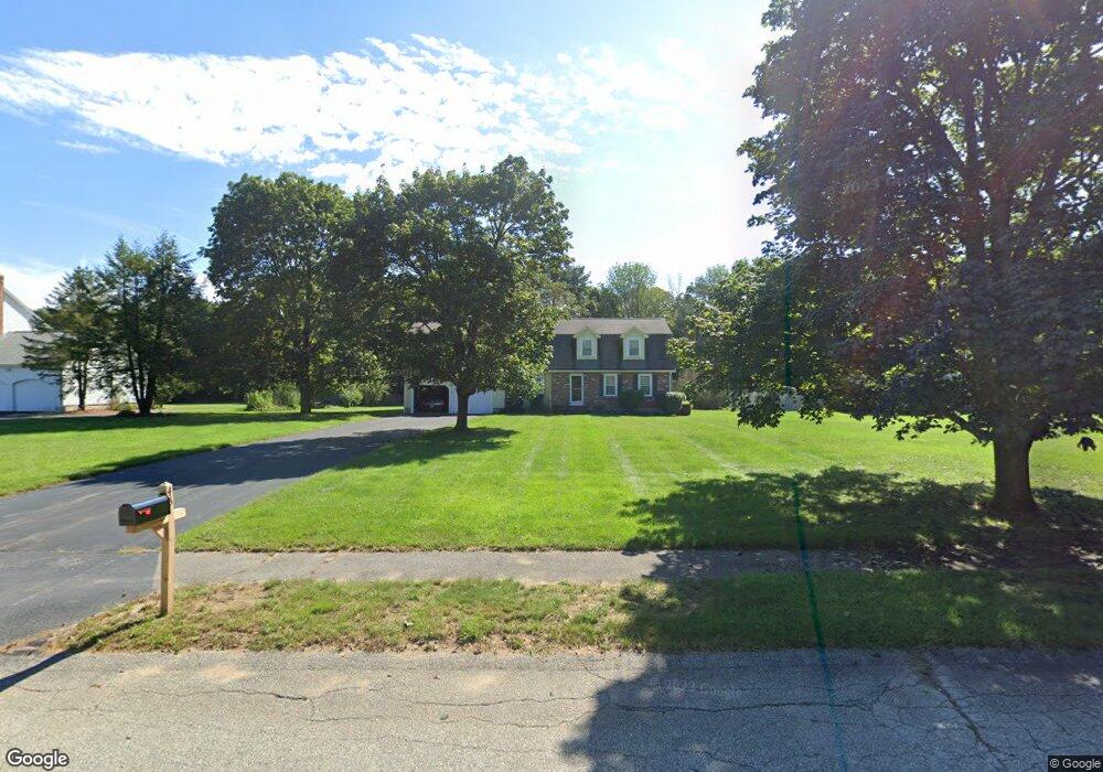
45 Deer Run Rd Wrentham, MA 02093
Estimated Value: $810,630 - $960,000
4
Beds
3
Baths
2,652
Sq Ft
$330/Sq Ft
Est. Value
About This Home
This home is located at 45 Deer Run Rd, Wrentham, MA 02093 and is currently estimated at $875,158, approximately $329 per square foot. 45 Deer Run Rd is a home located in Norfolk County with nearby schools including Delaney Elementary School and Charles E Roderick.
Ownership History
Date
Name
Owned For
Owner Type
Purchase Details
Closed on
Oct 26, 1990
Sold by
Smigiel Frank A
Bought by
Cassidy Joseph W
Current Estimated Value
Home Financials for this Owner
Home Financials are based on the most recent Mortgage that was taken out on this home.
Original Mortgage
$113,000
Interest Rate
10.08%
Mortgage Type
Purchase Money Mortgage
Purchase Details
Closed on
Jul 31, 1987
Sold by
Oloughlin Const Inc
Bought by
Smigiel Frank A
Create a Home Valuation Report for This Property
The Home Valuation Report is an in-depth analysis detailing your home's value as well as a comparison with similar homes in the area
Purchase History
| Date | Buyer | Sale Price | Title Company |
|---|---|---|---|
| Cassidy Joseph W | $217,000 | -- | |
| Smigiel Frank A | $240,000 | -- |
Source: Public Records
Mortgage History
| Date | Status | Borrower | Loan Amount |
|---|---|---|---|
| Open | Smigiel Frank A | $278,000 | |
| Closed | Smigiel Frank A | $66,000 | |
| Closed | Smigiel Frank A | $117,000 | |
| Closed | Smigiel Frank A | $113,000 |
Source: Public Records
Tax History Compared to Growth
Tax History
| Year | Tax Paid | Tax Assessment Tax Assessment Total Assessment is a certain percentage of the fair market value that is determined by local assessors to be the total taxable value of land and additions on the property. | Land | Improvement |
|---|---|---|---|---|
| 2025 | $8,193 | $706,900 | $293,700 | $413,200 |
| 2024 | $7,837 | $653,100 | $293,700 | $359,400 |
| 2023 | $8,096 | $641,500 | $267,000 | $374,500 |
| 2022 | $7,785 | $569,500 | $249,100 | $320,400 |
| 2021 | $7,491 | $532,400 | $217,400 | $315,000 |
| 2020 | $7,524 | $528,000 | $193,400 | $334,600 |
| 2019 | $7,455 | $528,000 | $193,400 | $334,600 |
| 2018 | $6,915 | $485,600 | $193,600 | $292,000 |
| 2017 | $6,727 | $472,100 | $189,900 | $282,200 |
| 2016 | $6,416 | $449,300 | $184,400 | $264,900 |
| 2015 | $6,440 | $429,900 | $177,300 | $252,600 |
| 2014 | $6,167 | $402,800 | $170,500 | $232,300 |
Source: Public Records
Map
Nearby Homes
- 11 Earle Stewart Ln
- Lot 1 - Blueberry 2 Car Plan at King Philip Estates
- Lot 8 - Blueberry 2 Car Plan at King Philip Estates
- Lot 5 - Hughes 2 car Plan at King Philip Estates
- Lot 6 - Blueberry 3 Car Plan at King Philip Estates
- 10 Earle Stewart Ln Unit Lot 5
- Lot 2 - Camden 2 Car Plan at King Philip Estates
- Lot 7 - Cedar Plan at King Philip Estates
- Lot 4 - Hemingway 2 Car Plan at King Philip Estates
- 14 Earle Stewart Ln
- Lot 3 - Blueberry 2 Car Plan at King Philip Estates
- 131 Creek St Unit 7
- 10 Nature View Dr
- 15 Nature View Dr
- 319 Taunton St
- 500 Franklin St
- 155 Clark Rd Unit 155
- 1 Lorraine Metcalf Dr
- 19 Nadeau Dr
- 287 Park St
- 55 Deer Run Rd
- 35 Deer Run Rd
- 25 Deer Run Rd
- 40 Deer Run Rd
- 324 South St
- 324 South St Unit B
- 324 South St Unit 324
- 322 South St Unit A
- 322 South St
- 322 South St Unit 322
- 322 South St Unit 1
- 30 Deer Run Rd
- 346 South St
- 15 Deer Run Rd
- 50 Deer Run Rd
- 20 Deer Run Rd
- 300 South St
- 335 South St
- 32 Eastside Rd
- 42 Eastside Rd