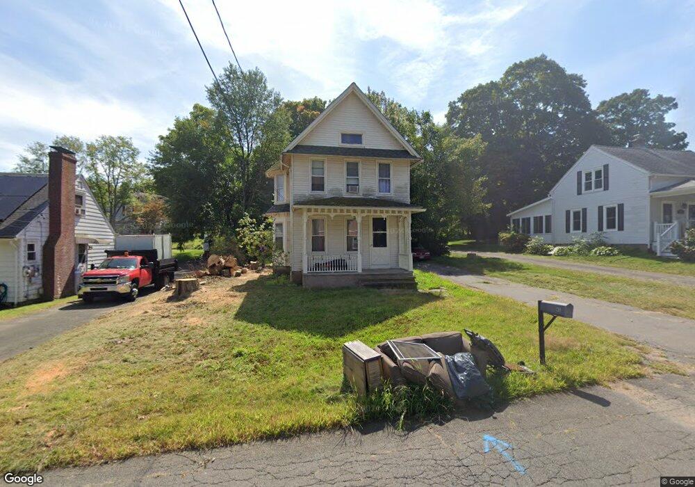
45 Durwin St Middletown, CT 06457
Estimated Value: $277,899 - $327,000
2
Beds
1
Bath
1,040
Sq Ft
$293/Sq Ft
Est. Value
About This Home
This home is located at 45 Durwin St, Middletown, CT 06457 and is currently estimated at $304,725, approximately $293 per square foot. 45 Durwin St is a home located in Middlesex County with nearby schools including Wilbert Snow Elementary School, Middletown High School, and St John Paul II School.
Ownership History
Date
Name
Owned For
Owner Type
Purchase Details
Closed on
Sep 19, 1994
Sold by
Wuestefeld L Kim
Bought by
Thody Howard R and Thody Nancy M
Current Estimated Value
Home Financials for this Owner
Home Financials are based on the most recent Mortgage that was taken out on this home.
Original Mortgage
$119,300
Interest Rate
8.5%
Mortgage Type
Unknown
Purchase Details
Closed on
Mar 1, 1991
Sold by
Fraser Elizabeth W and Fraser Peter Q
Bought by
Wuestefeld L Kim
Create a Home Valuation Report for This Property
The Home Valuation Report is an in-depth analysis detailing your home's value as well as a comparison with similar homes in the area
Home Values in the Area
Average Home Value in this Area
Purchase History
| Date | Buyer | Sale Price | Title Company |
|---|---|---|---|
| Thody Howard R | $117,000 | -- | |
| Wuestefeld L Kim | $130,000 | -- |
Source: Public Records
Mortgage History
| Date | Status | Borrower | Loan Amount |
|---|---|---|---|
| Open | Wuestefeld L Kim | $120,000 | |
| Closed | Wuestefeld L Kim | $119,300 | |
| Previous Owner | Wuestefeld L Kim | $92,000 | |
| Previous Owner | Wuestefeld L Kim | $92,250 |
Source: Public Records
Tax History
| Year | Tax Paid | Tax Assessment Tax Assessment Total Assessment is a certain percentage of the fair market value that is determined by local assessors to be the total taxable value of land and additions on the property. | Land | Improvement |
|---|---|---|---|---|
| 2025 | $5,024 | $129,140 | $59,200 | $69,940 |
| 2024 | $4,752 | $129,140 | $59,200 | $69,940 |
| 2023 | $4,533 | $129,140 | $59,200 | $69,940 |
| 2022 | $4,108 | $93,360 | $39,470 | $53,890 |
| 2021 | $4,108 | $93,360 | $39,470 | $53,890 |
| 2020 | $4,127 | $93,360 | $39,470 | $53,890 |
| 2019 | $4,145 | $93,360 | $39,470 | $53,890 |
| 2018 | $4,080 | $93,360 | $39,470 | $53,890 |
| 2017 | $4,317 | $101,810 | $46,420 | $55,390 |
| 2016 | $4,106 | $99,670 | $44,280 | $55,390 |
| 2015 | $3,947 | $99,670 | $44,280 | $55,390 |
| 2014 | $3,987 | $99,670 | $44,280 | $55,390 |
Source: Public Records
Map
Nearby Homes
- 56 Coles Rd
- 10 Guarino Dr
- 909 Randolph Rd
- 58 Durant Terrace
- Lot 3 Coleman Rd
- 13 Mckenna Dr
- 45 Mckenna Dr
- 91 Gleeson Rd
- 217 Ridge Rd
- 166 Ridge Rd
- 15 Blue Spruce St
- 11 Mansfield Terrace
- 1 Yellow Wood St
- 21 Butternut Knolls
- 236 Cross St
- 32 Burr Ave
- 63 Millbrook Rd
- 6 Hillside Ct
- 57 Edgewood Dr
- 23 Hotchkiss St
Your Personal Tour Guide
Ask me questions while you tour the home.