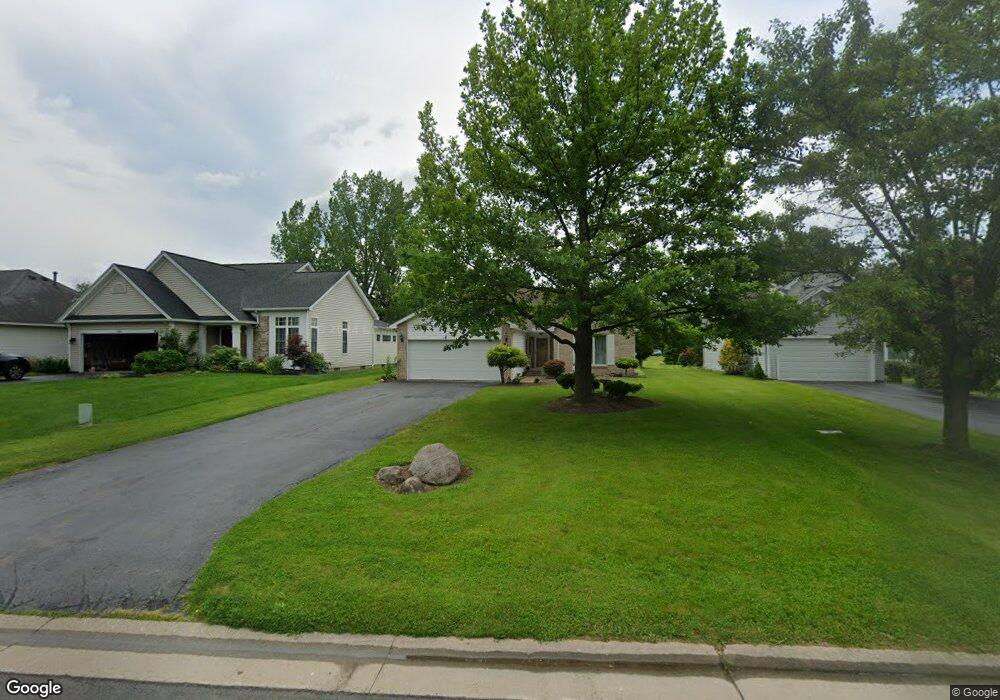
45 E Pointe Fairport, NY 14450
Estimated Value: $368,000 - $446,000
3
Beds
2
Baths
1,621
Sq Ft
$246/Sq Ft
Est. Value
About This Home
This home is located at 45 E Pointe, Fairport, NY 14450 and is currently estimated at $397,994, approximately $245 per square foot. 45 E Pointe is a home located in Monroe County with nearby schools including Dudley School, Northside School, and Johanna Perrin Middle School.
Ownership History
Date
Name
Owned For
Owner Type
Purchase Details
Closed on
Mar 4, 2016
Sold by
Ostrander David L and Ostrander Daniel
Bought by
Ostrander David L and Ostrander Daniel
Current Estimated Value
Purchase Details
Closed on
Nov 21, 2013
Sold by
Ostrander David L and Ostrander Mary Jude
Bought by
Ostrander David L
Purchase Details
Closed on
Sep 28, 2001
Sold by
Cristofori Caterina
Bought by
Ostrander David L
Create a Home Valuation Report for This Property
The Home Valuation Report is an in-depth analysis detailing your home's value as well as a comparison with similar homes in the area
Home Values in the Area
Average Home Value in this Area
Purchase History
| Date | Buyer | Sale Price | Title Company |
|---|---|---|---|
| Ostrander David L | -- | None Available | |
| Ostrander David L | -- | None Available | |
| Ostrander David L | $159,900 | Christopher A Schiano |
Source: Public Records
Tax History
| Year | Tax Paid | Tax Assessment Tax Assessment Total Assessment is a certain percentage of the fair market value that is determined by local assessors to be the total taxable value of land and additions on the property. | Land | Improvement |
|---|---|---|---|---|
| 2024 | $7,794 | $213,600 | $61,100 | $152,500 |
| 2023 | $7,494 | $213,600 | $61,100 | $152,500 |
| 2022 | $7,824 | $213,600 | $61,100 | $152,500 |
| 2021 | $7,828 | $213,600 | $61,100 | $152,500 |
| 2020 | $6,988 | $213,600 | $61,100 | $152,500 |
| 2019 | $2,341 | $213,600 | $61,100 | $152,500 |
| 2018 | $6,766 | $213,600 | $61,100 | $152,500 |
| 2017 | $947 | $197,800 | $61,100 | $136,700 |
| 2016 | $2,341 | $197,800 | $61,100 | $136,700 |
| 2015 | -- | $197,800 | $61,100 | $136,700 |
| 2014 | -- | $197,800 | $61,100 | $136,700 |
Source: Public Records
Map
Nearby Homes
- 19 Williamsburg Dr
- 16 Mount Vernon Cir
- 53 Squirrels Heath Rd
- 83 Country Downs Cir
- 55 Frank St
- 3 Rockford Ln
- 582 Watson Rd
- 95 Summit St
- 70 High St
- 531 MacEdon Center Rd
- 70 Summit St
- 142 S Main St
- 28 Misty Pine Rd
- 18 Deland Park A
- 38 Winchester Dr
- 8 Packet Boat Dr
- 6 Noahs Bluff
- 8 Noahs Bluff
- 4 Noahs Bluff
- 5 Noahs Bluff