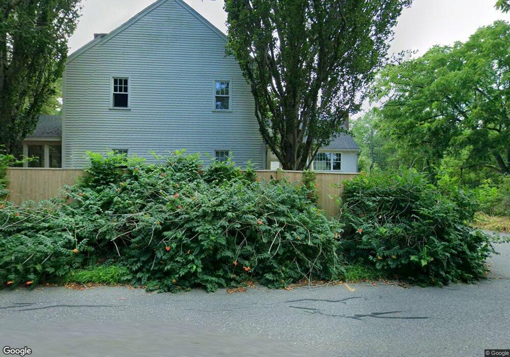
45 Estabrook Rd Concord, MA 01742
Estimated Value: $2,889,721 - $3,146,000
5
Beds
3
Baths
3,780
Sq Ft
$790/Sq Ft
Est. Value
About This Home
This home is located at 45 Estabrook Rd, Concord, MA 01742 and is currently estimated at $2,986,430, approximately $790 per square foot. 45 Estabrook Rd is a home located in Middlesex County with nearby schools including Alcott Elementary School, Concord Middle School, and Concord Carlisle High School.
Ownership History
Date
Name
Owned For
Owner Type
Purchase Details
Closed on
Dec 16, 2005
Sold by
Aley Allison Y and Aley Gordon Thomas
Bought by
James Benjamin B and James Katherine F
Current Estimated Value
Home Financials for this Owner
Home Financials are based on the most recent Mortgage that was taken out on this home.
Original Mortgage
$417,000
Interest Rate
6.34%
Mortgage Type
Purchase Money Mortgage
Purchase Details
Closed on
Aug 1, 2000
Sold by
Est Henderson Mildred and Henderson Kenneth
Bought by
Aley Gordon T and Aley Allison Y
Home Financials for this Owner
Home Financials are based on the most recent Mortgage that was taken out on this home.
Original Mortgage
$650,000
Interest Rate
8.18%
Mortgage Type
Purchase Money Mortgage
Create a Home Valuation Report for This Property
The Home Valuation Report is an in-depth analysis detailing your home's value as well as a comparison with similar homes in the area
Home Values in the Area
Average Home Value in this Area
Purchase History
| Date | Buyer | Sale Price | Title Company |
|---|---|---|---|
| James Benjamin B | $1,535,000 | -- | |
| Aley Gordon T | $650,000 | -- |
Source: Public Records
Mortgage History
| Date | Status | Borrower | Loan Amount |
|---|---|---|---|
| Open | Aley Gordon T | $387,000 | |
| Closed | James Benjamin B | $417,000 | |
| Previous Owner | Aley Gordon T | $787,500 | |
| Previous Owner | Aley Gordon T | $650,000 |
Source: Public Records
Tax History Compared to Growth
Tax History
| Year | Tax Paid | Tax Assessment Tax Assessment Total Assessment is a certain percentage of the fair market value that is determined by local assessors to be the total taxable value of land and additions on the property. | Land | Improvement |
|---|---|---|---|---|
| 2025 | $303 | $2,285,100 | $1,072,000 | $1,213,100 |
| 2024 | $29,758 | $2,266,400 | $1,072,000 | $1,194,400 |
| 2023 | $22,837 | $1,762,100 | $802,600 | $959,500 |
| 2022 | $22,419 | $1,518,900 | $642,100 | $876,800 |
| 2021 | $24,214 | $1,645,000 | $802,600 | $842,400 |
| 2020 | $24,302 | $1,707,800 | $848,400 | $859,400 |
| 2019 | $23,597 | $1,662,900 | $845,900 | $817,000 |
| 2018 | $23,070 | $1,614,400 | $805,600 | $808,800 |
| 2017 | $22,103 | $1,570,900 | $783,300 | $787,600 |
| 2016 | $23,273 | $1,671,900 | $868,100 | $803,800 |
| 2015 | $22,548 | $1,577,900 | $845,100 | $732,800 |
Source: Public Records
Map
Nearby Homes
- 76 Red Coat Ln
- 52 Bow St
- 343 Nashawtuc Rd
- 775 Monument St
- 29 Willard Common
- 38-40 Court Ln
- 49 Willard Common
- 168 Nashawtuc Rd
- 46 Sudbury Rd
- 244 Musterfield Rd
- 14 Thoreau St
- 106 Elm St
- 22 Belknap Ct
- 295 Musterfield Rd
- 987 Lowell Rd
- 46 Wood St
- 73 Ridge Rd
- 140 Revolutionary Rd
- 181 Stow St
- 96 Independence Rd
- 11 Cedar Way
- 55 Estabrook Rd
- 13 Estabrook Rd
- 81 Estabrook Rd
- 200 Barnes Hill Rd
- 82 Estabrook Rd
- 60 Cedar Way
- 121 Estabrook Rd
- 102 Estabrook Rd
- 63 Cedar Way
- 170 Barnes Hill Rd
- 0 Barnes Hill Rd
- 91 Liberty St
- 33 Liberty St
- 177 Barnes Hill Rd
- 156 Estabrook Rd
- 95 Red Coat Ln
- 160 Barnes Hill Rd
- 475 Monument St
- 495 Monument St