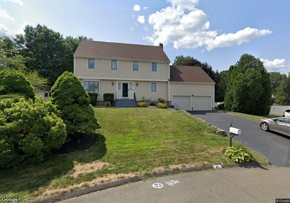
45 Haystack Rd Wethersfield, CT 06109
Estimated Value: $643,000 - $663,000
4
Beds
3
Baths
2,624
Sq Ft
$248/Sq Ft
Est. Value
About This Home
This home is located at 45 Haystack Rd, Wethersfield, CT 06109 and is currently estimated at $650,036, approximately $247 per square foot. 45 Haystack Rd is a home located in Hartford County with nearby schools including Samuel B. Webb Elementary School, Silas Deane Middle School, and Wethersfield High School.
Ownership History
Date
Name
Owned For
Owner Type
Purchase Details
Closed on
Dec 20, 2005
Sold by
Grigas Deborah D
Bought by
Humphrey Scott and Humphrey Catherine
Current Estimated Value
Create a Home Valuation Report for This Property
The Home Valuation Report is an in-depth analysis detailing your home's value as well as a comparison with similar homes in the area
Home Values in the Area
Average Home Value in this Area
Purchase History
| Date | Buyer | Sale Price | Title Company |
|---|---|---|---|
| Humphrey Scott | $404,900 | -- |
Source: Public Records
Mortgage History
| Date | Status | Borrower | Loan Amount |
|---|---|---|---|
| Open | Humphrey Scott | $90,500 | |
| Open | Humphrey Scott | $242,985 | |
| Closed | Humphrey Scott | $265,700 |
Source: Public Records
Tax History
| Year | Tax Paid | Tax Assessment Tax Assessment Total Assessment is a certain percentage of the fair market value that is determined by local assessors to be the total taxable value of land and additions on the property. | Land | Improvement |
|---|---|---|---|---|
| 2025 | $16,273 | $394,780 | $112,840 | $281,940 |
| 2024 | $10,943 | $253,190 | $83,430 | $169,760 |
| 2023 | $10,578 | $253,190 | $83,430 | $169,760 |
| 2022 | $10,401 | $253,190 | $83,430 | $169,760 |
| 2021 | $10,297 | $253,190 | $83,430 | $169,760 |
| 2020 | $10,302 | $253,190 | $83,430 | $169,760 |
| 2019 | $10,315 | $253,190 | $83,430 | $169,760 |
| 2018 | $9,914 | $243,100 | $79,300 | $163,800 |
| 2017 | $9,668 | $243,100 | $79,300 | $163,800 |
| 2016 | $9,369 | $243,100 | $79,300 | $163,800 |
| 2015 | $9,284 | $243,100 | $79,300 | $163,800 |
| 2014 | $8,931 | $243,100 | $79,300 | $163,800 |
Source: Public Records
Map
Nearby Homes
- 0 Collier Rd
- 101 Collier Rd
- 104 Willow St
- 5 Robeth Ln
- 7 Barrington Dr Unit C
- 455 Brimfield Rd
- 508 Highland St
- 76 Luca Lane Homesite 8
- 89 Merriman Rd
- 61 Luca Ln
- 8 Stella Dr
- 62 Harold Dr
- 155 Old Common Rd
- 6 Vinnie Dr
- 137 Dale Rd
- 20 Forest Dr
- 38 Wheeler Rd
- 378 Cypress Rd
- 47 Forest Dr
- 229 Cottonwood Rd Unit 229
Your Personal Tour Guide
Ask me questions while you tour the home.