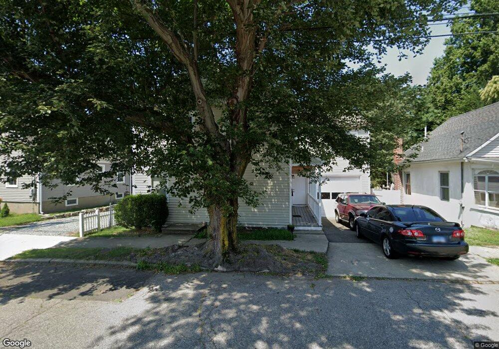
45 Hemlock St Bridgeport, CT 06605
Black Rock NeighborhoodEstimated Value: $505,217 - $679,000
5
Beds
2
Baths
2,645
Sq Ft
$227/Sq Ft
Est. Value
About This Home
This home is located at 45 Hemlock St, Bridgeport, CT 06605 and is currently estimated at $600,804, approximately $227 per square foot. 45 Hemlock St is a home located in Fairfield County with nearby schools including Black Rock School, Bassick High School, and Park City Prep Charter School.
Ownership History
Date
Name
Owned For
Owner Type
Purchase Details
Closed on
Jul 6, 2011
Sold by
Deutsche Bank Natl T C
Bought by
Dimitroglou Dimmitrios
Current Estimated Value
Purchase Details
Closed on
Aug 27, 1996
Sold by
Allen Mark S and Allen Tammy J
Bought by
Smith Edward T and Smith Jazmin E
Create a Home Valuation Report for This Property
The Home Valuation Report is an in-depth analysis detailing your home's value as well as a comparison with similar homes in the area
Home Values in the Area
Average Home Value in this Area
Purchase History
| Date | Buyer | Sale Price | Title Company |
|---|---|---|---|
| Dimitroglou Dimmitrios | $125,000 | -- | |
| Dimitroglou Dimmitrios | $125,000 | -- | |
| Smith Edward T | $130,000 | -- | |
| Smith Edward T | $130,000 | -- |
Source: Public Records
Mortgage History
| Date | Status | Borrower | Loan Amount |
|---|---|---|---|
| Closed | Smith Edward T | $150,000 | |
| Closed | Smith Edward T | $75,000 |
Source: Public Records
Tax History Compared to Growth
Tax History
| Year | Tax Paid | Tax Assessment Tax Assessment Total Assessment is a certain percentage of the fair market value that is determined by local assessors to be the total taxable value of land and additions on the property. | Land | Improvement |
|---|---|---|---|---|
| 2025 | $10,095 | $232,330 | $110,520 | $121,810 |
| 2024 | $10,095 | $232,330 | $110,520 | $121,810 |
| 2023 | $10,095 | $232,330 | $110,520 | $121,810 |
| 2022 | $10,095 | $232,330 | $110,520 | $121,810 |
| 2021 | $10,095 | $232,330 | $110,520 | $121,810 |
| 2020 | $8,887 | $164,600 | $71,740 | $92,860 |
| 2019 | $8,887 | $164,600 | $71,740 | $92,860 |
| 2018 | $8,949 | $164,600 | $71,740 | $92,860 |
| 2017 | $8,949 | $164,600 | $71,740 | $92,860 |
| 2016 | $8,949 | $164,600 | $71,740 | $92,860 |
| 2015 | $7,527 | $178,360 | $60,300 | $118,060 |
| 2014 | $7,527 | $178,360 | $60,300 | $118,060 |
Source: Public Records
Map
Nearby Homes
- 167 Scofield Ave
- 105 Scofield Ave
- 166 Alfred St
- 855 Brewster St Unit 857
- 51 Princeton St
- 2773 Fairfield Ave Unit 3
- 82 Waldorf Ave
- 165 Bennett St
- 37 Rowsley St Unit 6
- 26 Rowsley St Unit 3
- 135 Whittier St
- 144 Whittier St
- 20 Haddon St Unit 5
- 554 Brewster St Unit 4
- 105 Fox St Unit 107
- 31 Whittier St
- 25 Whittier St
- 39 Jetland Place Unit 41
- 450 Davidson St
- 222 Ellsworth St
- 55 Hemlock St
- 35 Hemlock St
- 65 Hemlock St
- 25 Hemlock St
- 36 Hemlock St
- 26 Hemlock St
- 75 Hemlock St
- 182 Canfield Ave
- 174 Canfield Ave Unit 178
- 174 Canfield Ave Unit 3
- 184 Canfield Ave
- 246 King St
- 164 Canfield Ave
- 164 Canfield Ave Unit 1 rear
- 85 Hemlock St
- 194 Canfield Ave Unit 2
- 194 Canfield Ave
- 192 Canfield Ave Unit 2
- 192 Canfield Ave Unit 194
- 192 Canfield Ave Unit 3