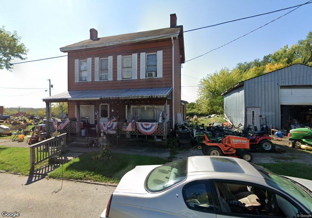
45 High Dillonvale, OH 43917
Estimated Value: $72,867 - $143,000
4
Beds
1
Bath
1,842
Sq Ft
$58/Sq Ft
Est. Value
About This Home
This home is located at 45 High, Dillonvale, OH 43917 and is currently estimated at $106,967, approximately $58 per square foot. 45 High is a home with nearby schools including Buckeye Local High School.
Create a Home Valuation Report for This Property
The Home Valuation Report is an in-depth analysis detailing your home's value as well as a comparison with similar homes in the area
Tax History
We collect this data history from publicly available records. To have your information removed, we recommend requesting removal directly through your county’s website.
| Year | Tax Paid | Tax Assessment Tax Assessment Total Assessment is a certain percentage of the fair market value that is determined by local assessors to be the total taxable value of land and additions on the property. | Land | Improvement |
|---|---|---|---|---|
| 2025 | $839 | $15,054 | $977 | $14,077 |
| 2024 | $180 | $15,054 | $977 | $14,077 |
| 2023 | $193 | $11,956 | $868 | $11,088 |
| 2022 | $117 | $11,956 | $868 | $11,088 |
| 2021 | $117 | $11,956 | $868 | $11,088 |
| 2020 | $43 | $9,808 | $655 | $9,153 |
| 2019 | $46 | $0 | $0 | $0 |
| 2018 | $43 | $0 | $0 | $0 |
| 2017 | $5 | $0 | $0 | $0 |
| 2016 | $10 | $0 | $0 | $0 |
| 2015 | $0 | $0 | $0 | $0 |
| 2014 | $1 | $0 | $0 | $0 |
| 2012 | $0 | $6,790 | $525 | $6,265 |
Source: Public Records
Map
Nearby Homes
- 77 North St
- 61 Green St
- 1857 Ohio 152
- 1667 County Rd 11
- 3275 County Road 15
- 84 Powerhouse Rd
- 135 Township Rd
- 3984 County Road 15
- 5554 State Route 152
- 5566 State Route 152
- 0 Ohio 152 Unit 5211287
- 213 Smithfield St
- 134 Coss St
- 1041 County Road 14
- 329 Township Road 177
- 4956 State Route 150
- 4351 County Road 17
- 291 Blairmont Rd
- 33 Hill St
- 531 Della Dr
Your Personal Tour Guide
Ask me questions while you tour the home.