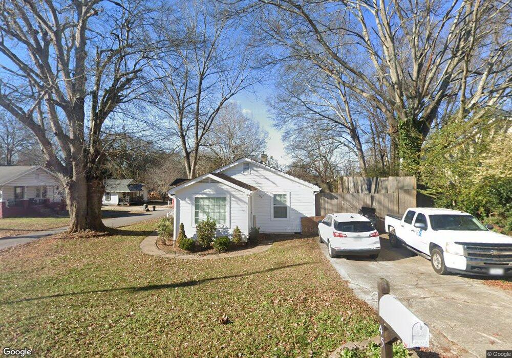
45 High St Unit 38 Buford, GA 30518
Estimated Value: $286,000 - $334,378
2
Beds
1
Bath
1,066
Sq Ft
$297/Sq Ft
Est. Value
About This Home
This home is located at 45 High St Unit 38, Buford, GA 30518 and is currently estimated at $317,095, approximately $297 per square foot. 45 High St Unit 38 is a home located in Gwinnett County with nearby schools including Buford Elementary School, Buford Senior Academy, and Buford Academy.
Ownership History
Date
Name
Owned For
Owner Type
Purchase Details
Closed on
Dec 12, 2017
Sold by
Shrader Lacey
Bought by
Hurd Tracy
Current Estimated Value
Purchase Details
Closed on
Nov 1, 2017
Sold by
Coleman Jason D
Bought by
Schrader Lacey and Pass Pennie
Purchase Details
Closed on
Jun 16, 2009
Sold by
Patterson Ricky
Bought by
Coleman Jason D
Home Financials for this Owner
Home Financials are based on the most recent Mortgage that was taken out on this home.
Original Mortgage
$108,498
Interest Rate
4.77%
Mortgage Type
FHA
Purchase Details
Closed on
Nov 4, 2008
Sold by
Jarrard Doris S
Bought by
Peoples Bank & Trust
Purchase Details
Closed on
May 25, 1993
Sold by
Joslin Geneva A
Bought by
Jarrard Doris A
Home Financials for this Owner
Home Financials are based on the most recent Mortgage that was taken out on this home.
Original Mortgage
$25,091
Interest Rate
7.39%
Create a Home Valuation Report for This Property
The Home Valuation Report is an in-depth analysis detailing your home's value as well as a comparison with similar homes in the area
Home Values in the Area
Average Home Value in this Area
Purchase History
| Date | Buyer | Sale Price | Title Company |
|---|---|---|---|
| Hurd Tracy | $166,000 | -- | |
| Schrader Lacey | $120,000 | -- | |
| Coleman Jason D | $110,500 | -- | |
| Peoples Bank & Trust | $10,012 | -- | |
| Jarrard Doris A | $45,000 | -- |
Source: Public Records
Mortgage History
| Date | Status | Borrower | Loan Amount |
|---|---|---|---|
| Previous Owner | Coleman Jason D | $108,498 | |
| Previous Owner | Jarrard Doris A | $25,091 |
Source: Public Records
Tax History Compared to Growth
Tax History
| Year | Tax Paid | Tax Assessment Tax Assessment Total Assessment is a certain percentage of the fair market value that is determined by local assessors to be the total taxable value of land and additions on the property. | Land | Improvement |
|---|---|---|---|---|
| 2025 | $1,727 | $120,320 | $40,000 | $80,320 |
| 2024 | $1,670 | $116,360 | $33,600 | $82,760 |
| 2023 | $1,670 | $85,760 | $26,000 | $59,760 |
| 2022 | $1,231 | $85,760 | $26,000 | $59,760 |
| 2021 | $870 | $60,600 | $16,800 | $43,800 |
| 2020 | $870 | $60,600 | $16,800 | $43,800 |
| 2019 | $750 | $57,840 | $16,800 | $41,040 |
| 2018 | $588 | $45,360 | $8,800 | $36,560 |
| 2016 | $198 | $25,040 | $5,600 | $19,440 |
| 2015 | $205 | $25,040 | $5,600 | $19,440 |
| 2014 | $189 | $23,560 | $5,600 | $17,960 |
Source: Public Records
Map
Nearby Homes