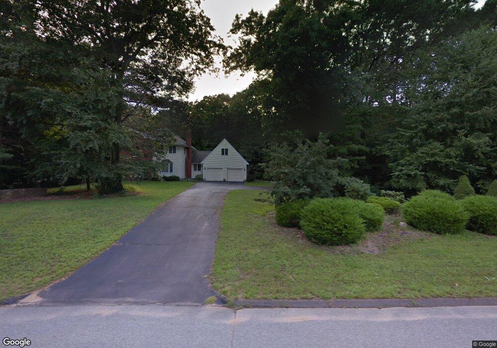
45 Jacobs Hill Rd Mansfield Center, CT 06250
Estimated Value: $564,000 - $791,000
4
Beds
3
Baths
4,034
Sq Ft
$174/Sq Ft
Est. Value
About This Home
This home is located at 45 Jacobs Hill Rd, Mansfield Center, CT 06250 and is currently estimated at $699,990, approximately $173 per square foot. 45 Jacobs Hill Rd is a home located in Tolland County with nearby schools including Mansfield Elementary School, Annie E. Vinton School, and Mansfield Middle School.
Ownership History
Date
Name
Owned For
Owner Type
Purchase Details
Closed on
Aug 25, 2011
Sold by
Bell David N
Bought by
Siegle Delbert L and Mccoach Dorothy E
Current Estimated Value
Home Financials for this Owner
Home Financials are based on the most recent Mortgage that was taken out on this home.
Original Mortgage
$300,000
Outstanding Balance
$207,329
Interest Rate
4.53%
Estimated Equity
$492,661
Purchase Details
Closed on
Dec 15, 1997
Sold by
Bell David
Bought by
Bell David
Create a Home Valuation Report for This Property
The Home Valuation Report is an in-depth analysis detailing your home's value as well as a comparison with similar homes in the area
Home Values in the Area
Average Home Value in this Area
Purchase History
| Date | Buyer | Sale Price | Title Company |
|---|---|---|---|
| Siegle Delbert L | $430,000 | -- | |
| Siegle Delbert L | $430,000 | -- | |
| Bell David | $325,000 | -- | |
| Bell David | $325,000 | -- |
Source: Public Records
Mortgage History
| Date | Status | Borrower | Loan Amount |
|---|---|---|---|
| Open | Bell David | $300,000 | |
| Closed | Bell David | $300,000 |
Source: Public Records
Tax History Compared to Growth
Tax History
| Year | Tax Paid | Tax Assessment Tax Assessment Total Assessment is a certain percentage of the fair market value that is determined by local assessors to be the total taxable value of land and additions on the property. | Land | Improvement |
|---|---|---|---|---|
| 2025 | $10,720 | $536,000 | $59,600 | $476,400 |
| 2024 | $10,334 | $338,600 | $56,000 | $282,600 |
| 2023 | $10,673 | $338,600 | $56,000 | $282,600 |
| 2022 | $10,287 | $338,600 | $56,000 | $282,600 |
| 2021 | $10,625 | $338,600 | $56,000 | $282,600 |
| 2020 | $10,625 | $338,600 | $56,000 | $282,600 |
| 2019 | $10,864 | $346,200 | $56,000 | $290,200 |
| 2018 | $10,907 | $353,200 | $58,900 | $294,300 |
| 2017 | $10,819 | $353,200 | $58,900 | $294,300 |
| 2016 | $10,550 | $353,200 | $58,900 | $294,300 |
| 2015 | $10,550 | $353,200 | $58,900 | $294,300 |
| 2014 | $9,984 | $357,210 | $55,720 | $301,490 |
Source: Public Records
Map
Nearby Homes
- 39 Jacobs Hill Rd
- 2 Pequot Square Unit 2
- 1 Heritage Square Unit 1
- 23 Liberty Dr Unit 23
- 31 Adeline Place
- 54 Meadowbrook Ln
- 23 Circle Dr
- 19 Eastbrook Heights Unit C
- 29 Eastbrook Heights Unit A
- 0 Storrs Rd Unit 2 170571015
- 0 Mansfield City Rd Unit LOT 2
- 378 Mansfield Ave
- 408 Storrs Rd
- 399 High St
- 29 Stone Gate Dr
- 17 Jacqueline Ln
- 34 Pond Way
- 21 Anthony St
- 366 Ash St Unit 2
- 22 Pond Way Unit POND022
- 51 Jacobs Hill Rd
- 33 Jacobs Hill Rd
- 61 Jacobs Hill Rd
- 65 Jacobs Hill Rd
- 34 Jacobs Hill Rd
- 27 Jacobs Hill Rd
- 21 Jacobs Hill Rd
- 6 Britony Dr
- 28 Jacobs Hill Rd
- 56 Jacobs Hill Rd
- 15 Jacobs Hill Rd
- 62 Jacobs Hill Rd
- 236 Puddin Ln
- 20 Jacobs Hill Rd
- 14 Britony Dr
- 17 Britony Dr
- 16 Jacobs Hill Rd
- 230 Puddin Ln
- 224 Puddin Ln
- 20 Britony Dr