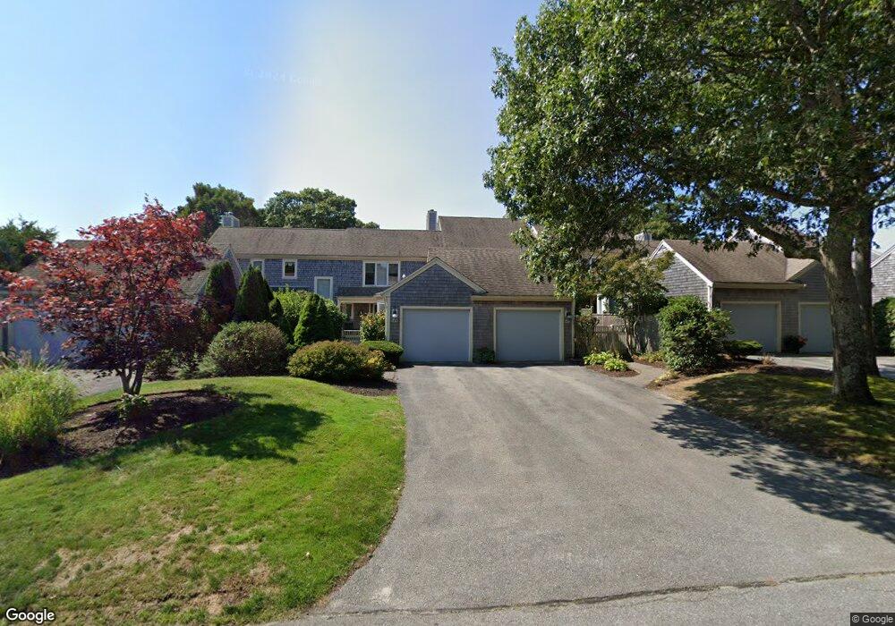
45 Kates Path Yarmouth Port, MA 02675
Yarmouth Port NeighborhoodEstimated Value: $531,000 - $571,000
2
Beds
3
Baths
1,460
Sq Ft
$379/Sq Ft
Est. Value
About This Home
This home is located at 45 Kates Path, Yarmouth Port, MA 02675 and is currently estimated at $553,861, approximately $379 per square foot. 45 Kates Path is a home located in Barnstable County with nearby schools including Dennis-Yarmouth Regional High School.
Ownership History
Date
Name
Owned For
Owner Type
Purchase Details
Closed on
Jul 16, 2021
Sold by
Maresco Ft and Adelizzi
Bought by
Adelizzi John J and Adelizzi Dianne M
Current Estimated Value
Purchase Details
Closed on
Nov 21, 2001
Sold by
Walsh Gerald R
Bought by
Lotane Carol A
Purchase Details
Closed on
Dec 11, 1998
Sold by
Johnson Robert E and Johnson Vilma M
Bought by
Walsh Gerald R
Home Financials for this Owner
Home Financials are based on the most recent Mortgage that was taken out on this home.
Original Mortgage
$136,500
Interest Rate
6.8%
Mortgage Type
Purchase Money Mortgage
Purchase Details
Closed on
May 11, 1988
Sold by
The Green Co Inc
Bought by
Hoffacker Lewis
Home Financials for this Owner
Home Financials are based on the most recent Mortgage that was taken out on this home.
Original Mortgage
$156,000
Interest Rate
10.02%
Mortgage Type
Purchase Money Mortgage
Create a Home Valuation Report for This Property
The Home Valuation Report is an in-depth analysis detailing your home's value as well as a comparison with similar homes in the area
Home Values in the Area
Average Home Value in this Area
Purchase History
| Date | Buyer | Sale Price | Title Company |
|---|---|---|---|
| Adelizzi John J | -- | None Available | |
| Lotane Carol A | $285,000 | -- | |
| Walsh Gerald R | $195,000 | -- | |
| Hoffacker Lewis | $185,000 | -- |
Source: Public Records
Mortgage History
| Date | Status | Borrower | Loan Amount |
|---|---|---|---|
| Previous Owner | Walsh Gerald R | $136,500 | |
| Previous Owner | Hoffacker Lewis | $156,000 |
Source: Public Records
Tax History Compared to Growth
Tax History
| Year | Tax Paid | Tax Assessment Tax Assessment Total Assessment is a certain percentage of the fair market value that is determined by local assessors to be the total taxable value of land and additions on the property. | Land | Improvement |
|---|---|---|---|---|
| 2025 | $3,448 | $487,000 | $0 | $487,000 |
| 2024 | $3,463 | $469,300 | $0 | $469,300 |
| 2023 | $3,118 | $384,500 | $0 | $384,500 |
| 2022 | $3,561 | $387,900 | $0 | $387,900 |
| 2021 | $3,464 | $362,300 | $0 | $362,300 |
| 2020 | $3,496 | $349,600 | $0 | $349,600 |
| 2019 | $3,277 | $324,500 | $0 | $324,500 |
| 2018 | $3,082 | $299,500 | $0 | $299,500 |
| 2017 | $2,876 | $287,000 | $0 | $287,000 |
| 2016 | $2,739 | $274,400 | $0 | $274,400 |
| 2015 | $2,896 | $288,400 | $0 | $288,400 |
Source: Public Records
Map
Nearby Homes
- 228 Kates Path
- 50 John Hall Cartway
- 50 John Hall Cartway Unit 50
- 17 Kates Path Unit A
- 64 Kates Path
- 34 Kates Path
- 34 Kates Path Unit 34
- 7 Forest Gate Unit 7
- 30 W Woods
- 30 W Woods Cir Unit 30
- 10 Oak Glen
- 43 Canterbury Rd
- 25 Oak Glen Village Unit 25
- 25 Oak Glen
- 44 Stratford Ln
- 29 Boxwood Cir Unit 29
- 59 Massachusetts 6a Unit 19-2
- 59 Main St Unit 19-2
- 59 Route 6a Unit 29-4
- 6 Nimble Hill Dr
- 53 Kates Path
- 51 Kates Path
- 49 Kates Path
- 47 Kates Path
- 43 Kates Path
- 47 Kates Path Unit 47-B
- 45 Kates Path Unit C45
- 53 Kate's Path
- 53 Kate's Point Unit 53
- 43 Kates Path Unit 43
- 51 Kates Path Unit A
- 43 Kates Path Unit H
- 53 Kates Path Unit D
- 61 Kates Path
- 59 Kates Path
- 57 Kates Path
- 55 Kates Path
- 61 Kates Path Unit A
- 59 Kate's Path Unit 59
- 57 Kates Path Unit 57