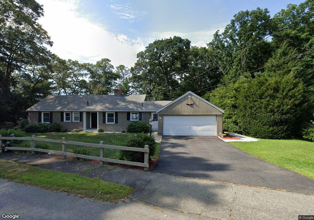
45 Lake Shore Rd Natick, MA 01760
Estimated Value: $806,000 - $1,215,000
3
Beds
3
Baths
1,457
Sq Ft
$732/Sq Ft
Est. Value
About This Home
This home is located at 45 Lake Shore Rd, Natick, MA 01760 and is currently estimated at $1,066,420, approximately $731 per square foot. 45 Lake Shore Rd is a home located in Middlesex County with nearby schools including Natick High School, Wilson Middle School, and Bennett-Hemenway (Ben-Hem) Elementary School.
Ownership History
Date
Name
Owned For
Owner Type
Purchase Details
Closed on
May 8, 2000
Sold by
Davis Rt
Bought by
Tangerini Chester G
Current Estimated Value
Home Financials for this Owner
Home Financials are based on the most recent Mortgage that was taken out on this home.
Original Mortgage
$140,000
Outstanding Balance
$48,610
Interest Rate
8.21%
Mortgage Type
Purchase Money Mortgage
Estimated Equity
$1,017,810
Create a Home Valuation Report for This Property
The Home Valuation Report is an in-depth analysis detailing your home's value as well as a comparison with similar homes in the area
Home Values in the Area
Average Home Value in this Area
Purchase History
| Date | Buyer | Sale Price | Title Company |
|---|---|---|---|
| Tangerini Chester G | $350,000 | -- |
Source: Public Records
Mortgage History
| Date | Status | Borrower | Loan Amount |
|---|---|---|---|
| Open | Tangerini Chester G | $140,000 | |
| Closed | Tangerini Chester G | $82,000 |
Source: Public Records
Tax History Compared to Growth
Tax History
| Year | Tax Paid | Tax Assessment Tax Assessment Total Assessment is a certain percentage of the fair market value that is determined by local assessors to be the total taxable value of land and additions on the property. | Land | Improvement |
|---|---|---|---|---|
| 2025 | $11,623 | $971,800 | $677,500 | $294,300 |
| 2024 | $10,606 | $865,100 | $599,400 | $265,700 |
| 2023 | $0 | $802,600 | $550,200 | $252,400 |
| 2022 | $0 | $737,200 | $496,300 | $240,900 |
| 2021 | $0 | $666,300 | $444,600 | $221,700 |
| 2020 | $9,068 | $666,300 | $444,600 | $221,700 |
| 2019 | $8,469 | $666,300 | $444,600 | $221,700 |
| 2018 | $0 | $650,900 | $444,600 | $206,300 |
| 2017 | $8,508 | $630,700 | $428,300 | $202,400 |
| 2016 | $8,078 | $595,300 | $394,700 | $200,600 |
| 2015 | $6,775 | $490,200 | $308,400 | $181,800 |
Source: Public Records
Map
Nearby Homes
- 293 Bacon St Unit A
- 287 Bacon St
- 7 Jackson Ct Unit B
- 8 Flynn St
- 12 Linden St
- 39 Evergreen Rd
- 8 Stanley St
- 278 N Main St
- 8 Hartford St
- 18 Magnolia Rd
- 13 Sheffield Rd
- 7 Sheffield Rd
- 38 Westlake Rd
- 4 Richard Rd
- 10 Nouvelle Way Unit 803
- 40 Nouvelle Way Unit 441
- 10 Nouvelle Way Unit 923
- 3 Ferndale Rd
- 58 N Main St Unit 304
- 14 Ferndale Rd
- 33 Lakeshore Rd
- 39 Lake Shore Rd
- 42 Lake Shore Rd
- 44 Lake Shore Rd
- 37 Lake Shore Rd
- 38 Lake Shore Rd
- 61 Lake Shore Rd
- 29 Lake Shore Rd
- 987 Worcester St
- 987 Worcester St Unit 1
- 34 Lake Shore Rd
- 991 Worcester St
- 971 Worcester St
- 63 Lake Shore Rd
- 41 Lakeshore Rd
- 0 Lakeshore Rd
- 51 Lakeshore Rd
- 959 Worcester St
- 25 Lake Shore Rd
- 65 Lake Shore Rd