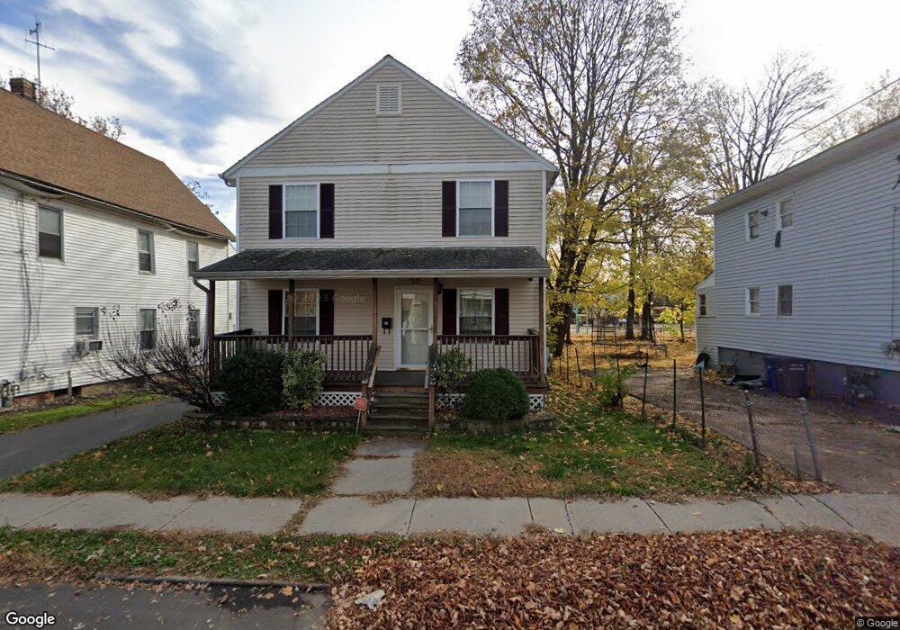
45 Loomis St Hartford, CT 06120
Clay Arsenal NeighborhoodEstimated Value: $221,000 - $293,000
4
Beds
2
Baths
1,456
Sq Ft
$172/Sq Ft
Est. Value
About This Home
This home is located at 45 Loomis St, Hartford, CT 06120 and is currently estimated at $251,031, approximately $172 per square foot. 45 Loomis St is a home located in Hartford County with nearby schools including Capital Preparatory Magnet School, Sand Elementary School, and Ib Global Communications Academy.
Ownership History
Date
Name
Owned For
Owner Type
Purchase Details
Closed on
Nov 17, 2008
Sold by
Htfd Area Habitat Huma
Bought by
Hawkins Nicole
Current Estimated Value
Home Financials for this Owner
Home Financials are based on the most recent Mortgage that was taken out on this home.
Original Mortgage
$104,685
Outstanding Balance
$55,731
Interest Rate
6.13%
Mortgage Type
Purchase Money Mortgage
Estimated Equity
$195,300
Create a Home Valuation Report for This Property
The Home Valuation Report is an in-depth analysis detailing your home's value as well as a comparison with similar homes in the area
Home Values in the Area
Average Home Value in this Area
Purchase History
| Date | Buyer | Sale Price | Title Company |
|---|---|---|---|
| Hawkins Nicole | $135,000 | -- |
Source: Public Records
Mortgage History
| Date | Status | Borrower | Loan Amount |
|---|---|---|---|
| Open | Hawkins Nicole | $104,685 | |
| Closed | Hawkins Nicole | $20,000 | |
| Closed | Hawkins Nicole | $10,315 | |
| Previous Owner | Hawkins Nicole | $1,850,000 |
Source: Public Records
Tax History
| Year | Tax Paid | Tax Assessment Tax Assessment Total Assessment is a certain percentage of the fair market value that is determined by local assessors to be the total taxable value of land and additions on the property. | Land | Improvement |
|---|---|---|---|---|
| 2025 | $3,872 | $56,154 | $2,940 | $53,214 |
| 2024 | $3,872 | $56,154 | $2,940 | $53,214 |
| 2023 | $3,872 | $56,154 | $2,940 | $53,214 |
| 2022 | $3,872 | $56,154 | $2,940 | $53,214 |
| 2021 | $3,383 | $45,535 | $3,010 | $42,525 |
| 2020 | $3,383 | $45,535 | $3,010 | $42,525 |
| 2019 | $3,383 | $45,535 | $3,010 | $42,525 |
| 2018 | $3,269 | $44,000 | $2,909 | $41,091 |
| 2016 | $3,242 | $43,645 | $2,771 | $40,874 |
| 2015 | $3,088 | $41,571 | $2,638 | $38,933 |
| 2014 | $3,013 | $40,555 | $2,574 | $37,981 |
Source: Public Records
Map
Nearby Homes
- 35 Loomis St
- 33 Warren St
- 2404 Main St
- 78 Martin St
- 147 Martin St
- 218 Martin St Unit 220
- 551 Garden St Unit 553
- 46 Risley St
- 178 Brook St Unit 180
- 183 Brook St Unit 185
- 472 Edgewood St Unit 474
- 147 Enfield St Unit 149
- 152 Brook St
- 57 Love Ln
- 280 Capen St Unit 34
- 275 Westland St
- 410 Garden St
- 87 Mansfield St Unit 89
- 88 Tower Ave
- 134 Magnolia St Unit 136