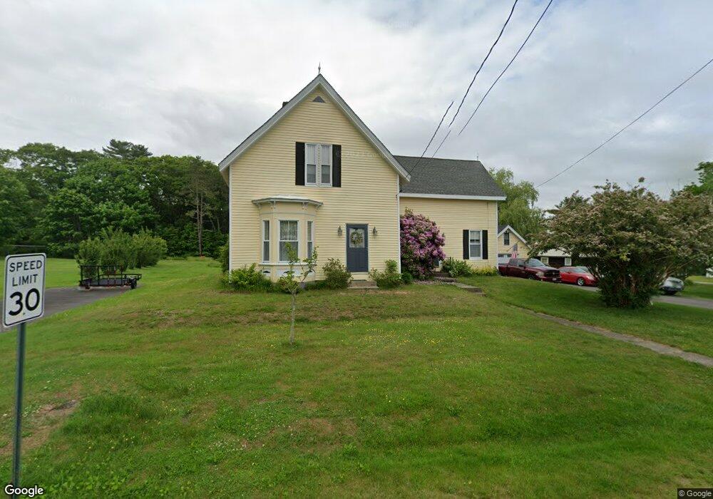
45 Maple St Warren, ME 04864
Estimated Value: $303,348 - $378,000
4
Beds
1
Bath
1,464
Sq Ft
$232/Sq Ft
Est. Value
About This Home
This home is located at 45 Maple St, Warren, ME 04864 and is currently estimated at $340,087, approximately $232 per square foot. 45 Maple St is a home located in Knox County with nearby schools including Medomak Valley High School.
Ownership History
Date
Name
Owned For
Owner Type
Purchase Details
Closed on
Jan 16, 2024
Sold by
Sheehan Robert L
Bought by
Mcguire Connie and Sheehan Robert L
Current Estimated Value
Purchase Details
Closed on
Apr 14, 2008
Sold by
Stimpson Freda J
Bought by
Sheehan Robert L and Sheehan Julie E
Home Financials for this Owner
Home Financials are based on the most recent Mortgage that was taken out on this home.
Original Mortgage
$93,069
Interest Rate
6.3%
Mortgage Type
Purchase Money Mortgage
Create a Home Valuation Report for This Property
The Home Valuation Report is an in-depth analysis detailing your home's value as well as a comparison with similar homes in the area
Home Values in the Area
Average Home Value in this Area
Purchase History
| Date | Buyer | Sale Price | Title Company |
|---|---|---|---|
| Mcguire Connie | -- | None Available | |
| Sheehan Robert L | -- | -- |
Source: Public Records
Mortgage History
| Date | Status | Borrower | Loan Amount |
|---|---|---|---|
| Previous Owner | Sheehan Robert L | $93,069 |
Source: Public Records
Tax History
| Year | Tax Paid | Tax Assessment Tax Assessment Total Assessment is a certain percentage of the fair market value that is determined by local assessors to be the total taxable value of land and additions on the property. | Land | Improvement |
|---|---|---|---|---|
| 2025 | $3,275 | $230,600 | $73,000 | $157,600 |
| 2024 | $3,256 | $229,300 | $73,000 | $156,300 |
| 2023 | $3,187 | $229,300 | $73,000 | $156,300 |
| 2022 | $2,534 | $126,700 | $48,100 | $78,600 |
| 2021 | $2,407 | $126,700 | $48,100 | $78,600 |
| 2020 | $2,458 | $126,700 | $48,100 | $78,600 |
| 2019 | $2,420 | $126,700 | $48,100 | $78,600 |
| 2018 | $2,319 | $126,700 | $48,100 | $78,600 |
| 2017 | $2,179 | $126,700 | $48,100 | $78,600 |
| 2016 | $2,053 | $126,700 | $48,100 | $78,600 |
| 2015 | $2,027 | $126,700 | $48,100 | $78,600 |
| 2014 | $2,040 | $126,700 | $48,100 | $78,600 |
| 2013 | $2,015 | $126,700 | $48,100 | $78,600 |
Source: Public Records
Map
Nearby Homes
- Lot 9 &7-1 Falcon Ln
- 350 Main St
- 38 Conary Ln
- 40 Pine Ridge Dr
- 895 Finntown Rd
- 986 Finntown Rd
- 71 Woodland Ave
- 46 Cedar Dr
- R12-23B Camden Rd
- 624-600 Beechwood St
- 710-644 Beechwood St
- 401 Beechwood St
- 186 Pistols N Petals Rd
- 000 Atlantic Highway Map 4 Lot 24
- 1344 Old Route One
- 360 Cushing Rd
- 26 Clark St
- Map 403 Lo 95 St
- 380 Wottons Mill Rd
- 90 Come Spring Ln
Your Personal Tour Guide
Ask me questions while you tour the home.