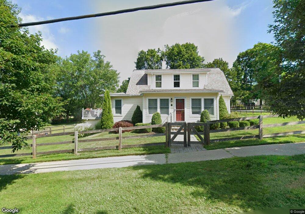
45 Merrit Ave Millbrook, NY 12545
Estimated Value: $606,858 - $708,000
3
Beds
2
Baths
1,696
Sq Ft
$398/Sq Ft
Est. Value
About This Home
This home is located at 45 Merrit Ave, Millbrook, NY 12545 and is currently estimated at $675,215, approximately $398 per square foot. 45 Merrit Ave is a home located in Dutchess County with nearby schools including Elm Drive Elementary School, Alden Place Elementary School, and Millbrook Middle School.
Ownership History
Date
Name
Owned For
Owner Type
Purchase Details
Closed on
Aug 18, 2015
Sold by
Hill Bonnie
Bought by
Stockton Carlisle and Hill
Current Estimated Value
Home Financials for this Owner
Home Financials are based on the most recent Mortgage that was taken out on this home.
Original Mortgage
$315,000
Outstanding Balance
$248,082
Interest Rate
4.07%
Mortgage Type
New Conventional
Estimated Equity
$427,133
Purchase Details
Closed on
Aug 16, 2012
Sold by
Barnello Giacomo
Bought by
Hill Bonnie
Create a Home Valuation Report for This Property
The Home Valuation Report is an in-depth analysis detailing your home's value as well as a comparison with similar homes in the area
Home Values in the Area
Average Home Value in this Area
Purchase History
| Date | Buyer | Sale Price | Title Company |
|---|---|---|---|
| Stockton Carlisle | $350,000 | Robert Butts | |
| Hill Bonnie | $235,000 | Evan B Handel |
Source: Public Records
Mortgage History
| Date | Status | Borrower | Loan Amount |
|---|---|---|---|
| Open | Stockton Carlisle | $315,000 |
Source: Public Records
Tax History Compared to Growth
Tax History
| Year | Tax Paid | Tax Assessment Tax Assessment Total Assessment is a certain percentage of the fair market value that is determined by local assessors to be the total taxable value of land and additions on the property. | Land | Improvement |
|---|---|---|---|---|
| 2024 | $8,811 | $338,000 | $65,400 | $272,600 |
| 2023 | $8,332 | $338,000 | $65,400 | $272,600 |
| 2022 | $8,191 | $338,000 | $65,400 | $272,600 |
| 2021 | $8,186 | $338,000 | $65,400 | $272,600 |
| 2020 | $8,452 | $338,000 | $65,400 | $272,600 |
| 2019 | $8,369 | $338,000 | $65,400 | $272,600 |
| 2018 | $8,113 | $338,000 | $65,400 | $272,600 |
| 2017 | $8,018 | $338,000 | $65,400 | $272,600 |
| 2016 | $7,622 | $340,500 | $65,400 | $275,100 |
| 2015 | -- | $268,300 | $65,400 | $202,900 |
| 2014 | -- | $268,300 | $65,400 | $202,900 |
Source: Public Records
Map
Nearby Homes
- 17 Washington Ave
- 18 Alden Terrace
- 54 Bennett Common
- 121 Stanford Rd
- 20 Orchard Hill Dr
- 121-125 Butts Hollow Rd
- 45 Hitchcock Ln
- 121 Valley Farm Rd
- 45 Maple Hill Dr
- 568 Oak Summit Rd
- 477 Canoe Hill Rd
- 3893 Route 82
- 3889 Route 82
- 174 Horseshoe Rd
- 3715 Route 44 Unit 37
- 0 Valley Farm Rd Unit KEY896424
- 508 Woodstock Rd
- 11 Sutton Rd
- 47 Crescent Rd
- 92 Sutton Rd Unit 114